
Jeannette is a small city in southwestern Pennsylvania, located in Westmoreland County about 30 miles east of Pittsburgh. It developed as an industrial community known for glassmaking and manufacturing. Today, Jeannette is known for its historic downtown, Penn Township surroundings, nearby Twin Lakes Park, and its location within the rolling hills of the western Pennsylvania region.
Location Map of Jeannette, Westmoreland County, Pennsylvania
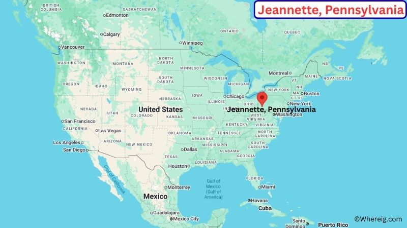
About Map: The map shows the location of Jeannette in Westmoreland County, in the U.S. state of Pennsylvania.
Jeannette Map, Pennsylvania
About Jeannette Map: The Google Map highlights the location of Jeannette in Westmoreland County, Pennsylvania. Use the zoom, satellite, and street-view options to explore the city's neighborhoods, roads, and nearby places.
Where is Jeannette Located?
Jeannette is a city located in Westmoreland County, Pennsylvania, the United States. It lies in southwestern Pennsylvania, about 30 miles east of Pittsburgh and roughly 10 miles west of Greensburg. Jeannette is part of the Pittsburgh metropolitan area and is surrounded by the rolling hills, wooded valleys, and small communities of Westmoreland County. The city is located at approximately 40.328° North latitude and 79.616° West longitude. The 2020 Census recorded 8,780 residents. Jeannette covers about 2.39 square miles, or 6.19 square kilometers. The city was incorporated in the late 19th century and grew rapidly as a center for glassmaking, manufacturing, rail transportation, and related industries. Its industrial heritage remains an important part of local history. One of the area's popular recreational destinations is Twin Lakes Park, which offers walking trails, fishing, boating, picnic areas, and seasonal activities. Downtown Jeannette contains older commercial buildings that reflect its industrial past. A unique feature of the city is its strong connection to the glass industry, which helped earn Jeannette a place in the history of American glass manufacturing. U.S. Route 30 and Pennsylvania Route 130 provide important connections to Greensburg, Pittsburgh, and other communities in western Pennsylvania.
Most Viewed US Maps
| USA Sttae Map | USA Region Map | USA Road Map |
| USA County Map | Where is USA in World Map? | US ZIP Code Map |
| USA Time Zones Map | US State and Capitals Map | USA Physical Map |
Find 4,400+ U.S. Cities by State - Explore Their Locations and Get Detailed Information
Jeannette City Facts
| City | Jeannette |
| State | Pennsylvania |
| County | Westmoreland County |
| Country | United States |
| Region | Western Pennsylvania / Pittsburgh Metro |
| Incorporated | 1889 |
| Founded | 1888 |
| Total Area | 2.39 sq mi (6.19 sq km) |
| Land Area | 2.39 sq mi (6.19 sq km) |
| Water Area | 0.00 sq mi (0.00 sq km) |
| Elevation | About 1,070 ft (326 m) |
| Population (2023 estimate) | About 8,500 |
| Population (2020 Census) | 8,780 |
| Population Density | About 3,674 people per sq mi |
| Time Zone | Eastern Time (ET) |
| ZIP Codes | 15644 |
| Area Code | 724, 878 |
| Major Highways | U.S. Route 30, Pennsylvania Route 130, Pennsylvania Route 66 |
| Public Transit | Westmoreland County Transit Authority |
| Major Attractions | Jeannette Historic District, Twin Lakes Park, Westmoreland Heritage Trail, Glass City heritage sites |
| Official Website | https://www.jeannettepa.gov/ |
Distance from Jeannette, PA to Nearby Cities
- Greensburg, PA – 10 miles (16 km)
- Irwin, PA – 10 miles (16 km)
- Latrobe, PA – 15 miles (24 km)
- Youngwood, PA – 8 miles (13 km)
- Scottdale, PA – 15 miles (24 km)
- Mount Pleasant, PA – 20 miles (32 km)
- Connellsville, PA – 30 miles (48 km)
- Monroeville, PA – 15 miles (24 km)
- Pittsburgh, PA – 30 miles (48 km)
- New Kensington, PA – 20 miles (32 km)
- Indiana, PA – 35 miles (56 km)
- Washington, PA – 45 miles (72 km)
- Johnstown, PA – 55 miles (89 km)
- Uniontown, PA – 40 miles (64 km)
- Butler, PA – 45 miles (72 km)
Top Attractions in Jeannette
- Jeannette Historic District – A local historic area containing older homes, commercial buildings, churches, and landmarks tied to the city's industrial development.
- Twin Lakes Park – A nearby Westmoreland County park offering fishing, boating, hiking, picnic areas, and seasonal recreation.
- Westmoreland Heritage Trail – A regional multi-use trail popular for walking, cycling, and enjoying the wooded landscapes of Westmoreland County.
- Jeannette Glass Industry Heritage Sites – Historic locations and buildings connected to the city's long history as a center of American glass manufacturing.
- Westmoreland Museum of American Art – A regional museum in nearby Greensburg featuring American paintings, sculpture, and decorative arts.
- Westmoreland County Historical Society – A nearby historical organization preserving artifacts and records related to the region's past.
- Idlewild & SoakZone – A long-running amusement and water park near Ligonier, offering rides, family attractions, and seasonal entertainment.
- Fort Ligonier – A reconstructed 18th-century fort in nearby Ligonier that interprets the region's role during the French and Indian War.
Airports Near Jeannette
- Arnold Palmer Regional Airport (LBE) – 20 miles
- Allegheny County Airport (AGC) – 30 miles
- Pittsburgh International Airport (PIT) – 50 miles
- John Murtha Johnstown-Cambria County Airport (JST) – 65 miles
- Washington County Airport (AFJ) – 55 miles
Sources:
Population and area data sourced from the United States Census Bureau (2020 Census). General city information referenced from the official Jeannette city website and local government records.
Pennsylvania More Maps & Info
- Where is Allentown
- Where is Allison Park
- Where is Altoona
- Where is Baldwin
- Where is Bethel Park
- Where is Bethlehem
- Where is Carlisle
- Where is Chambersburg
- Where is Chester
- Where is Colonial Park
- Where is Drexel Hill
- Where is Dunmore
- Where is Easton
- Where is Ephrata
- Where is Erie
- Where is Franklin Park
- Where is Fullerton
- Where is Greensburg
- Where is Hanover
- Where is Harrisburg
- Where is Hazleton
- Where is Hermitage
- Where is Horsham
- Where is Indiana
- Where is Johnstown
- Where is King of Prussia
- Where is Lancaster
- Where is Lansdale
- Where is Lebanon
- Where is Levittown
- Where is McKeesport
- Where is Monroeville
- Where is Murrysville
- Where is New Castle
- Where is Norristown
- Where is Phoenixville
- Where is Plum
- Where is Pottstown
- Where is Reading
- Where is Scranton
- Where is State College
- Where is Weigelstown
- Where is West Chester
- Where is West Mifflin
- Where is Whitehall
- Where is Wilkes-Barre
- Where is Williamsport
- Where is York