
Westminster is a historic city in northern Maryland and the county seat of Carroll County. It is about 35 miles northwest of Baltimore and 55 miles north of Washington, D.C. Located among the rolling hills of central Maryland, Westminster is known for its historic downtown, McDaniel College, Carroll County Farm Museum, and nearby parks, farms, and scenic countryside.
Location Map of Westminster, Carroll County, Maryland
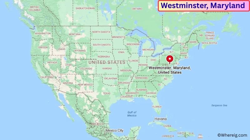
About Map: The map shows the location of Westminster in Carroll County, in the U.S. state of Maryland.
Westminster Map, Maryland
About Westminster Map: The Google Map highlights the location of Westminster in Carroll County, Maryland. Use the zoom, satellite, and street-view options to explore the city's neighborhoods, roads, and nearby places.
Where is Westminster Located?
Westminster is a city located in Carroll County, Maryland, the United States. It is in central Maryland, about 35 miles northwest of Baltimore, 55 miles north of Washington, D.C., and approximately 20 miles south of the Pennsylvania state line. Westminster lies at approximately 39.575° North latitude and 77.001° West longitude. The city had 20,126 residents in the 2020 Census and covers about 6.64 square miles, or 17.20 square kilometers. Westminster was founded in 1764 and became the county seat of Carroll County when the county was created in 1837. During the Civil War, the city was the site of the Battle of Westminster in 1863, an engagement that occurred shortly before the Battle of Gettysburg. The city's historic downtown contains preserved buildings, local shops, restaurants, and civic landmarks. McDaniel College is another important local institution and has been part of the community since the 19th century. Nearby attractions include the Carroll County Farm Museum, Hashawha Environmental Center, and Liberty Lake. Maryland Route 140 and Maryland Route 97 provide convenient connections to Baltimore, Gettysburg, and other communities in central Maryland.
Most Viewed US Maps
| USA Sttae Map | USA Region Map | USA Road Map |
| USA County Map | Where is USA in World Map? | US ZIP Code Map |
| USA Time Zones Map | US State and Capitals Map | USA Physical Map |
Find 4,400+ U.S. Cities by State - Explore Their Locations and Get Detailed Information
Westminster City Facts
| Fact | Details |
|---|---|
| City | Westminster |
| State | Maryland |
| County | Carroll County |
| Country | United States |
| Region | Central Maryland |
| Incorporated | 1833 |
| Founded | 1764 |
| Total Area | 6.64 sq mi (17.20 sq km) |
| Land Area | 6.63 sq mi (17.18 sq km) |
| Water Area | 0.01 sq mi (0.03 sq km) |
| Elevation | Approximately 800 ft (244 m) |
| Population (2023 estimate) | Approximately 20,500 |
| Population (2020 Census) | 20,126 |
| Population Density | Approximately 3,036 people per sq mi |
| Time Zone | Eastern Time Zone (EST/EDT) |
| ZIP Codes | 21157, 21158 |
| Area Code | 410, 443, 667 |
| Major Highways | Maryland Route 140, Maryland Route 97, Maryland Route 32, Maryland Route 31 |
| Public Transit | Carroll Transit |
| Major Attractions | Westminster Historic District, Carroll County Farm Museum, McDaniel College, Hashawha Environmental Center |
| Official Website | https://www.westminstermd.gov/ |
Distance from Westminster, MD to Nearby Cities
- New Windsor, MD – 8 miles (13 km)
- Hampstead, MD – 10 miles (16 km)
- Manchester, MD – 10 miles (16 km)
- Taneytown, MD – 12 miles (19 km)
- Mount Airy, MD – 20 miles (32 km)
- Gettysburg, PA – 25 miles (40 km)
- Frederick, MD – 25 miles (40 km)
- Towson, MD – 30 miles (48 km)
- Baltimore, MD – 35 miles (56 km)
- York, PA – 40 miles (64 km)
- Hagerstown, MD – 45 miles (72 km)
- Columbia, MD – 35 miles (56 km)
- Rockville, MD – 45 miles (72 km)
- Gaithersburg, MD – 45 miles (72 km)
- Washington, DC – 55 miles (89 km)
- Annapolis, MD – 60 miles (97 km)
- Harrisburg, PA – 65 miles (105 km)
- Philadelphia, PA – 110 miles (177 km)
Top Attractions in Westminster
- Westminster Historic District – The historic downtown area contains preserved homes, commercial buildings, churches, and civic landmarks dating from the city's early development.
- Carroll County Farm Museum – A living-history museum preserving historic farm buildings, agricultural equipment, gardens, and traditions from rural Carroll County.
- McDaniel College – A historic liberal arts college founded in 1867, with a traditional campus and long connection to Westminster.
- Westminster City Park – A local recreation area with walking paths, sports facilities, playgrounds, and open green space.
- Hashawha Environmental Center – A nearby environmental education and recreation area with trails, forests, wetlands, ponds, and wildlife habitats.
- Westminster Railroad Station – A historic railroad landmark reflecting the important role of rail transportation in the city's development.
- Battle of Westminster Historic Site – Historic locations around the city mark the 1863 Civil War engagement that took place shortly before the Battle of Gettysburg.
- Liberty Lake – A nearby recreation area offering fishing, walking, picnicking, and views of the surrounding Carroll County countryside.
- Patapsco Valley State Park – A large nearby state park with hiking trails, waterfalls, forests, river scenery, and historic sites along the Patapsco River.
- Gettysburg National Military Park – A major historic destination in nearby Pennsylvania preserving the battlefield and sites associated with the 1863 Battle of Gettysburg.
Airports Near Westminster, MD
- Carroll County Regional Airport (DMW) – 8 miles
- Frederick Municipal Airport (FDK) – 25 miles
- Martin State Airport (MTN) – 35 miles
- Baltimore/Washington International Thurgood Marshall Airport (BWI) – 40 miles
- Hagerstown Regional Airport (HGR) – 45 miles
Sources:
Population and area data sourced from the United States Census Bureau (2020 Census). General city information referenced from the official City of Westminster website and local government records.
Maryland Related Maps and Info
- Where is Annapolis
- Where is Aspen Hill
- Where is Bel Air North
- Where is Bel Air South
- Where is Baltimore
- Where is Bethesda
- Where is Bowie
- Where is Carney
- Where is Catonsville
- Where is Chillum
- Where is Clarksburg
- Where is Clinton
- Where is College Park
- Where is Columbia
- Where is Crofton
- Where is Dundalk
- Where is Eldersburg
- Where is Elkridge
- Where is Ellicott City
- Where is Essex
- Where is Frederick
- Where is Gaithersburg
- Where is Germantown
- Where is Glen Burnie
- Where is Hagerstown
- Where is Laurel
- Where is Middle River
- Where is Milford Mill
- Where is Montgomery Village
- Where is North Bethesda
- Where is North Laurel
- Where is Odenton
- Where is Olney
- Where is Owings Mills
- Where is Parkville
- Where is Pasadena
- Where is Perry Hall
- Where is Pikesville
- Where is Potomac
- Where is Randallstown
- Where is Rockville
- Where is Salisbury
- Where is Severn
- Where is Severna Park
- Where is Silver Spring
- Where is South Laurel
- Where is Towson
- Where is Waldorf
- Where is Wheaton
- Where is Woodlawn