
Meadville is a city in northwestern Pennsylvania and the county seat of Crawford County. Located about 40 miles south of Erie, it sits among wooded hills, farmland, and small waterways. Meadville is known for Allegheny College, its historic downtown, French Creek, and nearby outdoor attractions such as Woodcock Lake and Pymatuning State Park.
Location Map of Meadville, Crawford County, Pennsylvania
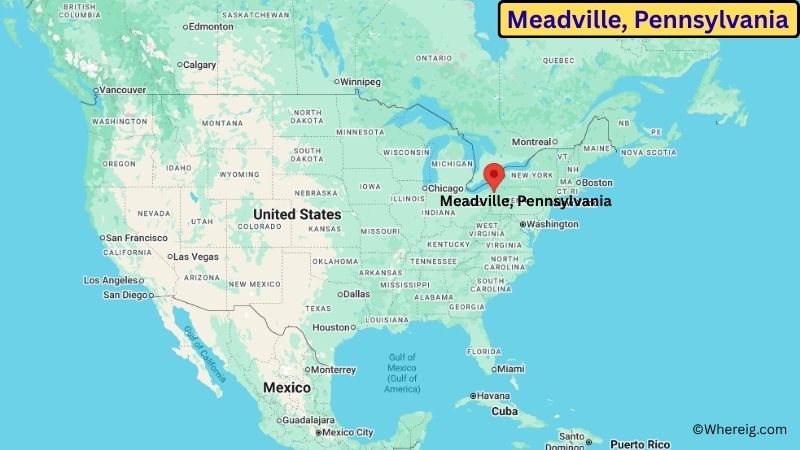
About Map: The map shows the location of Meadville in Crawford County, in the U.S. state of Pennsylvania.
Meadville Map, Pennsylvania
About Meadville Map: The Google Map highlights the location of Meadville in Crawford County, Pennsylvania. Use the zoom, satellite, and street-view options to explore the city's neighborhoods, roads, and nearby places.
Where is Meadville Located?
Meadville is a city located in Crawford County, Pennsylvania, the United States. It lies in northwestern Pennsylvania, about 40 miles south of Erie and roughly 40 miles east of the Ohio state line. Meadville is located at approximately 41.642° North latitude and 80.151° West longitude. The 2020 Census recorded 12,799 residents, and the city covers about 1.90 square miles (4.92 sq km). Meadville was founded in 1788 and incorporated as a borough in 1824 before becoming a city in 1887. It serves as the county seat of Crawford County and has long been an important center for government, education, manufacturing, and commerce in the region. Allegheny College, founded in 1815, is one of the city's most important institutions and gives Meadville a strong college-town character. The city developed near French Creek, which flows through the region and eventually joins the Allegheny River system. Meadville also became an early industrial center, particularly through iron production and later manufacturing. The surrounding landscape is characterized by rolling hills, forests, farmland, wetlands, and numerous lakes. Woodcock Lake and Woodcock Creek provide nearby opportunities for fishing, boating, hiking, and wildlife viewing. Pymatuning State Park is another major outdoor destination within driving distance. A unique feature of Meadville is its combination of historic architecture, higher education, and access to northwestern Pennsylvania's natural areas. U.S. Route 6 and Pennsylvania Route 19 provide important transportation connections to Erie, Franklin, Titusville, and other regional communities.
Most Viewed US Maps
| USA Sttae Map | USA Region Map | USA Road Map |
| USA County Map | Where is USA in World Map? | US ZIP Code Map |
| USA Time Zones Map | US State and Capitals Map | USA Physical Map |
Find 4,400+ U.S. Cities by State - Explore Their Locations and Get Detailed Information
Meadville City Facts
| City | Meadville |
| State | Pennsylvania |
| County | Crawford County |
| Country | United States |
| Region | Northwestern Pennsylvania |
| Incorporated | 1887 |
| Founded | 1788 |
| Total Area | 1.90 sq mi (4.92 sq km) |
| Land Area | 1.89 sq mi (4.90 sq km) |
| Water Area | 0.01 sq mi (0.03 sq km) |
| Elevation | About 1,430 ft (436 m) |
| Population (2023 estimate) | About 12,500 |
| Population (2020 Census) | 12,799 |
| Population Density | About 6,772 people per sq mi |
| Time Zone | Eastern Time (ET) |
| ZIP Codes | 16335 |
| Area Code | 814 |
| Major Highways | U.S. Route 6, U.S. Route 322, Pennsylvania Route 19, Pennsylvania Route 27 |
| Public Transit | Northwestern Pennsylvania Regional Planning and Development Commission transit services |
| Major Attractions | Allegheny College, Baldwin-Reynolds House Museum, French Creek, Woodcock Lake |
| Official Website | https://www.cityofmeadville.org/ |
Distance from Meadville, PA to Nearby Cities
- Conneaut Lake, PA – 10 miles (16 km)
- Saegertown, PA – 8 miles (13 km)
- Conneaut, OH – 25 miles (40 km)
- Titusville, PA – 25 miles (40 km)
- Franklin, PA – 25 miles (40 km)
- Edinboro, PA – 25 miles (40 km)
- Erie, PA – 40 miles (64 km)
- Grove City, PA – 35 miles (56 km)
- Oil City, PA – 30 miles (48 km)
- Warren, PA – 45 miles (72 km)
- Jamestown, NY – 50 miles (80 km)
- Youngstown, OH – 65 miles (105 km)
- Butler, PA – 65 miles (105 km)
- Pittsburgh, PA – 100 miles (161 km)
- Cleveland, OH – 105 miles (169 km)
Top Attractions in Meadville
- Allegheny College – A historic liberal arts college founded in 1815 with a distinctive campus and strong connection to Meadville's community life.
- Baldwin-Reynolds House Museum – A historic house museum featuring exhibits and artifacts connected to Meadville and Crawford County history.
- French Creek – A scenic waterway flowing through Meadville and the surrounding countryside, popular for fishing, paddling, and wildlife viewing.
- Woodcock Lake – A nearby reservoir offering boating, fishing, hiking, camping, and scenic outdoor recreation.
- Pymatuning State Park – A large state park on the Pennsylvania-Ohio border with a major lake, beaches, boating, fishing, camping, and hiking.
- Erie National Wildlife Refuge – A large protected natural area north of Meadville featuring wetlands, forests, wildlife habitats, and birdwatching opportunities.
- Conneaut Lake – Pennsylvania's largest natural lake, located near Meadville and popular for boating, fishing, swimming, and recreation.
- Oil Creek State Park – A nearby state park preserving landscapes associated with Pennsylvania's early petroleum industry and offering trails, streams, and historic sites.
Airports Near Meadville
- Erie International Airport (ERI) – 45 miles
- Venango Regional Airport (FKL) – 30 miles
- Youngstown-Warren Regional Airport (YNG) – 70 miles
- Akron-Canton Airport (CAK) – 110 miles
- Pittsburgh International Airport (PIT) – 105 miles
Sources:
Population and area data sourced from the United States Census Bureau (2020 Census). General city information referenced from the official Meadville city website and local government records.
Pennsylvania More Maps & Info
- Where is Allentown
- Where is Allison Park
- Where is Altoona
- Where is Baldwin
- Where is Bethel Park
- Where is Bethlehem
- Where is Carlisle
- Where is Chambersburg
- Where is Chester
- Where is Colonial Park
- Where is Drexel Hill
- Where is Dunmore
- Where is Easton
- Where is Ephrata
- Where is Erie
- Where is Franklin Park
- Where is Fullerton
- Where is Greensburg
- Where is Hanover
- Where is Harrisburg
- Where is Hazleton
- Where is Hermitage
- Where is Horsham
- Where is Indiana
- Where is Johnstown
- Where is King of Prussia
- Where is Lancaster
- Where is Lansdale
- Where is Lebanon
- Where is Levittown
- Where is McKeesport
- Where is Monroeville
- Where is Murrysville
- Where is New Castle
- Where is Norristown
- Where is Phoenixville
- Where is Plum
- Where is Pottstown
- Where is Reading
- Where is Scranton
- Where is State College
- Where is Weigelstown
- Where is West Chester
- Where is West Mifflin
- Where is Whitehall
- Where is Wilkes-Barre
- Where is Williamsport
- Where is York