
Smithville is a city in northwestern Missouri and part of the Kansas City metropolitan area in Clay County. Located about 20 miles north of downtown Kansas City, the city sits near the Little Platte River and Smithville Lake. Smithville is known for its lake recreation, historic downtown, parks, fishing, boating, and easy access to the larger Kansas City region.
Location Map of Smithville, Clay County, Missouri
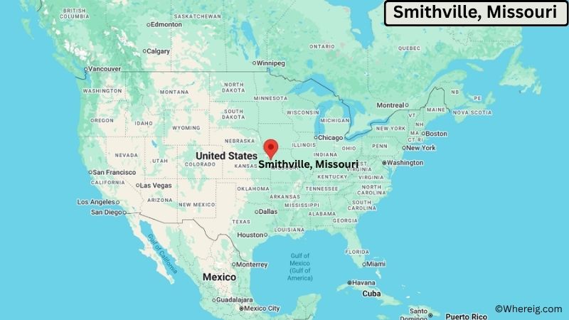
About Map: The map shows the location of Smithville in Clay County, in the U.S. state of Missouri.
Smithville Map, Missouri
About Smithville Map: The Google Map highlights the location of Smithville in Clay County, Missouri. Use the zoom, satellite, and street-view options to explore the city's neighborhoods, roads, and nearby places.
Where is Smithville Located?
Smithville is a city located in Clay County, Missouri, the United States. It lies in northwestern Missouri, about 20 miles north of downtown Kansas City and 15 miles north of Kansas City International Airport. Kearney is about 10 miles east, while Platte City is roughly 15 miles west of Smithville. The city is located at 39.3869° North latitude and 94.5816° West longitude. The 2020 Census recorded 10,406 residents. Smithville covers about 11.5 square miles (29.8 square kilometers), with most of its area consisting of land. Smithville Lake is the city's defining geographic feature and provides boating, fishing, camping, hiking, swimming, and wildlife viewing. The Little Platte River feeds the lake and forms part of the local landscape. Smithville's historic downtown reflects the community's early development. A unique feature of the city is its close connection to Smithville Lake, a major regional recreation destination just north of the Kansas City urban area.
Most Viewed US Maps
| USA Sttae Map | USA Region Map | USA Road Map |
| USA County Map | Where is USA in World Map? | US ZIP Code Map |
| USA Time Zones Map | US State and Capitals Map | USA Physical Map |
Find 4,400+ U.S. Cities by State - Explore Their Locations and Get Detailed Information
Smithville City Facts
| Fact | Details |
|---|---|
| City | Smithville |
| State | Missouri |
| County | Clay County |
| Country | United States |
| Region | Kansas City Metropolitan Area, Northwestern Missouri |
| Incorporated | 1845 |
| Founded | 1822 |
| Total Area | 11.5 sq mi (29.8 sq km) |
| Land Area | 11.0 sq mi (28.5 sq km) |
| Water Area | 0.5 sq mi (1.3 sq km) |
| Elevation | About 900 ft (274 m) |
| Population (2023 estimate) | About 11,000 |
| Population (2020 Census) | 10,406 |
| Population Density | About 946 people per sq mi |
| Time Zone | Central Time (CST/CDT) |
| ZIP Codes | 64089 |
| Area Code | 816 |
| Major Highways | U.S. Highway 169, Missouri Route 92, Missouri Route 33 |
| Public Transit | KCATA and regional demand-response transportation services |
| Major Attractions | Smithville Lake, Little Platte Park, Paradise Pointe Golf Complex, Smithville Historic District |
| Official Website | https://www.smithvillemo.org/ |
Distance from Smithville, MO to Nearby Cities
- Kearney, MO – 10 miles (16 km)
- Platte City, MO – 15 miles (24 km)
- Gladstone, MO – 15 miles (24 km)
- Liberty, MO – 15 miles (24 km)
- North Kansas City, MO – 18 miles (29 km)
- Kansas City, MO – 20 miles (32 km)
- Parkville, MO – 15 miles (24 km)
- Excelsior Springs, MO – 20 miles (32 km)
- Independence, MO – 30 miles (48 km)
- Blue Springs, MO – 35 miles (56 km)
- St. Joseph, MO – 45 miles (72 km)
- Lawson, MO – 25 miles (40 km)
- Raytown, MO – 30 miles (48 km)
- Lee's Summit, MO – 40 miles (64 km)
- Overland Park, KS – 35 miles (56 km)
- Olathe, KS – 45 miles (72 km)
- Leavenworth, KS – 30 miles (48 km)
- Topeka, KS – 90 miles (145 km)
Top Attractions in Smithville, Missouri
- Smithville Lake – A major regional recreation area offering boating, fishing, camping, hiking, swimming, beaches, and wildlife viewing.
- Little Platte Park – A large lakefront park with trails, picnic areas, boat access, camping facilities, and outdoor recreation.
- Paradise Pointe Golf Complex – A golf facility near Smithville Lake featuring two courses and scenic views of the surrounding landscape.
- Smithville Historic District – A collection of historic buildings and homes reflecting the community's development from the 19th century onward.
- Little Platte River – A local waterway that flows into Smithville Lake and contributes to the area's wetlands, wildlife habitat, and natural scenery.
- Smithville Dam – The large dam creates Smithville Lake and supports flood control, water management, recreation, and wildlife habitat.
- Watkins Mill State Park – A nearby historic and natural area featuring a preserved 19th-century woolen mill, trails, fishing, and camping.
- English Landing Park – A scenic riverfront park in nearby Parkville with walking and cycling trails, open lawns, and Missouri River views.
- Zona Rosa – A major shopping and dining district near Kansas City International Airport with pedestrian streets, restaurants, and community events.
Airports Near Smithville, Missouri
- Kansas City International Airport (MCI) – 15 miles
- Charles B. Wheeler Downtown Airport (MKC) – 25 miles
- Rosecrans Memorial Airport (STJ) – 45 miles
- New Century AirCenter (IXD) – 55 miles
Sources:
Population and area data sourced from the United States Census Bureau (2020 Census). General city information referenced from the official Smithville city website and local government records.
Other Missouri Maps & Info
- Where is Affton
- Where is Arnold
- Where is Ballwin
- Where is Belton
- Where is Blue Springs
- Where is Cape Girardeau
- Where is Chesterfield
- Where is Clayton
- Where is Columbia
- Where is Concord
- Where is Creve Coeur
- Where is Farmington
- Where is Ferguson
- Where is Florissant
- Where is Gladstone
- Where is Grandview
- Where is Hazelwood
- Where is Independence
- Where is Jefferson City
- Where is Joplin
- Where is Kirksville
- Where is Kirkwood
- Where is Lake St. Louis
- Where is Lee's Summit
- Where is Liberty
- Where is Manchester
- Where is Maryland Heights
- Where is Mehlville
- Where is Nixa
- Where is O'Fallon
- Where is Oakville
- Where is Old Jamestown
- Where is Ozark
- Where is Raymore
- Where is Raytown
- Where is Republic
- Where is Rolla
- Where is Sedalia
- Where is Spanish Lake
- Where is St. Charles
- Where is St. Joseph
- Where is St. Louis
- Where is St. Peters
- Where is University City
- Where is Warrensburg
- Where is Webster Groves
- Where is Wentzville
- Where is Wildwood