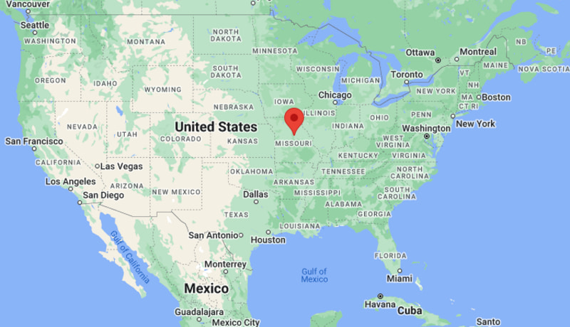
Where is Columbia Located? - Columbia is a city located in the Boone County of Missouri, United States. Columbia lies between 39.6360206 Degrees North latitudes and 119.8432487 Degrees West longitudes.
Location Map of Columbia, Missouri
Columbia Map, Missouri, USA
Where is Columbia?: The Google Map showing the location of Columbia in the U.S. state of Missouri.
Where is Columbia Located?
Columbia is a city located in the Boone County of Missouri, United States. Columbia lies between 39.6360206 Degrees North latitudes and 119.8432487 Degrees West longitudes. According to 2020 U.S.census, the population of Columbia city is 126254 people and the city has a total area of 65.57 sq mi. The city has numerous parks and recreational facilities.
Nearest Amtrak stations at Jefferson City and Hermann
Local Bus/Transit Service
Go COMO public transit system
Interstate 70 - Major east-west interstate connecting Columbia with St. Louis and Kansas City.
U.S. Route 63 - Primary north-south highway linking Columbia with Jefferson City, Kirksville, and Arkansas.
Missouri Route 740 (Stadium Boulevard) - Important commercial corridor serving shopping centers, businesses, and neighborhoods.
Broadway - Historic east-west street through downtown Columbia with restaurants, entertainment, and local businesses.
Providence Road - Major arterial connecting the University of Missouri campus with residential and commercial districts.
Key Landmarks and Places to Visit in Columbia, Missouri
Landmark Name
Type
University of Missouri
Public University Campus
Shelter Gardens
Botanical Garden
Rock Bridge Memorial State Park
State Park
The District
Downtown Entertainment District
Museum of Art and Archaeology
Museum
Mizzou Arena
Sports Arena
Finger Lakes State Park
State Park
Cosmo Park
City Park
Stephens Lake Park
Community Park
Boone County History and Culture Center
History Museum
Colleges and Universities in Columbia, Missouri
Institution Name
Type
Level
Notable For
University of Missouri
Public
University
Flagship research university, journalism, medicine, engineering
Columbia College
Private
College
Liberal arts, business, and online education
Stephens College
Private
College
Performing arts, fashion, and health sciences
Moberly Area Community College - Columbia Campus
Public
Community College
Career training and university transfer programs
William Woods University
Private
University
Business, education, and equestrian studies
Waterbodies in Columbia, Missouri
Missouri River, Perche Creek, Hinkson Creek, Grindstone Creek, Stephens Lake, Finger Lakes, Cedar Creek, Eagle Bluffs Lake, Little Bonne Femme Creek, Bonne Femme Creek
Golf Courses in Columbia, Missouri
The Club at Old Hawthorne, Columbia Country Club, A.L. Gustin Golf Course, Lake of the Woods Golf Course, Railwood Golf Club, Midway Golf & Games, Eagle Knoll Golf Course, Tanglewood Golf Course
Columbia, Missouri - Key Historical Facts
Columbia was founded in 1821 and became the county seat of Boone County shortly afterward.
The city was selected as the home of the University of Missouri in 1839, making higher education a defining part of its identity.
Throughout the 19th century, Columbia grew as a regional center for education, agriculture, commerce, and publishing.
The opening of Interstate 70 in the 20th century strengthened the city's economy by improving connections to Kansas City and St. Louis.
Healthcare, research, technology, education, and insurance have become major contributors to Columbia's modern economy.
Today, Columbia is recognized for its university culture, vibrant downtown, extensive trail system, healthcare facilities, and strong arts and music scene.