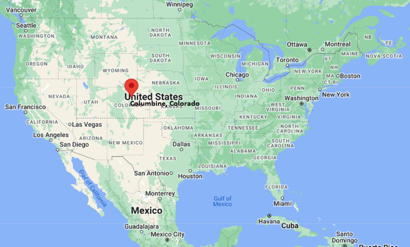
Where is Columbine Located? - Columbine is a city located in the Jefferson & ?Arapahoe County of Colorado, United States. Columbine lies between 41.9574 Degrees North latitudes and 72.5753 Degrees West longitudes.
Location Map of Columbine, Colorado
Columbine Map, Colorado, USA
Where is Columbine?: The Google Map showing the location of Columbine in the U.S. state of Colorado.
Where is Columbine Located?
Columbine is a city located in the Jefferson & ?Arapahoe County of Colorado, United States. Columbine lies between 41.9574 Degrees North latitudes and 72.5753 Degrees West longitudes. According to 2020 U.S.census, the population of Columbine city is 25229 people and the city has a total area of 6.63 sq mi. The city has numerous parks and recreational facilities.
Transportation and Connectivity in Columbine, Colorado
Feature
Details
Airport Name
Denver International Airport
IATA Code
DEN
Port
None (landlocked)
Major Highways
U.S. Highway 285, Colorado State Highway 121, C-470, Interstate 25 (nearby)
Train/Amtrak Service
No Amtrak station; nearby RTD Light Rail service at Littleton and Mineral stations
Local Bus/Transit Service
Regional Transportation District (RTD) bus and light rail services
U.S. Highway 285 - Major east-west corridor connecting Columbine with Denver and the Colorado foothills.
C-470 - Regional beltway providing convenient access to the southern and western Denver metropolitan area.
Colorado State Highway 121 (Wadsworth Boulevard) - Important north-south route serving residential and commercial districts.
South Pierce Street - Key local roadway connecting neighborhoods, parks, and shopping areas.
West Ken Caryl Avenue - Provides access to nearby communities, schools, and recreational facilities.
Key Landmarks and Places to Visit in Columbine, Colorado
Landmark Name
Type
Clement Park
Regional Park
Robert F. Clement Park Splash Pad
Family Recreation Area
South Platte Park and Carson Nature Center
Nature Preserve
Chatfield State Park
State Park
Hudson Gardens & Event Center
Botanical Garden
Denver Botanic Gardens at Chatfield Farms
Botanical Garden
Bear Creek Lake Park
Regional Park
Historic Downtown Littleton
Historic District
Red Rocks Park and Amphitheatre
Outdoor Amphitheater
DeKoevend Park
Community Park
Colleges and Universities in Columbine, Colorado
Institution Name
Type
Level
Notable For
Arapahoe Community College
Public
Community College
Transfer programs and workforce education
Red Rocks Community College
Public
Community College
Technical education and healthcare programs
University of Denver
Private
University
Business, law, and international studies
Metropolitan State University of Denver
Public
University
Business, education, and aviation
University of Colorado Denver
Public
University
Research, engineering, and health sciences
Waterbodies in Columbine, Colorado
South Platte River, Chatfield Reservoir, Marston Lake, Bear Creek, Bear Creek Lake, Quincy Reservoir, Soda Lakes, Cherry Creek Reservoir, Harriman Lake, Bowles Reservoir
Golf Courses in Columbine, Colorado
Raccoon Creek Golf Course, Foothills Golf Course, Columbine Country Club, The Meadows Golf Club, Pinehurst Country Club, Deer Creek Golf Club, Broken Tee Golf Course, Homestead Golf Course
Columbine, Colorado - Key Historical Facts
Columbine developed primarily during the 1950s and 1960s as suburban neighborhoods expanded southwest of Denver.
The community experienced rapid residential growth alongside the broader development of Jefferson County and the Denver metropolitan area.
Its location near the foothills of the Rocky Mountains made Columbine an attractive place for families seeking suburban living with easy access to outdoor recreation.
The area is served by extensive parks, trails, and open spaces, including nearby Chatfield State Park and South Platte Park.
Residential neighborhoods, local businesses, and recreational facilities continue to shape Columbine's community character.
Today, Columbine is known for its excellent parks, convenient transportation, quality schools, and proximity to both downtown Denver and the Rocky Mountain foothills.