
Where is Security-Widefield Located? - Security-Widefield is a city located in the El Paso County of Colorado, United States. Security-Widefield lies between 41.4570 Degrees North latitudes and 72.8231 Degrees West longitudes.
Location Map of Security-Widefield, Colorado
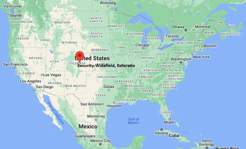
Security-Widefield Map, Colorado, USA
Where is Security-Widefield?: The Google Map showing the location of Security-Widefield in the U.S. state of Colorado.
Where is Security-Widefield Located?
Security-Widefield is a city located in the El Paso County of Colorado, United States. Security-Widefield lies between 41.4570 Degrees North latitudes and 72.8231 Degrees West longitudes. According to 2020 U.S.census, the population of Security-Widefield city is 38639 people and the city has a total area of 13 sq mi. The city has numerous parks and recreational facilities.
Most Viewed US Maps
| USA Sttae Map | USA Region Map | USA Road Map |
| USA County Map | Where is USA in World Map? | US ZIP Code Map |
| USA Time Zones Map | US State and Capitals Map | USA Physical Map |
Find 4,400+ U.S. Cities by State - Explore Their Locations and Get Detailed Information
Security-Widefield, Colorado Quick Facts
| Attribute | Details |
|---|---|
| City | Security-Widefield |
| County | El Paso County |
| State | Colorado |
| State Capital | Denver |
| US Region | Western United States |
| Latitude | 38.7473° N |
| Longitude | 104.7144° W |
| Elevation | 5,847 ft (1,782 m) |
| Land Area (sq mi) | 12.99 |
| Water Area (sq mi) | 0.48 |
| Total Area (sq mi) | 13.47 |
| Population (2020 Census) | 38,639 |
| Population Density (per sq mi) | 2,973.8 |
| ZIP Codes | 80817, 80911, 80913, 80925 |
| Area Code | 719 |
| Time Zone Standard | Mountain Standard Time (MST), UTC−7 |
| Time Zone Daylight | Mountain Daylight Time (MDT), UTC−6 |
| Currency | United States Dollar (USD) |
| FIPS Code | 0868847 |
| Congressional District | 5th Congressional District |
Transportation and Connectivity in Security-Widefield
| Transportation Feature | Details |
|---|---|
| Airport Name | Colorado Springs Airport |
| IATA Code | COS |
| Port | None |
| Major Highways | Interstate 25, U.S. Highway 85/87, Colorado State Highway 16, and Colorado State Highway 94 |
| Train/Amtrak Service | No Amtrak passenger rail station is located in Security-Widefield. The nearest Amtrak service is available in Colorado Springs. |
| Local Bus/Transit Service | Mountain Metro Transit provides bus service connecting Security-Widefield with Colorado Springs, Fountain, and surrounding communities. |
- Interstate 25 runs north-south west of Security-Widefield and connects the area with Colorado Springs, Denver, Pueblo, and other Front Range communities.
- U.S. Highway 85/87 provides a major north-south route through the Security-Widefield area and connects Colorado Springs with Fountain and southern El Paso County.
- Colorado State Highway 16 provides an east-west connection between Security-Widefield, Fort Carson, and areas toward the foothills west of Colorado Springs.
- Colorado State Highway 94 runs east-west south of the area and connects the region with Colorado Springs, Schriever Space Force Base, and eastern El Paso County.
Top Places to Visit in Security-Widefield, Colorado
| Landmark Name | Type |
|---|---|
| Widefield Community Park | Community Park |
| Bluestem Prairie Open Space | Open Space |
| Widefield Regional Park | Park |
| McCrae Reservoir | Reservoir |
| Big Johnson Reservoir | Reservoir |
| Fountain Creek Regional Park | Regional Park |
| Fountain Creek Nature Center | Nature Center |
| Fort Carson | Military Installation |
| Cheyenne Mountain State Park | State Park |
| Paint Mines Interpretive Park | Natural Attraction |
Driving Distances from Security-Widefield, Colorado to Nearby Cities
| City | State | Distance (mi) | Approx. Drive Time |
|---|---|---|---|
| Fountain | Colorado | 6 | 10 min |
| Colorado Springs | Colorado | 9 | 15 min |
| Stratmoor | Colorado | 5 | 10 min |
| Manitou Springs | Colorado | 16 | 25 min |
| Pueblo | Colorado | 45 | 45 min |
| Monument | Colorado | 29 | 30 min |
| Castle Rock | Colorado | 60 | 55 min |
| Woodland Park | Colorado | 35 | 45 min |
| Denver | Colorado | 75 | 1 hr 15 min |
| Canon City | Colorado | 55 | 1 hr |
Colleges and Universities in Security-Widefield, Colorado
| Institution Name | Type | Level | Notable For |
|---|---|---|---|
| Pikes Peak State College | Public | Community College | Career, technical, and transfer programs |
| University of Colorado Colorado Springs | Public | University | Research and undergraduate education |
| Colorado State University Pueblo | Public | University | Undergraduate and graduate programs |
| Colorado College | Private | University | Liberal arts education |
Waterbodies in Security-Widefield, Colorado
Fountain Creek, Big Johnson Reservoir, McCrae Reservoir, Widefield Aquatic Center ponds
Golf Courses in Security-Widefield, Colorado
Country Club of Colorado, Cheyenne Shadows Golf Club, Valley Hi Golf Course, Patty Jewett Golf Course
Key Landmarks and Places to Visit in Security-Widefield, Colorado
| Landmark Name | Type |
|---|---|
| Widefield Community Park | Community Park |
| Widefield Regional Park | Regional Park |
| Bluestem Prairie Open Space | Open Space |
| Fountain Creek Regional Park | Regional Park |
| Fountain Creek Nature Center | Nature Center |
| Big Johnson Reservoir | Reservoir |
| McCrae Reservoir | Reservoir |
| Fort Carson | Military Installation |
| Cheyenne Mountain State Park | State Park |
| Paint Mines Interpretive Park | Natural Attraction |
Waterbodies in Security-Widefield, Colorado
Fountain Creek, Big Johnson Reservoir, McCrae Reservoir
Golf Courses in Security-Widefield, Colorado
Country Club of Colorado, Cheyenne Shadows Golf Club, Valley Hi Golf Course, Patty Jewett Golf Course
Security-Widefield, Colorado — Key Historical Facts
- Security-Widefield developed as a suburban community south of Colorado Springs in El Paso County.
- The Security area was established in the 1950s as residential development expanded south of Colorado Springs.
- Widefield was developed as a planned community and grew alongside the expansion of nearby military installations and Colorado Springs.
- Fort Carson, established in 1942, has played an important role in the growth and economy of the surrounding Security-Widefield area.
- The community has expanded from its early suburban development into one of the larger unincorporated residential areas in the Colorado Springs region.
References
- El Paso County Government
- U.S. Census Bureau
- Pikes Peak State College
- University of Colorado Colorado Springs
- Cheyenne Mountain State Park — Colorado Parks and Wildlife
- Fort Carson — U.S. Army
Colorado Maps and Info
- Where is Arvada
- Where is Black Forest
- Where is Boulder
- Where is Brighton
- Where is Broomfield
- Where is Castle Rock
- Where is Centennial
- Where is Cimarron Hills
- Where is Clifton
- Where is Columbine
- Where is Commerce City
- Where is Dakota Ridge
- Where is Durango
- Where is Englewood
- Where is Erie
- Where is Evans
- Where is Firestone
- Where is Fort Carson
- Where is Fort Collins
- Where is Fountain
- Where is Frederick
- Where is Golden
- Where is Grand Junction
- Where is Greeley
- Where is Greenwood Village
- Where is Highlands Ranch
- Where is Johnstown
- Where is Ken Caryl
- Where is Lafayette
- Where is Lakewood
- Where is Littleton
- Where is Lone Tree
- Where is Longmont
- Where is Loveland
- Where is Montrose
- Where is Northglenn
- Where is Parker
- Where is Pueblo
- Where is Pueblo West
- Where is Security-Widefield
- Where is Sherrelwood
- Where is Thornton
- Where is Welby
- Where is Westminster
- Where is Wheat Ridge
- Where is Windsor