
Festus is a city in eastern Missouri and part of the St. Louis metropolitan area. It is about 35 miles south of downtown St. Louis in Jefferson County, near the Mississippi River. The city is known for its historic downtown, nearby Crystal City, Twin City Area, and easy access to outdoor attractions along the Big River and surrounding Ozark foothills.
Location Map of Festus, Jefferson County, Missouri
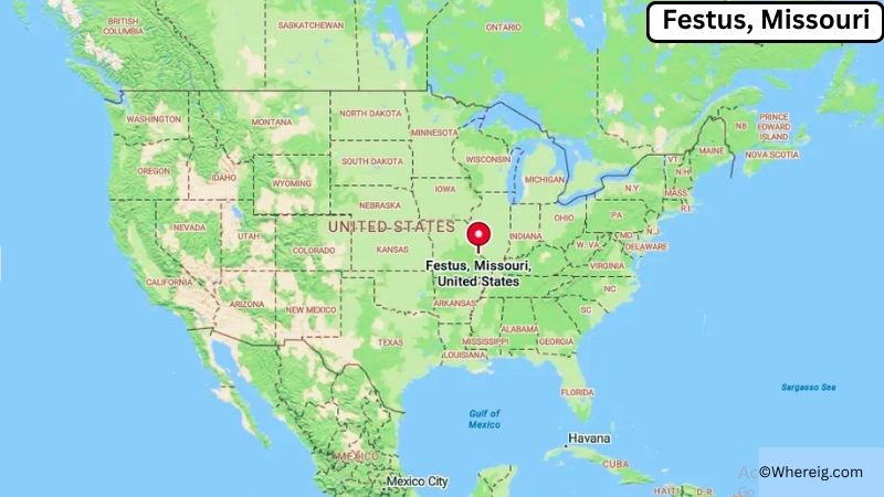
About Map: The map shows the location of Festus in Jefferson County, in the U.S. state of Missouri.
Festus Map, Missouri
About Festus Map: The Google Map highlights the location of Festus in Jefferson County, Missouri. Use the zoom, satellite, and street-view options to explore the city's neighborhoods, roads, and nearby places.
Where is Festus Located?
Festus is a city located in Jefferson County, Missouri, the United States. It lies in eastern Missouri, about 35 miles south of downtown St. Louis and roughly 5 miles west of the Mississippi River. Festus is positioned at approximately 38.220° North latitude and 90.396° West longitude. The city covers about 5.42 square miles, or 14.04 square kilometers, of land. The 2020 Census recorded 12,176 residents, while the 2023 population estimate was about 12,400. Festus stands at an elevation of roughly 500 feet above sea level. The city shares a close connection with neighboring Crystal City, and the two communities are often referred to together as the Twin Cities. Festus developed as an important commercial and transportation center in Jefferson County, with its location along Interstate 55 supporting continued growth. Nearby attractions include Crystal City Underground, Mastodon State Historic Site, and parks along the Big River. Its location south of St. Louis also makes it convenient for exploring the city's museums, historic districts, and Mississippi River attractions.
Most Viewed US Maps
| USA Sttae Map | USA Region Map | USA Road Map |
| USA County Map | Where is USA in World Map? | US ZIP Code Map |
| USA Time Zones Map | US State and Capitals Map | USA Physical Map |
Find 4,400+ U.S. Cities by State - Explore Their Locations and Get Detailed Information
Festus City Facts
| City | Festus |
|---|---|
| State | Missouri |
| County | Jefferson County |
| Country | United States |
| Region | Eastern Missouri, St. Louis Metropolitan Area |
| Incorporated | 1897 |
| Founded | 1878 |
| Total Area | 5.42 sq mi (14.04 sq km) |
| Land Area | 5.42 sq mi (14.04 sq km) |
| Water Area | 0 sq mi (0 sq km) |
| Elevation | 500 ft (152 m) |
| Population (2023 estimate) | About 12,400 |
| Population (2020 Census) | 12,176 |
| Population Density | 2,246.5 people per sq mi |
| Time Zone | Central Time (CST/CDT) |
| ZIP Codes | 63028, 63041 |
| Area Code | 636 |
| Major Highways | Interstate 55, U.S. Route 67, Missouri Route 32 |
| Public Transit | Jefferson County Transit |
| Major Attractions | Mastodon State Historic Site, Crystal City Underground, Twin City Area, Big River, Historic Downtown Festus |
| Official Website | https://www.festusmo.gov/ |
Distance from Festus, MO to Nearby Cities
- Crystal City, MO – 2 miles (3 km)
- Herculaneum, MO – 4 miles (6 km)
- Pevely, MO – 5 miles (8 km)
- Hillsboro, MO – 10 miles (16 km)
- Arnold, MO – 20 miles (32 km)
- Imperial, MO – 15 miles (24 km)
- De Soto, MO – 15 miles (24 km)
- Farmington, MO – 30 miles (48 km)
- Fenton, MO – 25 miles (40 km)
- Mehlville, MO – 25 miles (40 km)
- St. Louis, MO – 35 miles (56 km)
- Webster Groves, MO – 35 miles (56 km)
- Chesterfield, MO – 45 miles (72 km)
- Washington, MO – 55 miles (89 km)
- Union, MO – 60 miles (97 km)
- Cape Girardeau, MO – 90 miles (145 km)
- Columbia, MO – 115 miles (185 km)
- Springfield, MO – 220 miles (354 km)
Top Attractions in Festus
- Mastodon State Historic Site – A nationally significant archaeological site preserving Ice Age fossils and evidence of early human activity in the region.
- Crystal City Underground – A large former limestone mine beneath neighboring Crystal City used for events, storage, and special activities.
- Historic Downtown Festus – A local commercial district with older buildings, restaurants, shops, and community businesses.
- West City Park – A community recreation area with sports fields, playgrounds, walking areas, and open space.
- West City Park Aquatic Center – A seasonal community swimming facility serving Festus-area residents.
- Big River – A nearby waterway popular for fishing, canoeing, kayaking, and scenic outdoor recreation.
- Sunset Park – A local park with recreation facilities and open green space.
- Twin City Area – The connected communities of Festus and Crystal City offer local history, shopping, dining, and community events.
- Joachim Regional Landfill Recreation Area – A nearby outdoor area that provides recreational opportunities and open space.
- St. Francois State Park – A scenic park farther west with hiking trails, wooded hills, camping, and access to Big River.
Airports Near Festus
- Spirit of St. Louis Airport (SUS) – 45 miles
- St. Louis Downtown Airport (CPS) – 35 miles
- MidAmerica St. Louis Airport (BLV) – 45 miles
- St. Louis Lambert International Airport (STL) – 50 miles
- Farmington Regional Airport (FAM) – 35 miles
Sources:
Population and area data sourced from the United States Census Bureau (2020 Census). General city information referenced from the official City of Festus website and local government records.
Other Missouri Maps & Info
- Where is Affton
- Where is Arnold
- Where is Ballwin
- Where is Belton
- Where is Blue Springs
- Where is Cape Girardeau
- Where is Chesterfield
- Where is Clayton
- Where is Columbia
- Where is Concord
- Where is Creve Coeur
- Where is Farmington
- Where is Ferguson
- Where is Florissant
- Where is Gladstone
- Where is Grandview
- Where is Hazelwood
- Where is Independence
- Where is Jefferson City
- Where is Joplin
- Where is Kirksville
- Where is Kirkwood
- Where is Lake St. Louis
- Where is Lee's Summit
- Where is Liberty
- Where is Manchester
- Where is Maryland Heights
- Where is Mehlville
- Where is Nixa
- Where is O'Fallon
- Where is Oakville
- Where is Old Jamestown
- Where is Ozark
- Where is Raymore
- Where is Raytown
- Where is Republic
- Where is Rolla
- Where is Sedalia
- Where is Spanish Lake
- Where is St. Charles
- Where is St. Joseph
- Where is St. Louis
- Where is St. Peters
- Where is University City
- Where is Warrensburg
- Where is Webster Groves
- Where is Wentzville
- Where is Wildwood