
Rifle is a city in western Colorado and the county seat of Garfield County. It sits in the Colorado River Valley, about 60 miles west of Glenwood Springs and 190 miles west of Denver. The city is known for Rifle Falls, Rifle Gap State Park, nearby canyon country, and its location between the Grand Mesa and the rugged mountains of western Colorado.
Location Map of Rifle, Garfield County, Colorado
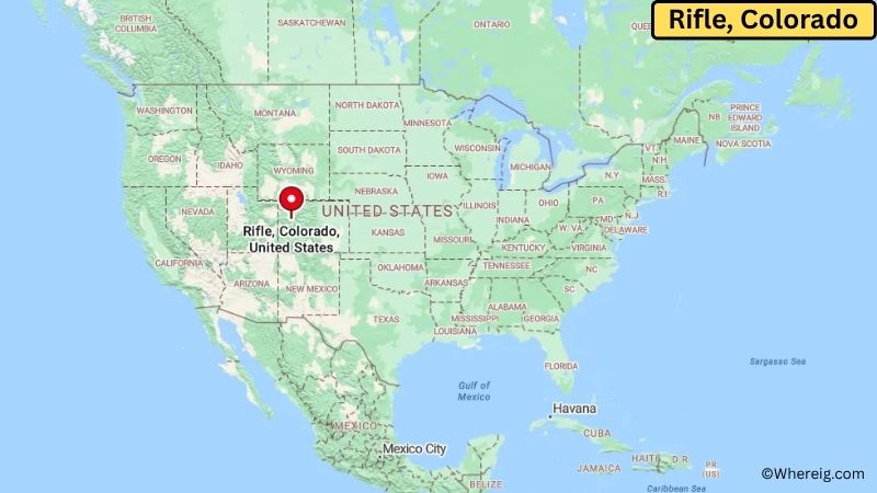
About Map: The map shows the location of Rifle in Garfield County, in the U.S. state of Colorado.
Rifle Map, Colorado
About Rifle Map: The Google Map highlights the location of Rifle in Garfield County, Colorado. Use the zoom, satellite, and street-view options to explore the city's neighborhoods, roads, and nearby places.
Where is Rifle Located?
Rifle is a city located in Garfield County, Colorado, the United States. It lies in western Colorado along the Colorado River, about 60 miles west of Glenwood Springs and roughly 190 miles west of Denver. Grand Junction is around 60 miles west, while Meeker is about 70 miles north. Rifle is positioned near 39.534° North latitude and 107.784° West longitude. The 2020 Census recorded 9,133 residents. The city covers about 5.84 square miles, or 15.13 square kilometers. Rifle was incorporated in 1904 and grew around agriculture, ranching, transportation, and natural resources. The Colorado River and nearby creeks support the fertile valley surrounding the city, while the surrounding mountains and plateaus create a rugged western Colorado landscape. Rifle Falls State Park is one of the area's best-known attractions and features a three-tiered waterfall, hiking trails, picnic areas, and limestone caves. Rifle Gap State Park provides boating, fishing, camping, and water recreation at a reservoir north of the city. A unique feature of Rifle is its close connection to both the Colorado River Valley and the high desert and mountain landscapes of the Western Slope. Rifle Mountain Park is also known for rock climbing and dramatic canyon scenery. Interstate 70 passes directly through the area, providing an important east-west route between Denver, Grand Junction, and Utah.
Most Viewed US Maps
| USA Sttae Map | USA Region Map | USA Road Map |
| USA County Map | Where is USA in World Map? | US ZIP Code Map |
| USA Time Zones Map | US State and Capitals Map | USA Physical Map |
Find 4,400+ U.S. Cities by State - Explore Their Locations and Get Detailed Information
Rifle City Facts
| City | Rifle |
| State | Colorado |
| County | Garfield County |
| Country | United States |
| Region | Western Colorado and Colorado River Valley |
| Incorporated | 1904 |
| Founded | 1882 |
| Total Area | 5.84 sq mi (15.13 sq km) |
| Land Area | 5.81 sq mi (15.05 sq km) |
| Water Area | 0.03 sq mi (0.08 sq km) |
| Elevation | 5,342 ft (1,628 m) |
| Population (2023 estimate) | About 9,200 |
| Population (2020 Census) | 9,133 |
| Population Density | 1,573 people per sq mi |
| Time Zone | Mountain Time (MST/MDT) |
| ZIP Codes | 81650 |
| Area Code | 970 |
| Major Highways | I-70, CO-13, and CO-325 |
| Public Transit | RFTA bus services |
| Major Attractions | Rifle Falls State Park, Rifle Gap State Park, Rifle Mountain Park, and Rifle Heritage Center |
| Official Website | https://www.rifleco.org/ |
Distance from Rifle, CO to Nearby Cities
- Silt, CO – 10 miles (16 km)
- Parachute, CO – 20 miles (32 km)
- New Castle, CO – 25 miles (40 km)
- Grand Junction, CO – 60 miles (97 km)
- Glenwood Springs, CO – 60 miles (97 km)
- Carbondale, CO – 50 miles (80 km)
- Basalt, CO – 65 miles (105 km)
- Delta, CO – 100 miles (161 km)
- Montrose, CO – 115 miles (185 km)
- Craig, CO – 115 miles (185 km)
- Meeker, CO – 70 miles (113 km)
- Steamboat Springs, CO – 150 miles (241 km)
- Vail, CO – 115 miles (185 km)
- Aspen, CO – 75 miles (121 km)
- Denver, CO – 190 miles (306 km)
- Moab, UT – 150 miles (241 km)
- Salt Lake City, UT – 270 miles (435 km)
- Durango, CO – 280 miles (451 km)
Top Attractions in Rifle
- Rifle Falls State Park – A scenic state park known for its three-tiered waterfall, limestone caves, hiking trails, picnic areas, and wooded canyon landscape.
- Rifle Gap State Park – A reservoir recreation area north of Rifle offering boating, fishing, camping, swimming, and hiking.
- Rifle Mountain Park – A popular outdoor area featuring limestone cliffs, rock climbing routes, hiking opportunities, and dramatic canyon scenery.
- Rifle Heritage Center – A local historical center preserving artifacts, photographs, and stories about Rifle and the surrounding region.
- Rifle Arch – A natural sandstone arch and hiking destination with views across the surrounding canyon and valley.
- Colorado River – The river flows through the Rifle area and supports fishing, boating, wildlife viewing, and scenic recreation.
- Harvey Gap State Park – A nearby reservoir park offering fishing, boating, camping, and quiet outdoor recreation.
- Grand Mesa – A large nearby mountain plateau with lakes, forests, hiking trails, fishing areas, and winter recreation.
- Glenwood Caverns Adventure Park – A major attraction near Glenwood Springs featuring cave tours, mountain views, and family rides.
Airports Near Rifle, CO
- Garfield County Regional Airport (RIL) – 3 miles
- Grand Junction Regional Airport (GJT) – 55 miles
- Aspen/Pitkin County Airport (ASE) – 70 miles
- Eagle County Regional Airport (EGE) – 75 miles
- Montrose Regional Airport (MTJ) – 115 miles
Sources:
Population and area data sourced from the United States Census Bureau (2020 Census). General city information referenced from the official Rifle city website and local government records.
Colorado Maps and Info
- Where is Arvada
- Where is Black Forest
- Where is Boulder
- Where is Brighton
- Where is Broomfield
- Where is Castle Rock
- Where is Centennial
- Where is Cimarron Hills
- Where is Clifton
- Where is Columbine
- Where is Commerce City
- Where is Dakota Ridge
- Where is Durango
- Where is Englewood
- Where is Erie
- Where is Evans
- Where is Firestone
- Where is Fort Carson
- Where is Fort Collins
- Where is Fountain
- Where is Frederick
- Where is Golden
- Where is Grand Junction
- Where is Greeley
- Where is Greenwood Village
- Where is Highlands Ranch
- Where is Johnstown
- Where is Ken Caryl
- Where is Lafayette
- Where is Lakewood
- Where is Littleton
- Where is Lone Tree
- Where is Longmont
- Where is Loveland
- Where is Montrose
- Where is Northglenn
- Where is Parker
- Where is Pueblo
- Where is Pueblo West
- Where is Security-Widefield
- Where is Sherrelwood
- Where is Thornton
- Where is Welby
- Where is Westminster
- Where is Wheat Ridge
- Where is Windsor