
St. John is a small city in eastern Missouri and part of St. Louis County. Located about 12 miles northwest of downtown St. Louis, it forms part of the suburban communities surrounding the city. St. John is known for its residential neighborhoods, convenient access to Lambert International Airport, nearby parks, and its location within the greater St. Louis metropolitan area.
Location Map of St. John, St. Louis County, Missouri
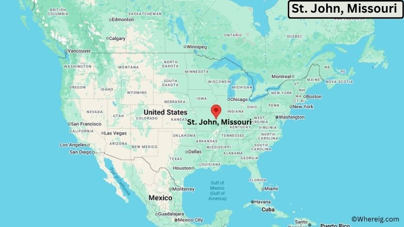
About Map: The map shows the location of St. John in St. Louis County, in the U.S. state of Missouri.
St. John Map, Missouri
About St. John Map: The Google Map highlights the location of St. John in St. Louis County, Missouri. Use the zoom, satellite, and street-view options to explore the city's neighborhoods, roads, and nearby places.
Where is St. John Located?
St. John is a city located in St. Louis County, Missouri, the United States. It lies in eastern Missouri within the St. Louis metropolitan area, about 12 miles northwest of downtown St. Louis and roughly 10 miles southwest of Florissant. Overland is about 5 miles west, while St. Ann is approximately 3 miles southeast of St. John. The city is located at 38.7137° North latitude and 90.3429° West longitude. The 2020 Census recorded 6,902 residents. St. John covers about 1.46 square miles, or approximately 3.78 square kilometers. Lambert-St. Louis International Airport is immediately nearby and is a major transportation feature for the area. St. John is primarily residential, with local businesses, schools, churches, parks, and municipal facilities serving the community. Its location provides easy access to major highways and employment centers throughout St. Louis County and the city of St. Louis. A unique feature of St. John is its compact suburban setting close to one of the region's major airports.
Most Viewed US Maps
| USA Sttae Map | USA Region Map | USA Road Map |
| USA County Map | Where is USA in World Map? | US ZIP Code Map |
| USA Time Zones Map | US State and Capitals Map | USA Physical Map |
Find 4,400+ U.S. Cities by State - Explore Their Locations and Get Detailed Information
St. John City Facts
| Fact | Details |
|---|---|
| City | St. John |
| State | Missouri |
| County | St. Louis County |
| Country | United States |
| Region | Eastern Missouri, St. Louis Metropolitan Area |
| Incorporated | 1948 |
| Founded | 1940s |
| Total Area | 1.46 sq mi (3.78 sq km) |
| Land Area | 1.46 sq mi (3.78 sq km) |
| Water Area | 0.00 sq mi (0.00 sq km) |
| Elevation | About 568 ft (173 m) |
| Population (2023 estimate) | About 6,900 |
| Population (2020 Census) | 6,902 |
| Population Density | About 4,727 people per sq mi |
| Time Zone | Central Time (CST/CDT) |
| ZIP Codes | 63114, 63134 |
| Area Code | 314, 557 |
| Major Highways | Interstate 70, Interstate 170, U.S. Route 67 |
| Public Transit | MetroBus and MetroLink services in the St. Louis region |
| Major Attractions | St. Louis Lambert International Airport, St. Louis Zoo, Forest Park, The Delmar Loop, St. Louis Science Center |
| Official Website | https://www.stjohnmo.gov/ |
Distance from St. John, MO to Nearby Cities
- St. Ann, MO – 3 miles (5 km)
- Overland, MO – 5 miles (8 km)
- Bridgeton, MO – 5 miles (8 km)
- Berkeley, MO – 5 miles (8 km)
- Breckenridge Hills, MO – 5 miles (8 km)
- Woodson Terrace, MO – 5 miles (8 km)
- St. Louis, MO – 12 miles (19 km)
- Florissant, MO – 10 miles (16 km)
- University City, MO – 10 miles (16 km)
- Maryland Heights, MO – 10 miles (16 km)
- Creve Coeur, MO – 12 miles (19 km)
- Clayton, MO – 12 miles (19 km)
- Hazelwood, MO – 8 miles (13 km)
- Chesterfield, MO – 20 miles (32 km)
- Kirkwood, MO – 20 miles (32 km)
- Webster Groves, MO – 18 miles (29 km)
- O'Fallon, MO – 25 miles (40 km)
- St. Charles, MO – 25 miles (40 km)
Top Attractions in St. John
- St. Louis Lambert International Airport – The region's primary commercial airport and an important transportation hub located immediately south of St. John.
- Forest Park – A large urban park in nearby St. Louis containing the St. Louis Zoo, museums, trails, lakes, and recreational facilities.
- St. Louis Zoo – A major free-admission zoo in Forest Park featuring animals, educational exhibits, and conservation programs.
- St. Louis Science Center – A science museum and educational complex with interactive exhibits, a planetarium, and hands-on programs.
- The Delmar Loop – A popular entertainment and dining district in University City and St. Louis with shops, restaurants, music venues, and cultural attractions.
- Missouri History Museum – A museum in Forest Park documenting the history of St. Louis and Missouri.
- Saint Louis Art Museum – A major art museum in Forest Park with collections spanning many periods and cultures.
- Gateway Arch National Park – A major St. Louis landmark centered on the Gateway Arch and the city's Mississippi River history.
- O'Fallon Park – A large St. Louis city park with walking paths, recreation areas, sports facilities, and a community pool.
Airports Near St. John, Missouri
- St. Louis Lambert International Airport (STL) – 2 miles
- Spirit of St. Louis Airport (SUS) – 20 miles
- St. Louis Downtown Airport (CPS) – 20 miles
- MidAmerica St. Louis Airport (BLV) – 35 miles
Sources:
Population and area data sourced from the United States Census Bureau (2020 Census). General city information referenced from the official St. John city website and local government records.
Other Missouri Maps & Info
- Where is Affton
- Where is Arnold
- Where is Ballwin
- Where is Belton
- Where is Blue Springs
- Where is Cape Girardeau
- Where is Chesterfield
- Where is Clayton
- Where is Columbia
- Where is Concord
- Where is Creve Coeur
- Where is Farmington
- Where is Ferguson
- Where is Florissant
- Where is Gladstone
- Where is Grandview
- Where is Hazelwood
- Where is Independence
- Where is Jefferson City
- Where is Joplin
- Where is Kirksville
- Where is Kirkwood
- Where is Lake St. Louis
- Where is Lee's Summit
- Where is Liberty
- Where is Manchester
- Where is Maryland Heights
- Where is Mehlville
- Where is Nixa
- Where is O'Fallon
- Where is Oakville
- Where is Old Jamestown
- Where is Ozark
- Where is Raymore
- Where is Raytown
- Where is Republic
- Where is Rolla
- Where is Sedalia
- Where is Spanish Lake
- Where is St. Charles
- Where is St. Joseph
- Where is St. Louis
- Where is St. Peters
- Where is University City
- Where is Warrensburg
- Where is Webster Groves
- Where is Wentzville
- Where is Wildwood