Map of Wright County - Wright County is a county located in the U.S. state of Missouri. Wright County Map showing cities, highways, important places and water bodies. Get Where is Wright County located in the map, major cities in Wright county, population, areas, and places of interest.
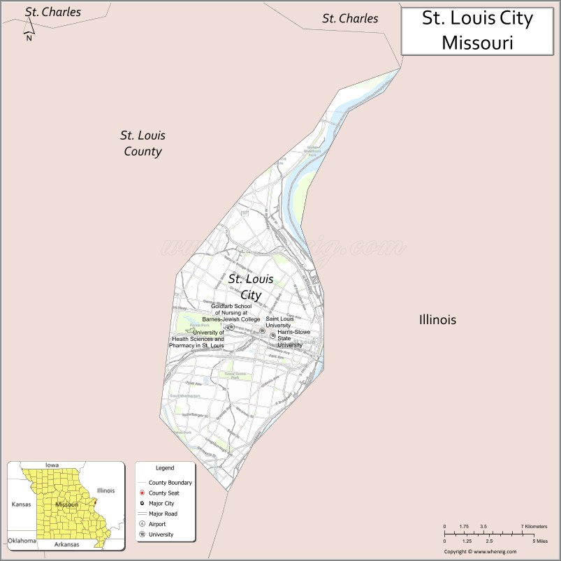
Map of St Louis County, Missouri
About Wright County Map, Missouri: The map showing the county boundary, county seat, major cities, highways, water bodies and neighbouring counties.
Related Missouri Maps & Info
St Louis County, Missouri
Cascade County is a county located in the U.S. state of Montana. It`s county seat is Great Falls. As per 2020 census, the population of Cascade County was 84511 and population density of Cascade was square miles. According to the United States Census Bureau, the county has a total area of 2,698 sq mi (6,988 km2). Cascade County was established on -4492.
St. Louis County Facts
| Continent | North America |
| Country | United States |
| State | Missouri |
| County Seat | Clayton |
| Largest City/Town | Florissant |
| Established | 1812 |
| Total Area | 523 sq mi (1,354 sq km) |
| Land Area | 508 sq mi (1,316 sq km) |
| Water Area | 15 sq mi (39 sq km) |
| Population | 1,004,125 (Census 2020) |
| Population Density | 1,977 people per sq mi |
| Time Zone | Central Time Zone (CST/CDT) |
| Major Highways | Interstate 64, Interstate 70, Interstate 170, Interstate 270, Interstate 44 |
| Major Rivers | Missouri River, Mississippi River nearby region, Meramec River |
| Neighboring Counties | St. Charles County, Jefferson County, Franklin County, Madison County (Illinois), St. Clair County (Illinois) |
| Famous For | Suburban St. Louis communities, Forest Park nearby region, major businesses, and cultural attractions |
| Top Attractions | St. Louis Zoo nearby region, Forest Park nearby region, Grant's Farm, and The Magic House nearby region |
| Official Website | Official Website |
About St. Louis County
St. Louis County is located in eastern Missouri surrounding the independent City of St. Louis and was established in 1812. The county seat is Clayton, while Florissant is the largest municipality. The county is known for major suburban communities, economic development, parks, museums, universities, and transportation networks.
Cities and Towns in St. Louis County, Missouri
| City/Town | Population (Census 2020) | Latitude & Longitude |
|---|---|---|
| Florissant | 52,533 | 38.7892°N, 90.3226°W |
| Chesterfield | 49,999 | 38.6631°N, 90.5771°W |
| Wildwood | 35,417 | 38.5820°N, 90.6412°W |
| University City | 35,065 | 38.6559°N, 90.3093°W |
| Clayton (county seat) | 17,355 | 38.6426°N, 90.3237°W |
| Kirkwood | 27,540 | 38.5814°N, 90.4068°W |
What are the Golf Courses in St. Louis County
| Golf Course | Location | Latitude & Longitude |
|---|---|---|
| Bellerive Country Club | Town and Country | 38.6258°N, 90.4852°W |
| Normandie Golf Club | Bel-Nor | 38.7024°N, 90.3028°W |
| Gateway National Golf Links nearby region | East St. Louis nearby region | 38.6264°N, 90.1410°W |
Major Roads and Highways in St. Louis County
Major highways connect St. Louis County with the greater St. Louis metropolitan region and national transportation corridors.
- Interstate 64 - major east-west interstate through the metropolitan area
- Interstate 70 - national transportation corridor linking Missouri and Illinois
- Interstate 170 - regional connector route through inner suburbs
- Interstate 270 - beltway serving suburban communities and business districts
- Interstate 44 - southwest transportation route connecting St. Louis with Springfield and Oklahoma
What are Neighboring Counties of St. Louis County
- St. Charles County (west)
- Franklin County (southwest)
- Jefferson County (south)
- Madison County, Illinois (northeast)
- St. Clair County, Illinois (east)
What Are the Top Attractions in St. Louis County
The county offers cultural attractions, parks, museums, shopping districts, and family entertainment destinations.
- Forest Park nearby region - museums, trails, lakes, and outdoor recreation
- St. Louis Zoo nearby region - nationally recognized zoo with family attractions
- Grant's Farm - historic estate, animal park, and family entertainment
- The Magic House nearby region - interactive children's museum and educational exhibits
- Delmar Loop nearby region - entertainment district with restaurants, music venues, and shopping
- Missouri Botanical Garden nearby region - botanical displays and historic landscapes
- West County Center and Chesterfield Valley - shopping and dining destinations
- Laumeier Sculpture Park - outdoor art installations and walking trails
- Parks and Greenways - biking, hiking, sports, and recreation facilities
- Community Festivals and Cultural Events - concerts, fairs, and seasonal celebrations
What Is the Distance from St. Louis County to Nearby Cities
The following distances are measured by road (driving).
- Clayton to St. Louis (St. Louis City), Missouri - 10 mi (16 km)
- Clayton to St. Charles (St. Charles County), Missouri - 20 mi (32 km)
- Clayton to Jefferson City (Cole County), Missouri - 129 mi (208 km)
- Clayton to Columbia (Boone County), Missouri - 126 mi (203 km)
- Clayton to Chesterfield (St. Louis County), Missouri - 18 mi (29 km)
- Clayton to Florissant (St. Louis County), Missouri - 16 mi (26 km)
- Clayton to Springfield (Greene County), Missouri - 216 mi (348 km)
- Clayton to Kansas City (Jackson County), Missouri - 248 mi (399 km)
- Clayton to Chicago (Cook County), Illinois - 296 mi (476 km)
- Clayton to Indianapolis (Marion County), Indiana - 242 mi (389 km)
- Clayton to Nashville (Davidson County), Tennessee - 309 mi (497 km)
- Clayton to Dallas (Dallas County), Texas - 635 mi (1,022 km)
- Clayton to Denver (Denver County), Colorado - 850 mi (1,368 km)
FAQs about St. Louis County
St. Louis County is located in eastern Missouri surrounding the independent City of St. Louis.
St. Louis County had a population of 1,004,125 according to the 2020 United States Census.
St. Louis County is known for suburban communities, parks, museums, cultural attractions, and economic development.
The county is served by Interstate 64, Interstate 70, Interstate 170, Interstate 270, and Interstate 44.
Yes, St. Louis County includes famous golf facilities such as Bellerive Country Club and Normandie Golf Club.
References
- QuickFacts - U.S. Census Bureau
- United States Census Bureau
- United States Geological Survey (USGS)
- National Geodetic Survey
- Official Website
- Adair County Map
- Andrew County Map
- Atchison County Map
- Audrain County Map
- Barry County Map
- Barton County Map
- Bates County Map
- Benton County Map
- Bollinger County Map
- Boone County Map
- Buchanan County Map
- Butler County Map
- Caldwell County Map
- Callaway County Map
- Camden County Map
- Cape Girardeau County Map
- Carroll County Map
- Carter County Map
- Cass County Map
- Cedar County Map
- Chariton County Map
- Christian County Map
- Clark County Map
- Clay County Map
- Clinton County Map
- Cole County Map
- Cooper County Map
- Crawford County Map
- Dade County Map
- Dallas County Map
- Daviess County Map
- DeKalb County Map
- Dent County Map
- Douglas County Map
- Dunklin County Map
- Franklin County Map
- Gasconade County Map
- Gentry County Map
- Greene County Map
- Grundy County Map
- Harrison County Map
- Henry County Map
- Hickory County Map
- Holt County Map
- Howard County Map
- Howell County Map
- Iron County Map
- Jackson County Map
- Jasper County Map
- Jefferson County Map
- Johnson County Map
- Knox County Map
- Laclede County Map
- Lafayette County Map
- Lawrence County Map
- Lewis County Map
- Lincoln County Map
- Linn County Map
- Livingston County Map
- McDonald County Map
- Macon County Map
- Madison County Map
- Maries County Map
- Marion County Map
- Mercer County Map
- Miller County Map
- Mississippi County Map
- Moniteau County Map
- Monroe County Map
- Montgomery County Map
- Morgan County Map
- New Madrid County Map
- Newton County Map
- Nodaway County Map
- Oregon County Map
- Osage County Map
- Ozark County Map
- Pemiscot County Map
- Perry County Map
- Pettis County Map
- Phelps County Map
- Pike County Map
- Platte County Map
- Polk County Map
- Pulaski County Map
- Putnam County Map
- Ralls County Map
- Randolph County Map
- Ray County Map
- Reynolds County Map
- Ripley County Map
- St Charles County Map
- St Clair County Map
- Ste Genevieve County Map
- St Francois County Map
- St Louis County Map
- Saline County Map
- Schuyler County Map
- Scotland County Map
- Scott County Map
- Shannon County Map
- Shelby County Map
- Stoddard County Map
- Stone County Map
- Sullivan County Map
- Taney County Map
- Texas County Map
- Vernon County Map
- Warren County Map
- Washington County Map
- Wayne County Map
- Webster County Map
- Worth County Map
- Wright County Map
- St Louis County Map
- Alabama Counties
- Alaska boroughs
- Arizona Counties
- Arkansas Counties
- California County Map
- Colorado Counties
- Connecticut Counties
- Delaware Counties
- Florida County Map
- Georgia County Map
- Hawaii Counties
- Idaho Counties
- Illinois Counties
- Indiana Counties
- Iowa Counties
- Kansas Counties
- Kentucky Counties
- Louisiana Counties
- Maine Counties
- Maryland Counties
- Massachusetts Counties
- Michigan County Map
- Minnesota Counties
- Mississippi Counties
- Missouri Counties
- Montana Counties
- Nebraska Counties
- Nevada Counties
- New York Counties
- New Hampshire Counties
- New Jersey Counties
- New Mexico Counties
- North Carolina Counties
- North Dakota Counties
- Ohio County Map
- Oklahoma Counties
- Oregon Counties
- Pennsylvania Counties
- Rhode Island Counties
- South Carolina Counties
- South Dakota Counties
- Map of Tennessee
- Texas County Map
- Utah Counties
- Vermont Counties
- Virginia Counties
- Washington Counties
- West Virginia Counties
- Wisconsin Counties
- Wyoming Counties