
Where is Eloy Located? - Eloy is a city located in the Pinal County of Arizona, United States. Eloy lies between 33.5836 Degrees North latitudes and 92.8341 Degrees West longitudes.
Location Map of Eloy, Arizona
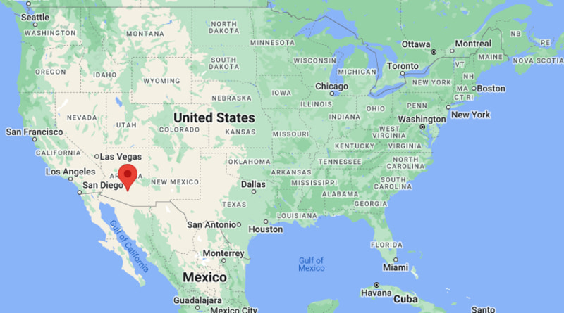
Eloy Map, Arizona, USA
Where is Eloy?: The Google Map showing the location of Eloy in the U.S. state of Arizona.
Where is Eloy Located?
Eloy is a city located in the Pinal County of Arizona, United States. Eloy lies between 33.5836 Degrees North latitudes and 92.8341 Degrees West longitudes. According to 2020 U.S.census, the population of Eloy city is 15635 people and the city has a total area of 113.49 sq mi. The city has numerous parks and recreational facilities.
Most Viewed US Maps
| USA Sttae Map | USA Region Map | USA Road Map |
| USA County Map | Where is USA in World Map? | US ZIP Code Map |
| USA Time Zones Map | US State and Capitals Map | USA Physical Map |
Find 4,400+ U.S. Cities by State - Explore Their Locations and Get Detailed Information
Eloy, Arizona Quick Facts
| Property | Details |
|---|---|
| City | Eloy |
| County | Pinal County |
| State | Arizona |
| State Capital | Phoenix |
| US Region | West |
| Latitude | 32.7559°N |
| Longitude | 111.5557°W |
| Elevation | 1,555 ft (474 m) |
| Land Area | 112.34 sq mi |
| Water Area | 0.03 sq mi |
| Total Area | 112.37 sq mi |
| Population (2020 Census) | 15,635 |
| Population Density | Approximately 139 per sq mi |
| ZIP Code | 85131 |
| Area Code | 520 |
| Time Zone Standard | Mountain Standard Time (MST), UTC−7 |
| Time Zone Daylight | Arizona does not observe Daylight Saving Time |
| Currency | US Dollar (USD) |
| FIPS Code | 04-23080 |
| Congressional District | Arizona's 6th Congressional District |
Nearby Cities to Eloy, Arizona
- Arizona City, Arizona - South - 8 mi
- Casa Grande, Arizona - Northwest - 16 mi
- Coolidge, Arizona - North - 24 mi
- Picacho, Arizona - Southeast - 24 mi
- Maricopa, Arizona - Northwest - 33 mi
- Florence, Arizona - Northeast - 36 mi
- Chandler, Arizona - North - 56 mi
- Phoenix, Arizona - North - 66 mi
- Tucson, Arizona - Southeast - 67 mi
- Apache Junction, Arizona - Northeast - 71 mi
Eloy, Arizona Climate and Weather Overview
| Month | Avg High (°F) | Avg Low (°F) | Avg Rainfall (in) |
|---|---|---|---|
| January | 67 | 39 | 0.80 |
| April | 88 | 55 | 0.20 |
| July | 105 | 78 | 1.10 |
| October | 90 | 59 | 0.60 |
| Annual | 88 | 58 | 9.20 |
| Climate Attribute | Details |
|---|---|
| Climate Classification (Köppen) | Hot Desert (BWh) |
| Annual Rainfall | Approximately 9 inches |
| Annual Sunshine Days | About 295 days |
| Hurricane/Tornado Risk | Very low hurricane risk; very low tornado risk |
| Snowfall | Rare (0 inches annually) |
Driving Distances from Eloy, Arizona
| City | State | Distance (mi) | Approx. Drive Time |
|---|---|---|---|
| Arizona City | Arizona | 8 | 10 min |
| Casa Grande | Arizona | 16 | 18 min |
| Coolidge | Arizona | 24 | 30 min |
| Picacho | Arizona | 24 | 25 min |
| Maricopa | Arizona | 33 | 40 min |
| Florence | Arizona | 36 | 45 min |
| Chandler | Arizona | 56 | 55 min |
| Phoenix | Arizona | 66 | 1 hr 10 min |
| Tucson | Arizona | 67 | 1 hr 10 min |
| Apache Junction | Arizona | 71 | 1 hr 20 min |
Transportation and Connectivity in Eloy, Arizona
| Transportation | Details |
|---|---|
| Airport Name | Phoenix Sky Harbor International Airport (nearest major airport) |
| IATA Code | PHX |
| Port | None |
| Major Highways | Interstate 10, Arizona State Route 87, Arizona State Route 84 |
| Train/Amtrak Service | No passenger rail service; nearest Amtrak station is in Maricopa, Arizona |
| Local Bus/Transit Service | Pinal County regional transportation services (limited) |
- Interstate 10 provides direct highway access to both Phoenix and Tucson, making Eloy an important transportation corridor in central Arizona.
- Arizona State Routes 84 and 87 connect the city with Casa Grande, Coolidge, and surrounding communities.
- Eloy Municipal Airport supports general aviation and is internationally recognized for skydiving activities.
- Phoenix Sky Harbor International Airport, about 65 miles north, is the nearest major airport offering domestic and international flights.
Places to Visit in Eloy, Arizona
| Landmark Name | Type |
|---|---|
| Skydive Arizona | Adventure Sports Center |
| Eloy Municipal Airport | Aviation Facility |
| Picacho Peak State Park | State Park |
| Casa Grande Ruins National Monument | National Monument |
| Santa Cruz Valley Historic Museum | History Museum |
| Main Street Park | Community Park |
| Robson Ranch Golf Club | Golf Resort |
| Arizona City Golf Course | Golf Course |
| McFarland State Historic Park | Historic Site |
| Pinal Fairgrounds and Event Center | Event Venue |
Colleges and Universities in Eloy, Arizona
| Institution Name | Type | Level | Notable For |
|---|---|---|---|
| Central Arizona College | Public | Community College | Transfer education and workforce training |
| Central Arizona College – Superstition Mountain Campus | Public | Community College | Career and technical education |
| University of Arizona | Public | University | Research, engineering, and agriculture |
| Arizona State University | Public | University | Research and professional education |
| Pima Community College | Public | Community College | Academic transfer and vocational programs |
| Chandler-Gilbert Community College | Public | Community College | Business, health sciences, and technology |
| Northern Arizona University | Public | University | Education and health sciences |
| Eloy Elementary School District | Public | K–12 District | Primary and secondary education |
Waterbodies in Eloy, Arizona
Santa Cruz River, Santa Rosa Wash, Greene Wash, Casa Grande Canal, Central Arizona Project Canal, Picacho Reservoir, Arizona City Lake, Robson Ranch Lake
Golf Courses in Eloy, Arizona
Robson Ranch Golf Club, Arizona City Golf Course, Mission Royale Golf Club, Dave White Municipal Golf Course, Francisco Grande Golf Club, Poston Butte Golf Club, Ak-Chin Southern Dunes Golf Club, The Duke at Rancho El Dorado
Eloy, Arizona — Key Historical Facts
- Eloy was founded in 1902 as a railroad town along the Southern Pacific Railroad and developed as an agricultural service center for central Arizona.
- The city's name originated from a railroad abbreviation meaning "East Line of Yuma."
- Cotton farming, cattle ranching, and irrigation projects played major roles in Eloy's early economic development.
- During the second half of the 20th century, the city expanded through transportation, correctional facilities, and aviation-related industries.
- Eloy gained international recognition as the home of Skydive Arizona, one of the world's largest skydiving centers attracting visitors from around the globe.
- Today, Eloy continues to grow as a transportation hub between Phoenix and Tucson while supporting agriculture, logistics, manufacturing, and adventure tourism.
References
Arizona Related Links
- Where is Anthem
- Where is Apache Junction
- Where is Avondale
- Where is Benson
- Where is Bullhead City
- Where is Casa Grande
- Where is Casas Adobes
- Where is Catalina Foothills
- Where is Douglas
- Where is Drexel Heights
- Where is El Mirage
- Where is Eloy
- Where is Flagstaff
- Where is Florence
- Where is Flowing Wells
- Where is Fort Mohave
- Where is Fortuna Foothills
- Where is Fountain Hills
- Where is Glendale
- Where is Globe
- Where is Goodyear
- Where is Green Valley
- Where is Guadalupe
- Where is Kingman
- Where is Lake Havasu City
- Where is Litchfield Park
- Where is Marana
- Where is Maricopa
- Where is New River
- Where is Nogales
- Where is Oro Valley
- Where is Page
- Where is Payson
- Where is Peoria
- Where is Prescott
- Where is Prescott Valley
- Where is Queen Creek
- Where is Rio Rico
- Where is Sahuarita
- Where is San Luis
- Where is San Tan Valley
- Where is Sierra Vista
- Where is Snowflake
- Where is Sun City
- Where is Sun City West
- Where is Sun Lakes
- Where is Surprise
- Where is Tanque Verde
- Where is Tempe
- Where is Thatcher
- Where is Tolleson
- Where is Valencia West
- Where is Wickenburg
- Where is Youngtown
- Where is Yuma