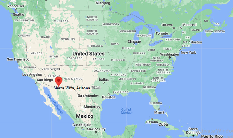
Where is Sierra Vista Located? - Sierra Vista is a city located in the Cochise County of Arizona, United States. Sierra Vista lies between 35.0918 Degrees North latitudes and 92.4367 Degrees West longitudes.
Location Map of Sierra Vista, Arizona

Sierra Vista Map, Arizona, USA
Where is Sierra Vista?: The Google Map showing the location of Sierra Vista in the U.S. state of Arizona.
Where is Sierra Vista Located?
Sierra Vista is a city located in the Cochise County of Arizona, United States. Sierra Vista lies between 35.0918 Degrees North latitudes and 92.4367 Degrees West longitudes. According to 2020 U.S.census, the population of Sierra Vista city is 45308 people and the city has a total area of 152.22 sq mi. The city has numerous parks and recreational facilities.
Most Viewed US Maps
Sierra Vista City Facts, Arizona
| City Name | Sierra Vista |
| County | Cochise County |
| State | Arizona |
| Country | United States |
| U.S. Region | Mountain |
| Coordinates | 31.5455° N, 110.2773° W |
| Latitude | 31.5455001 |
| Longitude | -110.2772856 |
| Population (2020 Census) | 45308 |
| Population Density (Sq mi) | 300 |
| Area (Sq mi) | 152.22 |
| Currency | US Dollar, $ (USD) |
| Time Zone | Mountain Time - UTC?07:00 (Standard), UTC?06:00 (DST) |
Arizona Related Links
- Where is Anthem
- Where is Apache Junction
- Where is Avondale
- Where is Bullhead City
- Where is Casa Grande
- Where is Casas Adobes
- Where is Catalina Foothills
- Where is Douglas
- Where is Drexel Heights
- Where is El Mirage
- Where is Eloy
- Where is Flagstaff
- Where is Florence
- Where is Flowing Wells
- Where is Fort Mohave
- Where is Fortuna Foothills
- Where is Fountain Hills
- Where is Goodyear
- Where is Green Valley
- Where is Kingman
- Where is Lake Havasu City
- Where is Marana
- Where is Maricopa
- Where is New River
- Where is Nogales
- Where is Oro Valley
- Where is Payson
- Where is Peoria
- Where is Prescott
- Where is Prescott Valley
- Where is Queen Creek
- Where is Rio Rico
- Where is Sahuarita
- Where is San Luis
- Where is San Tan Valley
- Where is Sierra Vista
- Where is Sun City
- Where is Sun City West
- Where is Sun Lakes
- Where is Surprise
- Where is Tanque Verde
- Where is Tempe
- Where is Valencia West
- Where is Yuma
