
Boonville is a city in southwestern Indiana and the county seat of Warrick County. It is about 13 miles east of Evansville and sits in the rolling countryside of the Ohio River region. The city is known for its historic courthouse square, Warrick County Museum, and its connection to early Indiana pioneer Daniel Boone's family.
Location Map of Boonville, Warrick County, Indiana
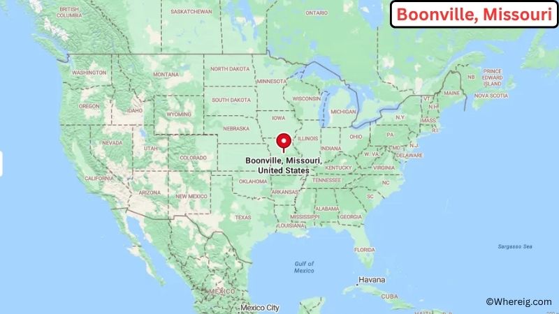
About Map: The map shows the location of Boonville in Warrick County, in the U.S. state of Indiana.
Boonville Map, Indiana
About Boonville Map: The Google Map highlights the location of Boonville in Warrick County, Indiana. Use the zoom, satellite, and street-view options to explore the city's neighborhoods, roads, and nearby places.
Where is Boonville Located?
Boonville is a city located in Warrick County, Indiana, the United States. It lies in southwestern Indiana, about 13 miles east of Evansville and roughly 30 miles southwest of Newburgh. Boonville is part of the Evansville metropolitan area and is located near the Ohio River valley. The city is positioned at approximately 38.0467° North latitude and 87.2747° West longitude. The 2020 Census recorded 6,246 residents. Boonville covers about 3.89 square miles, or 10.07 square kilometers, with most of its area consisting of land. The historic Warrick County Courthouse is a central landmark in the city. Boonville was founded in 1818 and named for Jesse Boon, an early settler and relative of frontiersman Daniel Boone. Its location gives residents easy access to Evansville and the scenic agricultural countryside of southwestern Indiana.
Most Viewed US Maps
| USA Sttae Map | USA Region Map | USA Road Map |
| USA County Map | Where is USA in World Map? | US ZIP Code Map |
| USA Time Zones Map | US State and Capitals Map | USA Physical Map |
Find 4,400+ U.S. Cities by State - Explore Their Locations and Get Detailed Information
Boonville City Facts
| Fact | Details |
|---|---|
| City | Boonville |
| State | Indiana |
| County | Warrick County |
| Country | United States |
| Region | Southwestern Indiana |
| Incorporated | 1858 |
| Founded | 1818 |
| Total Area | 3.89 sq mi (10.07 sq km) |
| Land Area | 3.87 sq mi (10.02 sq km) |
| Water Area | 0.02 sq mi (0.05 sq km) |
| Elevation | About 443 ft (135 m) |
| Population (2023 estimate) | 6,180 |
| Population (2020 Census) | 6,246 |
| Population Density | 1,613.4 people per sq mi |
| Time Zone | Central Standard Time (CST); Central Daylight Time (CDT) |
| ZIP Codes | 47601 |
| Area Code | 812 |
| Major Highways | U.S. Route 64, Indiana State Road 61, Indiana State Road 62 |
| Public Transit | Local and regional transportation services |
| Major Attractions | Warrick County Courthouse, Warrick County Museum, Scales Lake Park, Boonville Historic District |
| Official Website | https://www.boonville.net/ |
Distance from Boonville, IN to Nearby Cities
- Newburgh, IN – 9 miles (14 km)
- Chandler, IN – 10 miles (16 km)
- Evansville, IN – 13 miles (21 km)
- Rockport, IN – 21 miles (34 km)
- Mount Vernon, IN – 24 miles (39 km)
- Henderson, KY – 25 miles (40 km)
- Owensboro, KY – 28 miles (45 km)
- Jasper, IN – 34 miles (55 km)
- Tell City, IN – 37 miles (60 km)
- Princeton, IN – 39 miles (63 km)
- Washington, IN – 43 miles (69 km)
- Madisonville, KY – 48 miles (77 km)
- Vincennes, IN – 55 miles (89 km)
- Bloomington, IN – 101 miles (163 km)
- Louisville, KY – 115 miles (185 km)
- Indianapolis, IN – 160 miles (257 km)
Top Attractions in Boonville
- Warrick County Courthouse – Historic courthouse located in the center of downtown Boonville.
- Warrick County Museum – Museum featuring exhibits about local history, families, and communities.
- Scales Lake Park – County park with a lake, camping areas, trails, and outdoor recreation.
- Boonville Historic District – Area containing historic homes and buildings that reflect the city's early development.
- Boonville Square – Historic downtown area surrounding the county courthouse.
- Warrick County Public Library – Community library serving Boonville and surrounding areas.
- Ohio River – Major regional waterway located south of Boonville and important to the area's history.
- Lincoln State Park – Nearby state park known for wooded trails, Lincoln family history, and outdoor activities.
Airports Near Boonville
- Evansville Regional Airport (EVV) – 18 miles
- Henderson City-County Airport (EHR) – 25 miles
- Owensboro-Daviess County Regional Airport (OWB) – 34 miles
- Posey County Regional Airport (KPRG) – 38 miles
- Evansville Wartburg Airport (KJVY) – 39 miles
Sources:
Population and area data sourced from the United States Census Bureau (2020 Census). General city information referenced from the official City of Boonville website and local government records.
Indiana Related Maps and Info
- Where is Anderson
- Where is Auburn
- Where is Avon
- Where is Bedford
- Where is Beech Grove
- Where is Bluffton
- Where is Bloomington
- Where is Brownsburg
- Where is Carmel
- Where is Clarksville
- Where is Connersville
- Where is Crawfordsville
- Where is Crown Point
- Where is East Chicago
- Where is Elkhart
- Where is Evansville
- Where is Frankfort
- Where is Franklin
- Where is Gary
- Where is Goshen
- Where is Granger
- Where is Greencastle
- Where is Greenfield
- Where is Greensburg
- Where is Greenwood
- Where is Hammond
- Where is Highland
- Where is Hobart
- Where is Huntington
- Where is Jasper
- Where is Jeffersonville
- Where is Kendallville
- Where is Kokomo
- Where is La Porte
- Where is Lafayette
- Where is Lake Station
- Where is Lawrence
- Where is Lebanon
- Where is Logansport
- Where is Madison
- Where is Marion
- Where is Martinsville
- Where is Merrillville
- Where is Michigan City
- Where is Mishawaka
- Where is Muncie
- Where is Munster
- Where is New Albany
- Where is New Castle
- Where is New Haven
- Where is Noblesville
- Where is Peru
- Where is Plainfield
- Where is Plymouth
- Where is Portage
- Where is Schererville
- Where is Seymour
- Where is Shelbyville
- Where is South Bend
- Where is St. John
- Where is Terre Haute
- Where is Valparaiso
- Where is Vincennes
- Where is Warsaw
- Where is Washington
- Where is West Lafayette
- Where is Zionsville