
Winslow is a historic city in northeastern Arizona, located in Navajo County along Interstate 40 and the historic Route 66 corridor. It is about 60 miles southeast of Flagstaff and 90 miles east of the Grand Canyon's South Rim. Winslow is known for its railroad heritage, historic downtown, and its connection to the famous Route 66 song “Take It Easy.” Nearby attractions include Meteor Crater, Homolovi State Park, and the Painted Desert.
Location Map of Winslow, Navajo County, Arizona
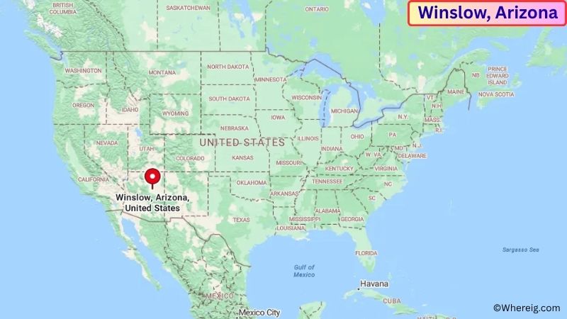
About Map: The map shows the location of Winslow in Navajo County, in the U.S. state of Arizona.
Winslow Map, Arizona
About Winslow Map: The Google Map highlights the location of Winslow in Navajo County, Arizona. Use the zoom, satellite, and street-view options to explore the city's neighborhoods, roads, and nearby places.
Where is Winslow Located?
Winslow is a city located in Navajo County, Arizona, the United States. It is in northeastern Arizona, about 60 miles southeast of Flagstaff, 60 miles east of Holbrook, and approximately 90 miles east of the Grand Canyon's South Rim. Winslow lies at approximately 35.024° North latitude and 110.697° West longitude. The city had 9,005 residents in the 2020 Census and covers about 16.45 square miles, or 42.61 square kilometers. Winslow was incorporated in 1900 and grew rapidly as an important railroad community on the Atchison, Topeka and Santa Fe Railway. The railroad played a major role in the city's economy and development, and Winslow remains an important transportation center along the BNSF Railway. The city is also closely associated with historic U.S. Route 66 and became famous through the Eagles song “Take It Easy,” which mentions standing on a corner in Winslow, Arizona. The surrounding landscape consists of high desert plains, grasslands, mesas, and volcanic features. Nearby attractions include Meteor Crater Natural Landmark, Homolovi State Park, and the Painted Desert. Interstate 40 provides the main east-west transportation route through Winslow, connecting the city with Flagstaff, Albuquerque, and communities across northern Arizona and New Mexico.
Most Viewed US Maps
| USA Sttae Map | USA Region Map | USA Road Map |
| USA County Map | Where is USA in World Map? | US ZIP Code Map |
| USA Time Zones Map | US State and Capitals Map | USA Physical Map |
Find 4,400+ U.S. Cities by State - Explore Their Locations and Get Detailed Information
Winslow City Facts
| Fact | Details |
|---|---|
| City | Winslow |
| State | Arizona |
| County | Navajo County |
| Country | United States |
| Region | Northern Arizona / Painted Desert Region |
| Incorporated | 1900 |
| Founded | 1880s |
| Total Area | 16.45 sq mi (42.61 sq km) |
| Land Area | 16.43 sq mi (42.55 sq km) |
| Water Area | 0.02 sq mi (0.05 sq km) |
| Elevation | Approximately 4,850 ft (1,478 m) |
| Population (2023 estimate) | Approximately 9,000 |
| Population (2020 Census) | 9,005 |
| Population Density | Approximately 548 people per sq mi |
| Time Zone | Mountain Standard Time (MST) |
| ZIP Codes | 86047 |
| Area Code | 928 |
| Major Highways | Interstate 40, Historic U.S. Route 66, Arizona State Route 87 |
| Public Transit | Little Colorado River Valley public transportation services |
| Major Attractions | Standin' on the Corner Park, Homolovi State Park, Meteor Crater, La Posada Hotel, Painted Desert |
| Official Website | https://www.winslowaz.gov/ |
Distance from Winslow, AZ to Nearby Cities
- Holbrook, AZ – 60 miles (97 km)
- Flagstaff, AZ – 60 miles (97 km)
- Joseph City, AZ – 35 miles (56 km)
- St. Johns, AZ – 85 miles (137 km)
- Show Low, AZ – 95 miles (153 km)
- Payson, AZ – 120 miles (193 km)
- Sedona, AZ – 100 miles (161 km)
- Page, AZ – 150 miles (241 km)
- Prescott, AZ – 145 miles (233 km)
- Phoenix, AZ – 185 miles (298 km)
- Albuquerque, NM – 325 miles (523 km)
- Tucson, AZ – 300 miles (483 km)
- Gallup, NM – 175 miles (282 km)
- Kingman, AZ – 250 miles (402 km)
- Grand Canyon Village, AZ – 125 miles (201 km)
- Williams, AZ – 95 miles (153 km)
- Page, AZ – 150 miles (241 km)
- Las Vegas, NV – 300 miles (483 km)
Top Attractions in Winslow
- Standin' on the Corner Park – A downtown landmark celebrating Winslow's connection to the Eagles song “Take It Easy,” with murals, statues, and Route 66-themed displays.
- La Posada Hotel – A historic railroad hotel designed by architect Mary Colter and restored as one of Winslow's best-known historic landmarks.
- Old Trails Museum – A local museum documenting the history of Winslow, the railroad, Route 66, and the surrounding communities.
- Homolovi State Park – A nearby archaeological and cultural park preserving ancestral Hopi sites, trails, exhibits, and high-desert landscapes.
- Meteor Crater Natural Landmark – One of the world's best-preserved meteorite impact sites, located about 20 miles west of Winslow.
- Painted Desert – A vast high-desert landscape featuring colorful layers of rock, mesas, badlands, and scenic overlooks.
- Petrified Forest National Park – A major national park east of Winslow known for petrified wood, colorful badlands, fossils, and historic Route 66 sites.
- Little Painted Desert County Park – A nearby scenic area featuring colorful desert formations and expansive views of the high-desert landscape.
- Winslow-Lindbergh Regional Airport – A local airport with historical connections to early aviation and Charles Lindbergh's transcontinental flight route.
- Apache Death Cave – A historic and geological site near Winslow associated with local legends and the region's Route 66-era attractions.
Airports Near Winslow, AZ
- Winslow-Lindbergh Regional Airport (INW) – 5 miles
- Flagstaff Pulliam Airport (FLG) – 65 miles
- Show Low Regional Airport (SOW) – 95 miles
- Grand Canyon National Park Airport (GCN) – 125 miles
- Phoenix Sky Harbor International Airport (PHX) – 185 miles
Sources:
Population and area data sourced from the United States Census Bureau (2020 Census). General city information referenced from the official City of Winslow website and local government records.
Arizona Related Links
- Where is Anthem
- Where is Apache Junction
- Where is Avondale
- Where is Benson
- Where is Bullhead City
- Where is Casa Grande
- Where is Casas Adobes
- Where is Catalina Foothills
- Where is Douglas
- Where is Drexel Heights
- Where is El Mirage
- Where is Eloy
- Where is Flagstaff
- Where is Florence
- Where is Flowing Wells
- Where is Fort Mohave
- Where is Fortuna Foothills
- Where is Fountain Hills
- Where is Glendale
- Where is Globe
- Where is Goodyear
- Where is Green Valley
- Where is Guadalupe
- Where is Kingman
- Where is Lake Havasu City
- Where is Litchfield Park
- Where is Marana
- Where is Maricopa
- Where is New River
- Where is Nogales
- Where is Oro Valley
- Where is Page
- Where is Payson
- Where is Peoria
- Where is Prescott
- Where is Prescott Valley
- Where is Queen Creek
- Where is Rio Rico
- Where is Sahuarita
- Where is San Luis
- Where is San Tan Valley
- Where is Sierra Vista
- Where is Snowflake
- Where is Sun City
- Where is Sun City West
- Where is Sun Lakes
- Where is Surprise
- Where is Tanque Verde
- Where is Tempe
- Where is Thatcher
- Where is Tolleson
- Where is Valencia West
- Where is Wickenburg
- Where is Youngtown
- Where is Yuma