
Where is Brentwood Located? - Brentwood is a city located in the Williamson County of Tennessee, United States. Brentwood lies between 36.03306 Degrees North latitudes and -86.7828 Degrees West longitudes.
Location Map of Bristol, Tennessee
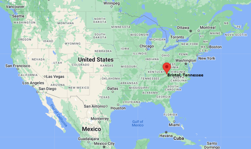
Brentwood Map, Tennessee, USA
Where is Brentwood?: The Google Map showing the location of Brentwood in the U.S. state of Tennessee.
Where is Brentwood Located?
Brentwood is a city located in the Williamson County of Tennessee, United States. Brentwood lies between 36.03306 Degrees North latitude and -86.7828 Degrees West longitude. According to the 2020 U.S. Census, the population of Brentwood city is 45,373 people and the city has a total area of 41.142 sq mi. The city has numerous parks and recreational facilities.
Most Viewed US Maps
| USA Sttae Map | USA Region Map | USA Road Map |
| USA County Map | Where is USA in World Map? | US ZIP Code Map |
| USA Time Zones Map | US State and Capitals Map | USA Physical Map |
Find 4,400+ U.S. Cities by State - Explore Their Locations and Get Detailed Information
Brentwood, Tennessee Quick Facts
| Fact | Details |
|---|---|
| City | Brentwood |
| County | Williamson County |
| State | Tennessee |
| State Capital | Nashville |
| Country | United States |
| US Region | South |
| Latitude | 36.03306 N |
| Longitude | -86.7828 W |
| Elevation | 745 ft (227 m) |
| Land Area | 41.07 sq mi |
| Water Area | 0.16 sq mi |
| Total Area | 41.142 sq mi |
| Population (Census 2020) | 44,370 |
| Population Density | Approximately 1,080 per sq mi |
| ZIP Codes | 37024, 37027 |
| Area Code | 615, 629 |
| Time Zone Standard | Central Standard Time (CST, UTC-6) |
| Time Zone Daylight | Central Daylight Time (CDT, UTC-5) |
| Currency | United States Dollar (USD) |
| FIPS Code | 47-08280 |
| Congressional District | Tennessee's 7th Congressional District |
Nearby Cities and Towns to Brentwood, Tennessee
- Nashville, Tennessee - 10 mi North
- Franklin, Tennessee - 10 mi South
- Nolensville, Tennessee - 8 mi East
- Oak Hill, Tennessee - 4 mi North
- Belle Meade, Tennessee - 9 mi Northwest
- Berry Hill, Tennessee - 8 mi North
- Spring Hill, Tennessee - 23 mi South
- Thompson's Station, Tennessee - 20 mi South
- La Vergne, Tennessee - 18 mi East
- Murfreesboro, Tennessee - 31 mi Southeast
Brentwood, Tennessee Climate and Weather Overview
| Month | Avg High (°F) | Avg Low (°F) | Avg Precipitation (in) |
|---|---|---|---|
| January | 48 | 30 | 4.3 |
| April | 71 | 48 | 4.8 |
| July | 89 | 69 | 4.2 |
| October | 72 | 49 | 3.2 |
| Annual | 70 | 49 | 50.0 |
| Climate Attribute | Details |
|---|---|
| Climate Classification | Humid Subtropical (Köppen Cfa) |
| Annual Precipitation | Approximately 50.0 inches |
| Annual Sunshine Days | About 208 days |
| Severe Weather Risk | Moderate - Thunderstorms, tornadoes, heavy rain and occasional winter ice storms |
| Annual Snowfall | Approximately 4 inches |
Driving Distances from Brentwood, Tennessee
| City | State | Distance (mi) | Approx. Drive Time |
|---|---|---|---|
| Oak Hill | Tennessee | 4 | 8 min |
| Nolensville | Tennessee | 8 | 15 min |
| Berry Hill | Tennessee | 8 | 15 min |
| Belle Meade | Tennessee | 9 | 18 min |
| Nashville | Tennessee | 10 | 20 min |
| Franklin | Tennessee | 10 | 18 min |
| La Vergne | Tennessee | 18 | 25 min |
| Thompson's Station | Tennessee | 20 | 25 min |
| Spring Hill | Tennessee | 23 | 30 min |
| Murfreesboro | Tennessee | 31 | 40 min |
Transportation and Connectivity in Brentwood, Tennessee
| Transportation | Details |
|---|---|
| Nearest Airport | John C. Tune Airport |
| IATA Code | JWN |
| Nearest Major Airport | Nashville International Airport |
| Major Highways | Interstate 65, Old Hickory Boulevard, Franklin Road (US 31) |
| Rail Service | No passenger rail; freight rail available in the Nashville area |
| Local Transit | WeGo Public Transit (regional connections) |
- Interstate 65 is the primary north-south route, providing quick access to downtown Nashville, Franklin, Huntsville and Louisville.
- Franklin Road (US 31) and Old Hickory Boulevard connect Brentwood with nearby residential, business and shopping districts.
- Nashville International Airport, about 16 miles northeast, offers extensive domestic and international flight connections.
- WeGo Public Transit provides commuter bus service linking Brentwood with downtown Nashville and surrounding communities.
Key Landmarks and Places to Visit in Brentwood, Tennessee
| Landmark | Type |
|---|---|
| Radnor Lake State Park | State Park |
| Owl's Hill Nature Sanctuary | Nature Preserve |
| Crockett Park | Community Park |
| Marcella Vivrette Smith Park | City Park |
| Ravenswood Mansion | Historic Site |
| Deerwood Arboretum and Nature Center | Arboretum |
| Brentwood Library | Public Library |
| Primm Historic Park | Historic Park |
| Mooreland Estate | Historic Landmark |
| Smith Park | Recreation Area |
Colleges and Universities in Brentwood, Tennessee
| Institution | Type | Level | Notable For |
|---|---|---|---|
| Lipscomb University | Private | University | Business, education, pharmacy and liberal arts |
| Belmont University | Private | University | Music, business, healthcare and law |
| Vanderbilt University | Private | Research University | Medicine, engineering, law and research |
| Nashville State Community College | Public | Community College | Associate degrees and workforce training |
| Middle Tennessee State University | Public | University | Aerospace, media, business and education |
| Williamson Campus of Columbia State Community College | Public | Community College | Transfer programs and career education |
Waterbodies in Brentwood, Tennessee
Little Harpeth River, Harpeth River, Radnor Lake, Owl Creek, Mill Creek, Crockett Creek, Percy Priest Lake, Lake Watauga, Richland Creek, Browns Creek.
Golf Courses in Brentwood, Tennessee
The Governors Club, Brentwood Country Club, Nashville Golf & Athletic Club, Vanderbilt Legends Club, Towhee Club, Franklin Bridge Golf Club, Harpeth Hills Golf Course, Temple Hills Country Club.
Brentwood, Tennessee - Key Historical Facts
- Brentwood's history dates to the early nineteenth century when settlers established farms and plantations in the fertile hills south of Nashville.
- The city played a role during the American Civil War, with several historic homes and estates serving military purposes during the Battle of Nashville campaign.
- Brentwood was officially incorporated in 1969 and experienced rapid residential growth as the Nashville metropolitan area expanded.
- The community has preserved many historic landmarks, including Ravenswood Mansion and Primm Historic Park, while developing modern neighborhoods and business districts.
- Its highly rated schools, parks and quality of life have made Brentwood one of Tennessee's most desirable suburban communities.
- Today, Brentwood is known for its executive residential neighborhoods, corporate offices, green spaces, historic sites and convenient access to downtown Nashville.
References
- City of Brentwood
- U.S. Census Bureau
- Tennessee Department of Tourist Development
- Williamson County Government
Tennessee Maps & Info
- Where is Athens
- Where is Bartlett
- Where is Brentwood
- Where is Bristol
- Where is Chattanooga
- Where is Clarksville
- Where is Collierville
- Where is Columbia
- Where is Cookeville
- Where is Crossville
- Where is Dickson
- Where is Dyersburg
- Where is East Ridge
- Where is Elizabethton
- Where is Farragut
- Where is Franklin
- Where is Gallatin
- Where is Germantown
- Where is Goodlettsville
- Where is Greeneville
- Where is Hartsville
- Where is Hendersonville
- Where is Jackson
- Where is Johnson City
- Where is Kingsport
- Where is Knoxville
- Where is La Vergne
- Where is Lakeland
- Where is Lebanon
- Where is Lewisburg
- Where is Manchester
- Where is Maryville
- Where is McMinnville
- Where is Morristown
- Where is Mount Juliet
- Where is Murfreesboro
- Where is Nolensville
- Where is Oak Ridge
- Where is Sevierville
- Where is Seymour
- Where is Shelbyville
- Where is Smyrna
- Where is Soddy-Daisy
- Where is Spring Hill
- Where is Tullahoma
- Where is White House