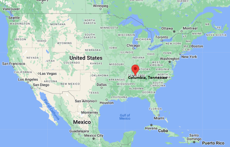
Where is Columbia Located? - Columbia is a city located in the Maury County of Tennessee, United States. Columbia lies between 40.121497 Degrees North latitudes and 75.3399048 Degrees West longitudes.
Location Map of Columbia, Tennessee
Columbia Map, Tennessee, USA
Where is Columbia?: The Google Map showing the location of Columbia in the U.S. state of Tennessee.
Where is Columbia Located?
Columbia is a city located in the Maury County of Tennessee, United States. Columbia lies between 40.121497 Degrees North latitudes and 75.3399048 Degrees West longitudes. According to 2020 U.S.census, the population of Columbia city is 41690 people and the city has a total area of 32.98 sq mi. The city has numerous parks and recreational facilities.
Remnants of tropical systems possible; moderate tornado risk
Snowfall
About 4 in annually
Driving Distances from Columbia, Tennessee
City
State
Distance (mi)
Approx. Drive Time
Spring Hill
Tennessee
13
20 min
Mount Pleasant
Tennessee
12
15 min
Lewisburg
Tennessee
18
25 min
Franklin
Tennessee
31
35 min
Pulaski
Tennessee
31
35 min
Shelbyville
Tennessee
40
45 min
Lawrenceburg
Tennessee
38
45 min
Nashville
Tennessee
46
55 min
Murfreesboro
Tennessee
50
1 hr
Huntsville
Alabama
83
1 hr 30 min
Transportation and Connectivity in Columbia, Tennessee
Feature
Details
Airport Name
Maury County Airport
IATA Code
MRC
Port
None (landlocked)
Major Highways
U.S. Highway 31, U.S. Highway 43, U.S. Highway 412, Tennessee State Route 6, Tennessee State Route 50
Train/Amtrak Service
No passenger rail service; nearest Amtrak station in Nashville
Local Bus/Transit Service
South Central Tennessee Human Resource Agency transit services
U.S. Highway 31 - Historic north-south highway connecting Columbia with Franklin and northern Alabama.
U.S. Highway 43 - Major regional route linking Columbia with Lawrenceburg and western Tennessee.
U.S. Highway 412 - East-west corridor providing access to Lewisburg and western Middle Tennessee.
Tennessee State Route 50 - Important route connecting the city with Interstate 65 and nearby communities.
James M. Campbell Boulevard - Main bypass serving commercial, industrial, and residential areas around Columbia.
Key Landmarks and Places to Visit in Columbia, Tennessee
Landmark Name
Type
President James K. Polk Home & Museum
Historic House Museum
Maury County Courthouse
Historic Government Building
Riverwalk Park
City Park
Elm Springs
Historic Mansion
Maury County Park
Community Park
Stoneybrook Golf Club
Golf Club
Chickasaw Trace Park
Outdoor Recreation Area
Yanahli Park
City Park
aMuse'um Columbia Children's Museum
Children's Museum
Rippa Villa
Historic House
Colleges and Universities in Columbia, Tennessee
Institution Name
Type
Level
Notable For
Columbia State Community College
Public
Community College
Academic transfer and workforce education
University of Tennessee Southern
Public
University
Liberal arts and professional studies
Middle Tennessee State University
Public
University
Business, aerospace, and education
Tennessee College of Applied Technology - Hohenwald
Public
Technical College
Technical and skilled trades education
Belmont University
Private
University
Business, health sciences, and music
Waterbodies in Columbia, Tennessee
Duck River, Big Bigby Creek, Rutherford Creek, Williamsport Lakes, Catheys Creek, Bear Creek, Fountain Creek, Big Swan Creek, Tennessee River, Normandy Lake
Golf Courses in Columbia, Tennessee
Stoneybrook Golf Club, Graymere Country Club, Saddle Creek Golf Club, King's Creek Golf Club, Towhee Club, Vanderbilt Legends Club, Henry Horton Golf Course, Pine Creek Golf Course
Columbia, Tennessee - Key Historical Facts
Columbia was founded in 1808 and became the county seat of Maury County shortly afterward.
The city developed as an agricultural and trading center because of its location along the Duck River and fertile Middle Tennessee farmland.
James K. Polk, the 11th President of the United States, lived in Columbia before beginning his political career, and his family home remains a historic landmark.
During the 19th century, Columbia grew through cotton production, commerce, and railroad connections.
Manufacturing, healthcare, automotive industries, and education have contributed significantly to the city's modern economic growth.
Today, Columbia is known for its historic downtown, annual Mule Day celebration, expanding business community, and proximity to the greater Nashville metropolitan area.