Where is Clarksville Located? - Clarksville is a city located in the Montgomery County of Tennessee, United States. Clarksville lies between 41.335494 Degrees North latitudes and 71.7066428 Degrees West longitudes.
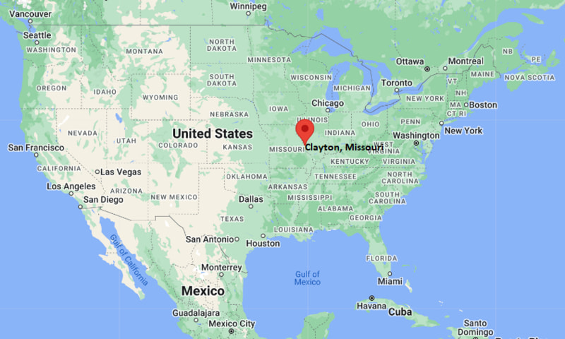
Location Map of Clayton, Missouri
Clarksville Map, Tennessee, USA
Where is Clarksville?: The Google Map showing the location of Clarksville in the U.S. state of Tennessee.
Where is Clarksville Located?
Clarksville is a city located in the Montgomery County of Tennessee, United States. Clarksville lies between 41.335494 Degrees North latitudes and 71.7066428 Degrees West longitudes. According to 2020 U.S.census, the population of Clarksville city is 166722 people and the city has a total area of 98.8 sq mi. The city has numerous parks and recreational facilities.
Clarksville, Tennessee Climate and Weather Overview
Month
Avg High (°F)
Avg Low (°F)
Avg Rainfall (in)
January
47
29
4.4
April
71
49
4.9
July
90
70
4.1
October
72
49
3.3
Annual
70
49
50.0
Climate Attribute
Details
Climate Classification (Köppen)
Humid Subtropical (Cfa)
Annual Rainfall
About 50.0 in
Annual Sunshine Days
About 214 days
Hurricane/Tornado Risk
Very low hurricane risk and moderate tornado risk
Snowfall
About 5 in annually
Driving Distances from Clarksville, Tennessee
City
State
Distance (mi)
Approx. Drive Time
Oak Grove
Kentucky
10
15 min
Pleasant View
Tennessee
23
25 min
Hopkinsville
Kentucky
27
30 min
Springfield
Tennessee
29
35 min
Ashland City
Tennessee
32
40 min
Dickson
Tennessee
35
40 min
Erin
Tennessee
35
45 min
Russellville
Kentucky
38
45 min
Nashville
Tennessee
50
55 min
Bowling Green
Kentucky
68
1 hr 15 min
Transportation and Connectivity in Clarksville, Tennessee
Transportation
Details
Airport Name
Clarksville Regional Airport
IATA Code
CKV
Major Airport
Nashville International Airport
Major Highways
Interstate 24, U.S. Highway 41A, U.S. Highway 79, Tennessee State Route 48
Train Service
Freight rail service
Local Bus/Transit Service
Clarksville Transit System (CTS)
Interstate 24 connects Clarksville with Nashville, Paducah, and western Kentucky.
Nashville International Airport is approximately 55 miles southeast and provides extensive domestic and international flight connections.
Clarksville Transit System operates fixed-route bus services throughout the city.
Clarksville Regional Airport supports general aviation, corporate aviation, and flight training.
Clarksville is home to Austin Peay State University, borders Fort Campbell, and is one of Tennessee's fastest-growing cities.
Key Landmarks and Places to Visit in Clarksville, Tennessee
Landmark Name
Type
Dunbar Cave State Park
State Park
Fort Defiance Civil War Park & Interpretive Center
Historic Site
Customs House Museum & Cultural Center
Museum
Liberty Park and Marina
City Park
McGregor Park Riverwalk
Riverfront Park
Austin Peay State University
University Campus
Roxy Regional Theatre
Performing Arts Theater
Beachaven Vineyards & Winery
Winery
Historic Collinsville Pioneer Settlement
Living History Museum
Fort Campbell
U.S. Army Installation
Colleges and Universities in and near Clarksville, Tennessee
Institution Name
Type
Level
Notable For
Austin Peay State University
Public
University
Business, education, nursing, agriculture, and military-affiliated programs
Nashville State Community College - Clarksville Campus
Public
Community College
Transfer programs, workforce development, and technical education
University of Tennessee at Martin - Parsons Center
Public
University Center
Adult education and graduate programs
Volunteer State Community College
Public
Community College
Healthcare, business, and transfer education
Trevecca Nazarene University
Private
University
Education, business, healthcare, and liberal arts
Waterbodies in Clarksville, Tennessee
Cumberland River, Red River, Dunbar Cave Lake, Lake Barkley, Cheatham Lake, Yellow Creek, Spring Creek, Cross Creeks National Wildlife Refuge
Golf Courses in and near Clarksville, Tennessee
Swan Lake Golf Course, Eastland Green Golf Course, The River Club Golf & Learning Center, Clarksville Country Club, Pebble Brook Golf Course, King's Run Golf Course, Links at Novadell, Greystone Golf Club
Clarksville, Tennessee - Key Historical Facts
Clarksville was founded in 1785 and named in honor of Revolutionary War hero General George Rogers Clark.
The city's location on the Cumberland River helped it develop into an important river port and tobacco trading center during the nineteenth century.
During the Civil War, Clarksville's strategic river access made it an important military location, leading to the construction of Fort Defiance.
The establishment and growth of nearby Fort Campbell after World War II significantly influenced the city's economy, population, and development.
Austin Peay State University, founded in 1927, has become a major educational institution and cultural center for the region.
Today, Clarksville is recognized for its thriving economy, military connections, historic downtown, outdoor recreation, and status as one of Tennessee's fastest-growing cities.