Map of Niobrara County - Niobrara County is a county located in the U.S. state of Wyoming. Niobrara County Map showing cities, highways, important places and water bodies. Get Where is Niobrara County located in the map, major cities in Niobrara county, population, areas, and places of interest.
Map of Niobrara County, Wyoming
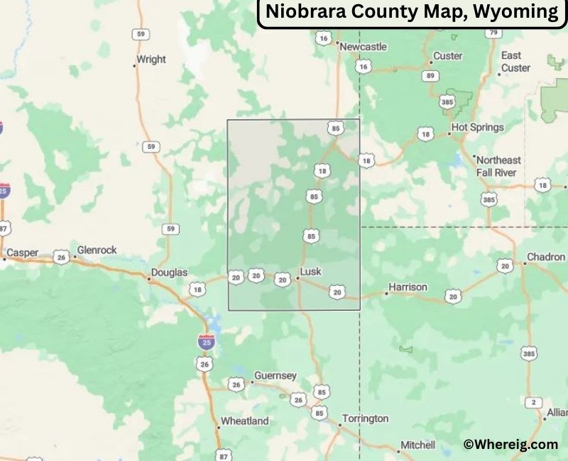
About Niobrara County Map, Alabama: The map showing the county boundary, county seat, major cities, highways, water bodies and neighbouring counties.
Most Viewed Links
About Niobrara County, Wyoming
Niobrara County is located in the northeastern part of Wyoming, United States. Established in 1911, the county was named after the Niobrara River. The county seat and largest town is Lusk, which serves as the primary commercial and administrative center. Niobrara County is characterized by wide-open plains, ranching operations, and a strong rural heritage.
Population
According to the United States Census Bureau, the population of Niobrara County was 2,467 as recorded in the 2020 Census. It is one of the least populous counties in Wyoming, with most residents living in Lusk and surrounding rural areas.
Area and Geography
According to the United States Census Bureau, Niobrara County covers a total area of approximately 2,628 square miles, including about 2,625 square miles of land and 3 square miles of water. The county features rolling grasslands, open prairies, and landscapes typical of northeastern Wyoming.
Bordering Counties
Niobrara County shares borders with Weston County to the north, Crook County to the northwest, Converse County to the west, Platte County to the south, Goshen County to the southeast, and the state of Nebraska to the east.
Major Cities and Communities
The principal community in Niobrara County is Lusk, which functions as the county seat and central hub for commerce, education, and public services.
Attractions and Recreation
Niobrara County offers opportunities for outdoor recreation including hunting, fishing, and exploring open prairie landscapes. The county’s quiet rural setting reflects Wyoming’s traditional ranching culture and western heritage.
Transportation
Major transportation routes serving Niobrara County include U.S. Highways 18 and 20, which provide regional connectivity across northeastern Wyoming and into neighboring states.
Explore more counties in Wyoming Counties or view the complete USA States Map section for additional geographic information.
Sources:
Population and area data sourced from the United States Census Bureau (2020 Census). General county information referenced from the Facts about Niobrara County, Wyoming
Lusk, Manville, Lance Creek
Country United States State Wyoming Region Eastern Wyoming County Seat Lusk Named After Niobrara River Established 1911 Organized 1911 Coordinates 43.05° N, 104.48° W Total Area 2,628 sq mi Land Area 2,627 sq mi Water Area 1 sq mi Population (2020) 2,467 Population Rank Least populous county in Wyoming Largest Town Lusk Main Industries Agriculture, Government, Energy Major Highways U.S. Highway 18, U.S. Highway 20, State Highway 85 Time Zone Mountain Time (UTC−07:00) Known For High plains ranching, fossil beds, rural communities Official Website https://www.niobraracountywy.gov Top Attractions in Niobrara County, Wyoming
List of Cities and Towns in Niobrara County, Wyoming