
Rancho Mirage is a desert city in the Coachella Valley of Southern California, located in Riverside County. It sits about 12 miles southeast of Palm Springs and is surrounded by the San Jacinto and Santa Rosa mountains. The city is known for its palm-lined streets, desert scenery, golf courses, and nearby Sunnylands estate and gardens.
Location Map of Rancho Mirage, Riverside County, California
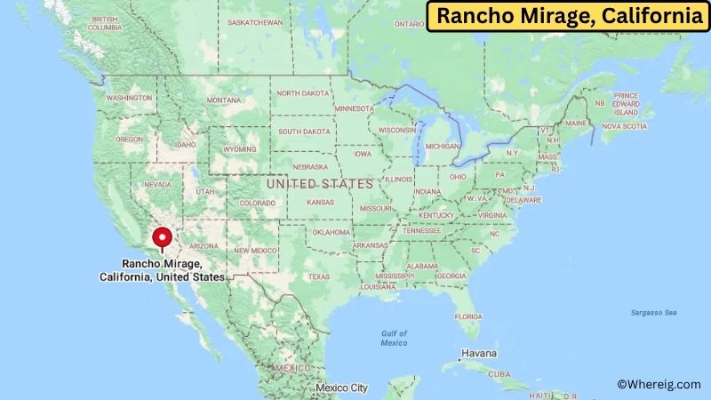
About Map: The map shows the location of Rancho Mirage in Riverside County, in the U.S. state of California.
Rancho Mirage Map, California
About Rancho Mirage Map: The Google Map highlights the location of Rancho Mirage in Riverside County, California. Use the zoom, satellite, and street-view options to explore the city's neighborhoods, roads, and nearby places.
Where is Rancho Mirage Located?
Rancho Mirage is a city located in Riverside County, California, the United States. It lies in the central Coachella Valley, about 12 miles southeast of Palm Springs and roughly 6 miles west of Palm Desert. Cathedral City is about 5 miles northwest, while Indio is around 12 miles east. Rancho Mirage is positioned near 33.739° North latitude and 116.412° West longitude. The 2020 Census recorded 16,999 residents. The city covers about 24.01 square miles, or 62.19 square kilometers. Rancho Mirage was incorporated in 1973 after developing as a desert residential and resort community. Its landscape is shaped by the surrounding San Jacinto and Santa Rosa mountains, while the Coachella Valley floor contains palms, irrigated neighborhoods, golf courses, and desert vegetation. Sunnylands, the former Annenberg estate, is one of the city's best-known landmarks. The 200-acre estate includes gardens, historic buildings, walking paths, and a visitor center. Rancho Mirage also has a long connection to tourism and winter recreation, attracting visitors to the wider Palm Springs area. A unique fact about the city is that Sunnylands has hosted major meetings involving U.S. presidents and other international leaders. The nearby Santa Rosa and San Jacinto Mountains National Monument protects important desert and mountain habitats. Interstate 10 and California State Route 111 provide convenient connections to Palm Springs, Palm Desert, Indio, and other Coachella Valley communities.
Most Viewed US Maps
| USA Sttae Map | USA Region Map | USA Road Map |
| USA County Map | Where is USA in World Map? | US ZIP Code Map |
| USA Time Zones Map | US State and Capitals Map | USA Physical Map |
Find 4,400+ U.S. Cities by State - Explore Their Locations and Get Detailed Information
Rancho Mirage City Facts
| City | Rancho Mirage |
| State | California |
| County | Riverside County |
| Country | United States |
| Region | Coachella Valley and Southern California |
| Incorporated | 1973 |
| Founded | 1960s |
| Total Area | 24.01 sq mi (62.19 sq km) |
| Land Area | 24.01 sq mi (62.19 sq km) |
| Water Area | 0.00 sq mi (0.00 sq km) |
| Elevation | 272 ft (83 m) |
| Population (2023 estimate) | About 17,000 |
| Population (2020 Census) | 16,999 |
| Population Density | 708 people per sq mi |
| Time Zone | Pacific Time (PST/PDT) |
| ZIP Codes | 92270 |
| Area Code | 760 and 442 |
| Major Highways | I-10, CA-111, and CA-74 nearby |
| Public Transit | SunLine Transit Agency |
| Major Attractions | Sunnylands, Children's Discovery Museum of the Desert, Agua Caliente Casino Rancho Mirage, and Coachella Valley landscapes |
| Official Website | https://ranchomirageca.gov/ |
Distance from Rancho Mirage, CA to Nearby Cities
- Cathedral City, CA – 5 miles (8 km)
- Palm Desert, CA – 6 miles (10 km)
- Palm Springs, CA – 12 miles (19 km)
- Indian Wells, CA – 9 miles (14 km)
- La Quinta, CA – 12 miles (19 km)
- Indio, CA – 12 miles (19 km)
- Desert Hot Springs, CA – 15 miles (24 km)
- Coachella, CA – 17 miles (27 km)
- Hemet, CA – 55 miles (89 km)
- San Jacinto, CA – 55 miles (89 km)
- Beaumont, CA – 45 miles (72 km)
- Moreno Valley, CA – 65 miles (105 km)
- Riverside, CA – 75 miles (121 km)
- Temecula, CA – 95 miles (153 km)
- San Bernardino, CA – 80 miles (129 km)
- Los Angeles, CA – 125 miles (201 km)
- San Diego, CA – 125 miles (201 km)
- Las Vegas, NV – 280 miles (451 km)
Top Attractions in Rancho Mirage
- Sunnylands – The historic Annenberg estate features landscaped gardens, a visitor center, art, and walking areas in a desert setting.
- Sunnylands Center & Gardens – A public garden and visitor center offering walking paths, desert landscaping, educational programs, and views of the surrounding mountains.
- Children's Discovery Museum of the Desert – A family-oriented museum in Rancho Mirage featuring interactive exhibits and educational activities for children.
- Agua Caliente Casino Rancho Mirage – A major entertainment and resort complex located near the base of the San Jacinto Mountains.
- Rancho Mirage Community Park – A local recreation area with sports fields, walking paths, playgrounds, and open green space.
- San Jacinto and Santa Rosa Mountains – The surrounding mountains provide hiking, wildlife viewing, scenic drives, and striking views over the Coachella Valley.
- Coachella Valley Preserve – A nearby protected desert area known for native palm oases, hiking trails, wetlands, and wildlife habitat.
- Cabot's Pueblo Museum – A historic pueblo-style building and museum in nearby Desert Hot Springs preserving the work and collection of Cabot Yerxa.
Airports Near Rancho Mirage, CA
- Palm Springs International Airport (PSP) – 10 miles
- Bermuda Dunes Airport (UDD) – 15 miles
- Jacqueline Cochran Regional Airport (TRM) – 20 miles
- March Air Reserve Base (RIV) – 65 miles
- Ontario International Airport (ONT) – 85 miles
Sources:
Population and area data sourced from the United States Census Bureau (2020 Census). General city information referenced from the official Rancho Mirage city website and local government records.
California Related Links
- Where is Los Angeles
- Where is San Diego
- Where is San Francisco
- Where is Anaheim
- Where is Bakersfield
- Where is Chula Vista
- Where is Freemont
- Where is Fresno
- Where is Glendale
- Where is Irvine
- Where is Long Beach
- Where is Modesto
- Where is Oakland
- Where is Paradise
- Where is Riverside
- Where is Sacramento
- Where is San Bernardino
- Where is San Jose
- Where is Santa Ana
- Where is Stockton
- Where is Berkeley
- Where is Clovis
- Where is Corona
- Where is Elk Grove
- Where is Escondido
- Where is Fontana
- Where is Fremont
- Where is Fullerton
- Where is Garden Grove
- Where is Hayward
- Where is Huntington Beach
- Where is Lancaster
- Where is Moreno Valley
- Where is Oceanside
- Where is Ontario
- Where is Orange
- Where is Oxnard
- Where is Palmdale
- Where is Pasadena
- Where is Pomona
- Where is Rancho Cucamonga
- Where is Roseville
- Where is Salinas
- Where is Santa Clara
- Where is Santa Clarita
- Where is Santa Rosa
- Where is Sunnyvale
- Where is Thousand Oaks
- Where is Torrance
- Where is Vallejo
- Where is Victorville
- Where is Visalia