
Where is Booneville Located? - Booneville is a city located in the Prentiss County of Mississippi, United States. Booneville lies between 334.66943 Degrees North latitudes and -88.5443 Degrees West longitudes.
Location Map of Bottineau, North Dakota
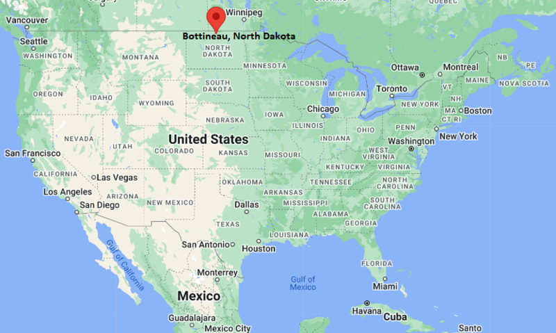
Booneville Map, Mississippi, USA
Where is Booneville?: The Google Map showing the location of Booneville in the U.S. state of Mississippi.
Where is Booneville Located?
Booneville is a city located in the Prentiss County of Mississippi, United States. Booneville lies between 334.66943 Degrees North latitude and -88.5443 Degrees West longitude. According to the 2020 U.S. Census, the population of Booneville city is 9,126 people and the city has a total area of 25.787 sq mi. The city has numerous parks and recreational facilities.
Most Viewed US Maps
| USA Sttae Map | USA Region Map | USA Road Map |
| USA County Map | Where is USA in World Map? | US ZIP Code Map |
| USA Time Zones Map | US State and Capitals Map | USA Physical Map |
Find 4,400+ U.S. Cities by State - Explore Their Locations and Get Detailed Information
Booneville, Mississippi Quick Facts
| Fact | Details |
|---|---|
| City | Booneville |
| County | Prentiss County |
| State | Mississippi |
| State Capital | Jackson |
| Country | United States |
| US Region | South |
| Latitude | 34.66943 N |
| Longitude | -88.5443 W |
| Elevation | 423 ft (129 m) |
| Land Area | 25.40 sq mi |
| Water Area | 0.10 sq mi |
| Total Area | 25.787 sq mi |
| Population (Census 2020) | 8,550 |
| Population Density | Approximately 337 per sq mi |
| ZIP Code | 38829 |
| Area Code | 662 |
| Time Zone Standard | Central Standard Time (CST, UTC-6) |
| Time Zone Daylight | Central Daylight Time (CDT, UTC-5) |
| Currency | United States Dollar (USD) |
| FIPS Code | 28-07700 |
| Congressional District | Mississippi's 1st Congressional District |
Nearby Cities and Towns to Booneville, Mississippi
- Baldwyn, Mississippi - 12 mi Southwest
- Corinth, Mississippi - 20 mi Northeast
- Ripley, Mississippi - 22 mi West
- Tupelo, Mississippi - 34 mi South
- New Albany, Mississippi - 30 mi Southwest
- Iuka, Mississippi - 36 mi East
- Fulton, Mississippi - 39 mi Southeast
- Amory, Mississippi - 53 mi South
- Selmer, Tennessee - 35 mi North
- Florence, Alabama - 55 mi East
Booneville, Mississippi Climate and Weather Overview
| Month | Avg High (°F) | Avg Low (°F) | Avg Precipitation (in) |
|---|---|---|---|
| January | 50 | 31 | 5.2 |
| April | 73 | 49 | 5.4 |
| July | 90 | 70 | 4.7 |
| October | 75 | 50 | 3.7 |
| Annual | 72 | 50 | 56.5 |
| Climate Attribute | Details |
|---|---|
| Climate Classification | Humid Subtropical (Köppen Cfa) |
| Annual Precipitation | Approximately 56.5 inches |
| Annual Sunshine Days | About 213 days |
| Severe Weather Risk | Moderate - Thunderstorms, tornadoes, heavy rain and occasional winter ice events |
| Annual Snowfall | Approximately 2 inches |
Driving Distances from Booneville, Mississippi
| City | State | Distance (mi) | Approx. Drive Time |
|---|---|---|---|
| Baldwyn | Mississippi | 12 | 15 min |
| Corinth | Mississippi | 20 | 25 min |
| Ripley | Mississippi | 22 | 30 min |
| New Albany | Mississippi | 30 | 35 min |
| Tupelo | Mississippi | 34 | 40 min |
| Selmer | Tennessee | 35 | 45 min |
| Iuka | Mississippi | 36 | 45 min |
| Fulton | Mississippi | 39 | 50 min |
| Amory | Mississippi | 53 | 1 hr |
| Florence | Alabama | 55 | 1 hr 10 min |
Transportation and Connectivity in Booneville, Mississippi
| Transportation | Details |
|---|---|
| Nearest Airport | Tupelo Regional Airport |
| IATA Code | TUP |
| Nearest International Airport | Memphis International Airport |
| Major Highways | U.S. Route 45, Mississippi Highway 4, Mississippi Highway 30, Mississippi Highway 145 |
| Rail Service | Kansas City Southern freight rail service |
| Local Transit | Regional transportation services |
- U.S. Route 45 is the primary north-south highway through Booneville, providing direct access to Tupelo, Corinth and Meridian.
- Mississippi Highways 4 and 30 connect the city with Ripley, New Albany and surrounding communities in northeast Mississippi.
- Tupelo Regional Airport, about 40 miles south, provides commercial air service, while Memphis International Airport, approximately 110 miles northwest, offers extensive domestic and international connections.
- Booneville's location along major regional highways supports commerce, education and travel throughout northeast Mississippi and neighboring states.
Key Landmarks and Places to Visit in Booneville, Mississippi
| Landmark | Type |
|---|---|
| Northeast Mississippi Community College | College Campus |
| Prentiss County Agricultural Coliseum | Event Venue |
| Booneville City Park | Community Park |
| Booneville Historic Depot | Historic Site |
| The Crossroads Museum | History Museum |
| Tishomingo State Park | State Park |
| Brice's Cross Roads National Battlefield Site | Historic Battlefield |
| Tanglefoot Trail | Multi-Use Rail Trail |
| Prentiss County Museum | Local History Museum |
| Lake Lamar Bruce | Recreation Area |
Colleges and Universities in Booneville, Mississippi
| Institution | Type | Level | Notable For |
|---|---|---|---|
| Northeast Mississippi Community College | Public | Community College | Academic transfer, workforce training and athletics |
| University of Mississippi | Public | Research University | Law, business and liberal arts |
| Mississippi State University | Public | Research University | Engineering, agriculture and veterinary medicine |
| Blue Mountain Christian University | Private | University | Liberal arts and teacher education |
| Itawamba Community College | Public | Community College | Career education and transfer programs |
| Freed-Hardeman University | Private | University | Business, education and healthcare programs |
Waterbodies in Booneville, Mississippi
Twenty Mile Creek, Mackys Creek, Yellow Creek, Lake Lamar Bruce, Tennessee-Tombigbee Waterway, Bay Springs Lake, Bear Creek, Tombigbee River, Pickwick Lake, Tuscumbia River.
Golf Courses in Booneville, Mississippi
Booneville Country Club, Hillandale Golf Course, Shiloh Ridge Athletic Club, Tupelo National Golf Club, Pickwick Landing Golf Course, Cherokee Country Club, Mallard Pointe Golf Course, North Creek Golf Club.
Booneville, Mississippi - Key Historical Facts
- Booneville was founded in the mid-nineteenth century and was named after early settler Colonel R. H. Boone.
- The city became the county seat of Prentiss County in 1870, helping establish it as the region's governmental and commercial center.
- Railroad development and agriculture played major roles in Booneville's early economic growth, particularly cotton production and timber industries.
- Northeast Mississippi Community College, established in 1948, has become one of the city's leading educational institutions and economic contributors.
- Nearby Civil War sites, including Brice's Cross Roads National Battlefield, preserve the area's important military history.
- Today, Booneville is recognized for its educational opportunities, regional healthcare services, outdoor recreation and strong community traditions in northeast Mississippi.
References
Other Mississippi Maps & Info
- Where is Aberdeen
- Where is Amory
- Where is Baldwyn
- Where is Batesville
- Where is Bay St. Louis
- Where is Biloxi
- Where is Booneville
- Where is Brandon
- Where is Brookhaven
- Where is Byram
- Where is Canton
- Where is Carthage
- Where is Clarksdale
- Where is Cleveland
- Where is Clinton
- Where is Columbia
- Where is Columbus
- Where is Corinth
- Where is Crystal Springs
- Where is D'Iberville
- Where is Diamondhead
- Where is Ellisville
- Where is Florence
- Where is Flowood
- Where is Forest
- Where is Fulton
- Where is Gautier
- Where is Greenville
- Where is Greenwood
- Where is Grenada
- Where is Gulf Hills
- Where is Gulfport
- Where is Hattiesburg
- Where is Hazlehurst
- Where is Hernando
- Where is Holly Springs
- Where is Horn Lake
- Where is Houston
- Where is Indianola
- Where is Iuka
- Where is Jackson
- Where is Kosciusko
- Where is Laurel
- Where is Leland
- Where is Long Beach
- Where is Louisville
- Where is Madison
- Where is Magee
- Where is McComb
- Where is Meridian
- Where is Morton
- Where is Moss Point
- Where is Natchez
- Where is New Albany
- Where is Newton
- Where is Ocean Springs
- Where is Olive Branch
- Where is Oxford
- Where is Pass Christian
- Where is Pascagoula
- Where is Pearl
- Where is Petal
- Where is Philadelphia
- Where is Picayune
- Where is Pontotoc
- Where is Richland
- Where is Ridgeland
- Where is Ripley
- Where is Ruleville
- Where is Saltillo
- Where is Senatobia
- Where is Southaven
- Where is St. Martin
- Where is Starkville
- Where is Tupelo
- Where is Tutwiler
- Where is Verona
- Where is Vicksburg
- Where is Water Valley
- Where is Waveland
- Where is Waynesboro
- Where is West Point
- Where is Wiggins
- Where is Winona
- Where is Yazoo City