
Hawaiian Gardens is a small city in southeastern Los Angeles County, California. It is located about 20 miles southeast of downtown Los Angeles and near the cities of Long Beach, Lakewood, and Cerritos. The city is known for its compact urban setting and location within the Los Angeles metropolitan area.
Location Map of Hawaiian Gardens, Los Angeles County, California
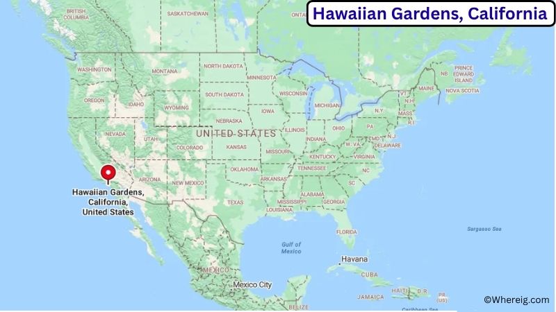
About Map: The map shows the location of Hawaiian Gardens in Los Angeles County, in the U.S. state of California.
Hawaiian Gardens Map, California
About Hawaiian Gardens Map: The Google Map highlights the location of Hawaiian Gardens in Los Angeles County, California. Use the zoom, satellite, and street-view options to explore the city's neighborhoods, roads, and nearby places.
Where is Hawaiian Gardens Located?
Hawaiian Gardens is a city located in Los Angeles County, California, the United States. It lies in southeastern Los Angeles County, about 20 miles southeast of downtown Los Angeles and roughly 15 miles northwest of Anaheim. The city is surrounded by other communities in the Gateway Cities region, including Lakewood, Long Beach, Cerritos, and Norwalk. Hawaiian Gardens is located at approximately 33.831° North latitude and 118.073° West longitude. The 2020 Census recorded 14,149 residents. The city covers about 0.96 square miles, or 2.49 square kilometers, making it one of the smallest incorporated cities in California by area. Hawaiian Gardens was incorporated in 1964 and developed as a residential community in the postwar period. Its compact location gives residents convenient access to major employment, shopping, and transportation centers across Los Angeles and Orange counties. The city is near the Los Cerritos Wetlands, San Gabriel River, and several regional parks. Long Beach, downtown Los Angeles, Disneyland, and the Pacific coast are all within driving distance. Interstate 605 and nearby Interstate 5 provide major transportation connections to Long Beach, Los Angeles, Orange County, and other parts of Southern California.
Most Viewed US Maps
| USA Sttae Map | USA Region Map | USA Road Map |
| USA County Map | Where is USA in World Map? | US ZIP Code Map |
| USA Time Zones Map | US State and Capitals Map | USA Physical Map |
Find 4,400+ U.S. Cities by State - Explore Their Locations and Get Detailed Information
Hawaiian Gardens City Facts
| Fact | Details |
|---|---|
| City | Hawaiian Gardens |
| State | California |
| County | Los Angeles County |
| Country | United States |
| Region | Southeastern Los Angeles County / Gateway Cities |
| Incorporated | April 9, 1964 |
| Founded | 20th century |
| Total Area | 0.96 sq mi (2.49 sq km) |
| Land Area | 0.96 sq mi (2.49 sq km) |
| Water Area | 0.00 sq mi (0.00 sq km) |
| Elevation | About 30 ft (9 m) |
| Population (2023 estimate) | About 14,000 |
| Population (2020 Census) | 14,149 |
| Population Density | About 14,739 people per sq mi |
| Time Zone | Pacific Time (PT) |
| ZIP Codes | 90716 |
| Area Code | 562 |
| Major Highways | Interstate 605, Interstate 5, California State Route 91 |
| Public Transit | Long Beach Transit, LA Metro |
| Major Attractions | Hawaiian Gardens Casino, Los Cerritos Wetlands, Cerritos Towne Center, Long Beach waterfront |
| Official Website | https://www.hgcity.org/ |
Distance from Hawaiian Gardens, CA to Nearby Cities
- Lakewood, CA – 3 miles (5 km)
- Cerritos, CA – 4 miles (6 km)
- Long Beach, CA – 8 miles (13 km)
- Norwalk, CA – 6 miles (10 km)
- Bellflower, CA – 5 miles (8 km)
- Downey, CA – 8 miles (13 km)
- Compton, CA – 10 miles (16 km)
- Anaheim, CA – 15 miles (24 km)
- Fullerton, CA – 12 miles (19 km)
- Santa Ana, CA – 20 miles (32 km)
- Los Angeles, CA – 20 miles (32 km)
- Pasadena, CA – 30 miles (48 km)
- Riverside, CA – 45 miles (72 km)
- San Bernardino, CA – 50 miles (80 km)
- San Diego, CA – 115 miles (185 km)
Top Attractions in Hawaiian Gardens
- Hawaiian Gardens Casino – A local entertainment and gaming venue that has been part of the city's commercial landscape for decades.
- Los Cerritos Wetlands – A protected coastal wetland area near Hawaiian Gardens featuring marsh habitat, native plants, and wildlife.
- Cerritos Towne Center – A nearby shopping, dining, entertainment, and community destination in Cerritos.
- El Dorado Nature Center – A large natural area in Long Beach with trails, ponds, gardens, and wildlife habitats.
- El Dorado Regional Park – A major recreational park in Long Beach offering lakes, trails, picnic areas, sports facilities, and outdoor activities.
- Long Beach Waterfront – A major Southern California destination with beaches, marinas, museums, restaurants, and waterfront attractions.
- Queen Mary – A historic ocean liner permanently docked in Long Beach and used as a museum, hotel, and event venue.
- Seal Beach National Wildlife Refuge – A protected coastal wetland area south of Hawaiian Gardens with marshes and important bird habitat.
Airports Near Hawaiian Gardens
- Long Beach Airport (LGB) – 8 miles
- Los Angeles International Airport (LAX) – 25 miles
- John Wayne Airport (SNA) – 25 miles
- Fullerton Municipal Airport (FUL) – 15 miles
- Ontario International Airport (ONT) – 45 miles
Sources:
Population and area data sourced from the United States Census Bureau (2020 Census). General city information referenced from the official Hawaiian Gardens city website and local government records.
California Related Links
- Where is Los Angeles
- Where is San Diego
- Where is San Francisco
- Where is Anaheim
- Where is Bakersfield
- Where is Chula Vista
- Where is Freemont
- Where is Fresno
- Where is Glendale
- Where is Irvine
- Where is Long Beach
- Where is Modesto
- Where is Oakland
- Where is Paradise
- Where is Riverside
- Where is Sacramento
- Where is San Bernardino
- Where is San Jose
- Where is Santa Ana
- Where is Stockton
- Where is Berkeley
- Where is Clovis
- Where is Corona
- Where is Elk Grove
- Where is Escondido
- Where is Fontana
- Where is Fremont
- Where is Fullerton
- Where is Garden Grove
- Where is Hayward
- Where is Huntington Beach
- Where is Lancaster
- Where is Moreno Valley
- Where is Oceanside
- Where is Ontario
- Where is Orange
- Where is Oxnard
- Where is Palmdale
- Where is Pasadena
- Where is Pomona
- Where is Rancho Cucamonga
- Where is Roseville
- Where is Salinas
- Where is Santa Clara
- Where is Santa Clarita
- Where is Santa Rosa
- Where is Sunnyvale
- Where is Thousand Oaks
- Where is Torrance
- Where is Vallejo
- Where is Victorville
- Where is Visalia