
Sierra Madre is a small city in the San Gabriel Valley of Southern California and part of the Los Angeles metropolitan area. Located about 15 miles northeast of downtown Los Angeles, the city sits at the foot of the San Gabriel Mountains. Sierra Madre is known for its historic downtown, tree-lined streets, hiking trails, and access to the Angeles National Forest.
Location Map of Sierra Madre, Los Angeles County, California
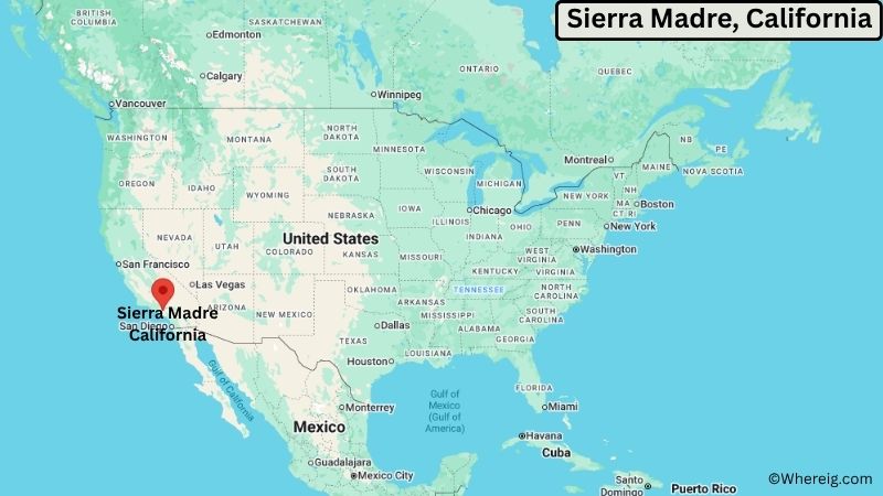
About Map: The map shows the location of Sierra Madre in Los Angeles County, in the U.S. state of California.
Sierra Madre Map, California
About Sierra Madre Map: The Google Map highlights the location of Sierra Madre in Los Angeles County, California. Use the zoom, satellite, and street-view options to explore the city's neighborhoods, roads, and nearby places.
Where is Sierra Madre Located?
Sierra Madre is a city located in Los Angeles County, California, the United States. It lies at the southern foothills of the San Gabriel Mountains in the San Gabriel Valley. Sierra Madre is about 15 miles northeast of downtown Los Angeles, 4 miles north of Pasadena, and roughly 10 miles east of Glendale. The city is located at 34.1617° North latitude and 118.0528° West longitude. The 2020 Census recorded 10,585 residents. Sierra Madre covers about 3.00 square miles (7.77 square kilometers), with most of the city consisting of land. The San Gabriel Mountains form a dramatic backdrop, while Bailey Canyon Wilderness Park provides access to local hiking trails and natural areas. The city is also known for its historic downtown and annual community traditions. A unique feature of Sierra Madre is its location directly below the San Gabriel Mountains, giving the small city a distinctly foothill setting while remaining close to the Los Angeles urban area.
Most Viewed US Maps
| USA Sttae Map | USA Region Map | USA Road Map |
| USA County Map | Where is USA in World Map? | US ZIP Code Map |
| USA Time Zones Map | US State and Capitals Map | USA Physical Map |
Find 4,400+ U.S. Cities by State - Explore Their Locations and Get Detailed Information
Sierra Madre City Facts
| Fact | Details |
|---|---|
| City | Sierra Madre |
| State | California |
| County | Los Angeles County |
| Country | United States |
| Region | San Gabriel Valley, Southern California |
| Incorporated | February 16, 1907 |
| Founded | 1881 |
| Total Area | 3.00 sq mi (7.77 sq km) |
| Land Area | 3.00 sq mi (7.77 sq km) |
| Water Area | 0.00 sq mi (0.00 sq km) |
| Elevation | About 571 ft (174 m) |
| Population (2023 estimate) | About 10,500 |
| Population (2020 Census) | 10,585 |
| Population Density | About 3,528 people per sq mi |
| Time Zone | Pacific Time (PST/PDT) |
| ZIP Codes | 91024, 91025 |
| Area Code | 626 |
| Major Highways | Interstate 210, Angeles Crest Highway, Foothill Boulevard |
| Public Transit | Los Angeles County Metro bus services |
| Major Attractions | Bailey Canyon Wilderness Park, Sierra Madre Memorial Park, Mount Wilson Trail, Sierra Madre Historic District |
| Official Website | https://www.cityofsierramadre.com/ |
Distance from Sierra Madre, CA to Nearby Cities
- Arcadia, CA – 3 miles (5 km)
- Pasadena, CA – 4 miles (6 km)
- Monrovia, CA – 5 miles (8 km)
- San Marino, CA – 6 miles (10 km)
- Bradbury, CA – 6 miles (10 km)
- Temple City, CA – 8 miles (13 km)
- Glendora, CA – 10 miles (16 km)
- Azusa, CA – 10 miles (16 km)
- Alhambra, CA – 10 miles (16 km)
- El Monte, CA – 9 miles (14 km)
- West Covina, CA – 12 miles (19 km)
- Glendale, CA – 12 miles (19 km)
- Burbank, CA – 15 miles (24 km)
- Los Angeles, CA – 15 miles (24 km)
- Pomona, CA – 20 miles (32 km)
- Ontario, CA – 30 miles (48 km)
- Riverside, CA – 35 miles (56 km)
- Santa Monica, CA – 30 miles (48 km)
Top Attractions in Sierra Madre, California
- Mount Wilson Trail – A historic hiking route ascending into the San Gabriel Mountains and offering access to scenic mountain terrain.
- Bailey Canyon Wilderness Park – A foothill park with hiking trails, natural vegetation, canyon scenery, and access to the San Gabriel Mountains.
- Sierra Madre Memorial Park – A central community park with lawns, trees, walking areas, and recreational facilities.
- Sierra Madre Historic District – A collection of historic homes, streets, and buildings reflecting the city's development from the late 19th and early 20th centuries.
- Sierra Madre Playhouse – A historic local theater and cultural venue presenting live performances and community programs.
- Lizzie's Trail – A local hiking route connecting Sierra Madre neighborhoods with foothill terrain and mountain views.
- Angeles National Forest – A vast mountain forest directly north of Sierra Madre with hiking, camping, scenic drives, and wildlife areas.
- Los Angeles County Arboretum and Botanic Garden – A major botanical garden in nearby Arcadia featuring historic structures, landscaped gardens, plants, and wildlife.
- Los Angeles County Museum of Art – A major art museum in Los Angeles with extensive collections spanning many cultures and historical periods.
Airports Near Sierra Madre, California
- Hollywood Burbank Airport (BUR) – 25 miles
- Los Angeles International Airport (LAX) – 35 miles
- Ontario International Airport (ONT) – 35 miles
- Long Beach Airport (LGB) – 30 miles
Sources:
Population and area data sourced from the United States Census Bureau (2020 Census). General city information referenced from the official Sierra Madre city website and local government records.
California Related Links
- Where is Los Angeles
- Where is San Diego
- Where is San Francisco
- Where is Anaheim
- Where is Bakersfield
- Where is Chula Vista
- Where is Freemont
- Where is Fresno
- Where is Glendale
- Where is Irvine
- Where is Long Beach
- Where is Modesto
- Where is Oakland
- Where is Paradise
- Where is Riverside
- Where is Sacramento
- Where is San Bernardino
- Where is San Jose
- Where is Santa Ana
- Where is Stockton
- Where is Berkeley
- Where is Clovis
- Where is Corona
- Where is Elk Grove
- Where is Escondido
- Where is Fontana
- Where is Fremont
- Where is Fullerton
- Where is Garden Grove
- Where is Hayward
- Where is Huntington Beach
- Where is Lancaster
- Where is Moreno Valley
- Where is Oceanside
- Where is Ontario
- Where is Orange
- Where is Oxnard
- Where is Palmdale
- Where is Pasadena
- Where is Pomona
- Where is Rancho Cucamonga
- Where is Roseville
- Where is Salinas
- Where is Santa Clara
- Where is Santa Clarita
- Where is Santa Rosa
- Where is Sunnyvale
- Where is Thousand Oaks
- Where is Torrance
- Where is Vallejo
- Where is Victorville
- Where is Visalia