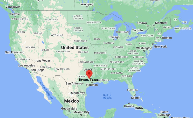
Where is Bryan Located? - Bryan is a city located in the Brazos County of Texas, United States. Bryan lies between 30.6327 Degrees North latitudes and -96.3662 Degrees West longitudes.
Location Map of Bryan, Texas
Bryan Map, Texas, USA
Where is Bryan?: The Google Map showing the location of Bryan in the U.S. state of Texas.
Where is Bryan Located?
Bryan is a city located in the Brazos County of Texas, United States. Bryan lies between 30.6327 Degrees North latitude and -96.3662 Degrees West longitude. According to the 2020 U.S. Census, the population of Bryan city is 83,980 people and the city has a total area of 45.969 sq mi. The city has numerous parks and recreational facilities.
State Highway 6, US 190, State Highway 21, FM 2818
Train/Amtrak Service
No local Amtrak service; freight rail operated by Union Pacific
Local Bus/Transit Service
Bryan-College Station (The District) Public Transit
State Highway 6 - Main north-south highway connecting Bryan with Waco, Houston and the Texas Gulf Coast.
US Highway 190 - East-west route linking Bryan with Hearne, Huntsville and Central Texas.
State Highway 21 - Connects Bryan with Austin, Nacogdoches and East Texas.
Farm to Market Road 2818 - Important bypass serving Bryan, College Station and Texas A&M University.
University Drive (FM 60) - Major corridor connecting Bryan with College Station, commercial districts and Easterwood Airport.
Key Landmarks and Places to Visit in Bryan, Texas
Landmark Name
Type
Historic Downtown Bryan
Historic District
Brazos Valley Museum of Natural History
Museum
Lake Bryan
Recreation Area
Travis Bryan Midtown Park
City Park
Messina Hof Winery
Winery
Boonville Heritage Park
Historic Site
Carnegie History Center
Museum
Children's Museum of the Brazos Valley
Museum
Baker Field
Sports Complex
Veterans Park and Athletic Complex
Park
Colleges and Universities in Bryan, Texas
Institution Name
Type
Level
Notable For
Texas A&M University
Public
University
Flagship research university
Blinn College - Bryan Campus
Public
Community College
Transfer and workforce programs
Texas A&M Health Science Center
Public
University
Medical and health sciences
Allen Academy
Private
K-12 District
College preparatory education
Bryan Independent School District
Public
K-12 District
Public education services
Waterbodies in Bryan, Texas
Brazos River, Lake Bryan, Burton Creek, Carter Creek, Still Creek, Davidson Creek, Wickson Creek, Navasota River
Golf Courses in Bryan, Texas
Traditions Club, Bryan Municipal Golf Course, Miramont Country Club, The Golf Club at Texas A&M, Pebble Creek Country Club, Copperas Hollow Country Club, Hilltop Lakes Golf Course, Brenham Country Club
Bryan, Texas - Key Historical Facts
Bryan was established in 1866 after the Houston and Texas Central Railway selected the area for a rail station.
The city became the Brazos County seat and quickly developed as an important transportation and agricultural center.
The opening of Texas A&M University in neighboring College Station helped drive long-term economic and population growth.
Historic Downtown Bryan preserves many late nineteenth- and early twentieth-century buildings that reflect the city's railroad heritage.
Bryan has grown into a regional center for healthcare, manufacturing, education, and technology while maintaining its historic character.
Today, Bryan and College Station together form the heart of the Brazos Valley and one of the fastest-growing metropolitan areas in Texas.