Map of Saline County - Saline County is a county located in the U.S. state of Illinois. Saline County Map showing cities, highways, important places and water bodies. Get Where is Saline County located in the map, major cities in Saline county, population, areas, and places of interest.
St Clair County Map, Illinois
About Saline County Map, Illinois: The map showing the county boundary, county seat, major cities, highways, water bodies and neighbouring counties.
Most Viewed Illinois Links
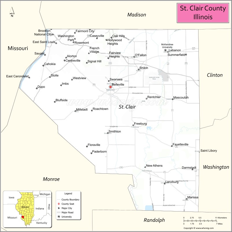
St Clair County, Illinois
St. Clair County is a county located in the U.S. state of Illinois. It's county seat is Belleville. As per 2020 census, the population of St. Clair County is 254796 people and population density is square miles. According to the United States Census Bureau, the county has a total area of 657 sq mi (1,702 km2). St. Clair County was established on 1790.
Facts about St. Clair County, Illinois
| Country | United States |
| State | Illinois |
| Region | Southwestern Illinois / Metro East |
| County Seat | Belleville |
| Named After | Arthur St. Clair |
| Established | 1790 |
| Organized | 1790 |
| Coordinates | 38.47° N, 89.93° W |
| Total Area | ~674 sq mi |
| Land Area | ~657 sq mi |
| Water Area | ~17 sq mi |
| Population (2020) | ~257,400 |
| Population Rank | Third-most populous county in Illinois |
| Largest City | Belleville |
| Main Industries | Healthcare, Manufacturing, Education, Transportation |
| Major Highways | Interstate 64, Interstate 255, Interstate 270 |
| Time Zone | Central Time (UTC−06:00) |
| Known For | Metro East suburbs, Scott Air Force Base, historic Belleville |
| Website | https://www.co.st-clair.il.us |