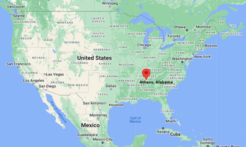
Where is Ashaway Located? - Ashaway is a city located in the Washington County of Rhode Island, United States. Ashaway lies between 41.4276 Degrees North latitudes and 71.7800 Degrees West longitudes.
Location Map of Athens, Alabama
Ashaway Map, Rhode Island, USA
Where is Ashaway?: The Google Map showing the location of Ashaway in the U.S. state of Rhode Island.
Where is Ashaway Located?
Ashaway is a city located in the Washington County of Rhode Island, United States. Ashaway lies at approximately 41.4276 Degrees North latitude and 71.7800 Degrees West longitude. According to the 2020 U.S. Census, the population of Ashaway city is 1,501 people and the city has a total area of 2.38 sq mi. The city has numerous parks and recreational facilities.
Nearby Cities and Communities to Ashaway, Rhode Island
Hope Valley, Rhode Island - 5 mi Northeast
Westerly, Rhode Island - 8 mi South
Pawcatuck, Connecticut - 9 mi South
Bradford, Rhode Island - 4 mi East
Charlestown, Rhode Island - 10 mi East
Mystic, Connecticut - 15 mi Southwest
Narragansett, Rhode Island - 22 mi East
New London, Connecticut - 24 mi Southwest
Warwick, Rhode Island - 35 mi Northeast
Providence, Rhode Island - 40 mi Northeast
Ashaway, Rhode Island Climate and Weather Overview
Month
Avg High (°F)
Avg Low (°F)
Avg Precipitation (in)
January
39
23
4.1
April
57
39
4.4
July
82
64
3.4
October
64
47
4.3
Annual
61
44
49.0
Climate Attribute
Details
Climate Classification (Köppen)
Dfa - Humid Continental
Annual Precipitation
Approximately 49 inches
Annual Sunshine Days
Approximately 200 days
Severe Weather Risk
Winter Storms, Coastal Storms and Thunderstorms
Average Snowfall
Approximately 30 inches annually
Driving Distances from Ashaway, Rhode Island
City
State
Distance (mi)
Approx. Drive Time
Bradford
Rhode Island
4
10 min
Hope Valley
Rhode Island
5
10 min
Westerly
Rhode Island
8
15 min
Pawcatuck
Connecticut
9
15 min
Charlestown
Rhode Island
10
20 min
Mystic
Connecticut
15
25 min
Narragansett
Rhode Island
22
35 min
New London
Connecticut
24
35 min
Warwick
Rhode Island
35
45 min
Providence
Rhode Island
40
55 min
Transportation and Connectivity in Ashaway, Rhode Island
Nearest Airport
Westerly State Airport
IATA Code
WST
Major Airport
T.F. Green International Airport (PVD)
Major Highways
Rhode Island Route 3, Rhode Island Route 216, Interstate 95 Nearby
Rail Service
Nearby Amtrak Service at Westerly Station
Public Transit
Regional Bus Services
Ashaway is a historic village within the Town of Hopkinton in southwestern Rhode Island.
The community developed along the Ashaway River and became known for textile manufacturing.
Interstate 95 provides convenient access to Providence, Boston and New York City.
The village maintains a small-town atmosphere while benefiting from nearby coastal attractions.
Tourism, local businesses and regional services contribute to the area's economy.
Key Landmarks and Places to Visit in Ashaway, Rhode Island
Landmark Name
Type
Ashaway River
Natural Attraction
Hopkinton Historical Association
Historical Site
Ashaway Free Library
Historic Library
Wood River Management Area
Outdoor Recreation Area
Burlingame State Park
State Park
Ninigret National Wildlife Refuge
Wildlife Refuge
Wilcox Park
Nearby Community Park
Downtown Westerly
Shopping and Dining Area
Mystic Seaport Museum
Nearby Museum
Misquamicut Beach
Nearby Coastal Attraction
Colleges and Universities Near Ashaway, Rhode Island
Institution Name
Type
Distance
Notable For
University of Rhode Island
Public University
18 mi
Research and marine sciences
Three Rivers Community College
Community College
22 mi
Career and transfer programs
Connecticut College
Private College
24 mi
Liberal arts education
University of New Haven at Groton
Private University
20 mi
Professional studies
Brown University
Private University
40 mi
Research and higher education
Waterbodies in and Near Ashaway, Rhode Island
Ashaway River, Wood River, Pawcatuck River, Worden Pond, Chapman Pond, Quonochontaug Pond, Ninigret Pond, Watchaug Pond, Little Narragansett Bay, Block Island Sound
Golf Courses in and Near Ashaway, Rhode Island
Winnapaug Country Club, Weekapaug Golf Club, Fenner Hill Golf Club, Richmond Country Club, Laurel Lane Country Club, Elmridge Golf Course, Cedar Ridge Golf Course, Montaup Country Club
Ashaway, Rhode Island - Key Historical Facts
Ashaway developed during the nineteenth century as a mill village along the Ashaway River.
The community became known for textile manufacturing and thread production.
The Ashaway Line & Twine Manufacturing Company helped establish the village's industrial reputation.
Rail transportation and water-powered mills contributed to local economic growth.
The village remained an important manufacturing center within Hopkinton for many decades.
Today, Ashaway is recognized for its historic character, natural surroundings and New England heritage.