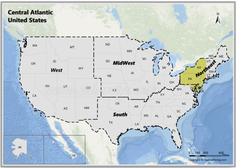
The Central Atlantic region, is a region of the United States.
Map of Central Atlantic States, USA
 About Map - Map showing Central Atlantic United States.
The Central Atlanticern United States consists of nine states: Delaware, Maryland, New Jersey, New York, Pennsylvania, District of Columbia. Popular cities in the Central Atlantic region are Washington DC, New York, Dover, Newark, Baltimore, Philadelphia, Pittsburgh, Buffalo, Rochester
Most Viewd Links
List of Central Atlantic United States with Capitals
| State | Capital | Major Cities | Populaion 2020 Census | Land Area (Sq mi) | Density (Sq mi) | Total County |
|---|---|---|---|---|---|---|
| Delaware | Dover | Wilmington, Dover, Newark, Middletown and Smyrna | 989,948 | 1,949 sq mi (5,047 km2) | 480.1 | 3 |
| District Of Columbia | #N/A | #N/A | 689,545 | 61 sq mi (158 km2) | 10,801.50 | 1 |
| Maryland | Annapolis | Baltimore, Frederick, Rockville, Gaithersburg, Bowie and Annapolis | 6,177,224 | 9,707 sq mi (25,142 km2) | 615.7 | 24 |
| New Jersey | Trenton | Newark, Jersey City, Paterson, Elizabeth, Edison and Trenton | 9,288,994 | 7,354 sq mi (19,047 km2) | 1,215.40 | 21 |
| New York | Albany | New York, Buffalo, Rochester, Yonkers, Syracuse and Albany | 20,201,249 | 47,126 sq mi (122,057 km2) | 419 | 62 |
| Pennsylvania | Harrisburg | Philadelphia, Pittsburgh, Allentown, Erie, Reading and Harrisburg | 13,002,700 | 44,743 sq mi (115,883 km2) | 285.8 | 67 |
U.S. Central Atlantic States Facts
| Region Name | Central Atlantic States (Mid-Atlantic) |
| Country | United States of America |
| Common Definition | U.S. Census Bureau - Middle Atlantic region |
| States & Territory Included | New York, New Jersey, Pennsylvania, Delaware, Maryland, Washington, D.C. |
| Number of States/Territories | 6 |
| Total Population (2025 est.) | 65-68 million |
| Total Area | 200,000 sq mi (518,000 km²) |
| Most Populous State | New York |
| Largest City | New York City |
| Major Cities | New York City, Philadelphia, Baltimore, Newark, Jersey City, Wilmington, Washington, D.C. |
| Capital Cities | Albany, Trenton, Harrisburg, Dover, Annapolis, Washington, D.C. |
| Climate | Humid subtropical (south), humid continental (north), coastal influences |
| Major Rivers | Delaware River, Hudson River, Susquehanna River, Potomac River |
| Major Water Bodies | Atlantic Ocean, Chesapeake Bay, Delaware Bay |
| Economic Profile | Finance, government, healthcare, education, manufacturing, ports and trade |
| Cultural Significance | Early U.S. history, immigration hubs, political centers, arts and media |
| Time Zone | UTC -5 (Eastern Time) |
| Famous For | Wall Street, U.S. Capitol, major ports, historic cities, cultural diversity |
