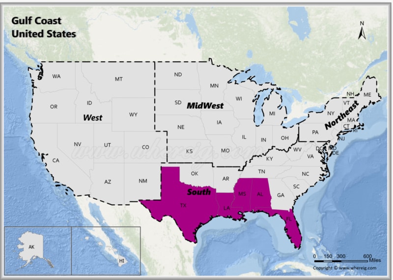
The Gulf Coast States of the United States are those states that have a coastline along the Gulf of Mexico. The Gulf Coast region includes five states: Texas, Louisiana, Mississippi, Alabama and Florida. The Gulf Coast features sandy beaches, wetlands, estuaries, and coastal plains. It is also home to major rivers like the Mississippi River.
Map of Gulf Coast States, USA
 About Map - Map showing Gulf Coast United States.
The Gulf Coast United States consists of fourteen states: Alabama, Florida, Louisiana, Mississippi, and Texas. Principal cities in the Gulf Coast region are Houston, St. Petersburg, Tampa, Brownsville, Corpus Christi,Galveston, Beaumont, Lake Charles, Lafayette, Baton Rouge, New Orleans, Gulfport, Biloxi, Mobile, and Pensacola.
Most Viewd Links
List of Gulf Coast USA States with Capitals
| State | Capital | Major Cities | Populaion 2020 Census | Land Area (Sq mi) | Density (Sq mi) | Total County |
|---|---|---|---|---|---|---|
| Alabama | Montgomery | Birmingham, Montgomery, Mobile, Huntsville and Tuscaloosa | 5,024,279 | 50,645 sq mi (131,171 km2) | 95.8 | 67 |
| Florida | Tallahassee | Jacksonville, Miami, Tampa, St. Petersburg, Orlando and Tallahassee | 21,538,187 | 53,625 sq mi (138,887 km2) | 371 | 67 |
| Louisiana | Baton Rouge | New Orleans, Baton Rouge, Shreveport, Lafayette and Lake Charles | 4,657,757 | 43,204 sq mi (111,898 km2) | 107.6 | 64 |
| Mississippi | Jackson | Jackson, Gulfport, Hattiesburg, Southaven, Biloxi | 2,961,279 | 46,923 sq mi (121,531 km2) | 63.8 | 82 |
| Texas | Austin | Houston, San Antonio, Dallas, Austin and Fort Worth | 29,145,505 | 261,232 sq mi (676,587 km2) | 103.2 | 254 |
USA Gulf Coast States Facts
| Region Name | Gulf Coast States |
| Country | United States of America |
| Geographic Definition | U.S. states bordering the Gulf of Mexico |
| States Included | Texas, Louisiana, Mississippi, Alabama, Florida |
| Number of States | 5 |
| Total Population (2025 est.) | 75-80 million |
| Total Area | 770,000 sq mi (2.0 million km²) |
| Most Populous State | Texas |
| Largest City | Houston, Texas |
| Major Cities | Houston, Dallas, Miami, Tampa, New Orleans, Mobile, Pensacola, Corpus Christi |
| Capital Cities | Austin, Baton Rouge, Jackson, Montgomery, Tallahassee |
| Climate | Humid subtropical and tropical; hot summers and mild winters |
| Major Water Body | Gulf of Mexico |
| Major Rivers | Mississippi River, Rio Grande, Sabine River, Mobile River |
| Economic Profile | Energy (oil & gas), ports and trade, tourism, fishing, agriculture |
| Natural Hazards | Hurricanes, tropical storms, flooding, coastal erosion |
| Cultural Significance | Southern culture, Cajun & Creole heritage, coastal cuisine, music |
| Time Zones | UTC -5 (Eastern Time), UTC -6 (Central Time) |
| Famous For | Beaches, energy industry, ports, seafood, wetlands, coastal cities |
