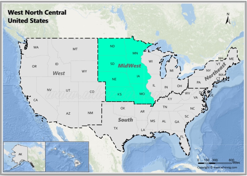
The West North Central region, is one of the nine Census Bureau Divisions of the United States.
Map of West North Central States, USA
 About Map - Map showing West North Central United States.
The West North Centralern United States consists of seven states: Iowa, Kansas, Minnesota, Missouri, Nebraska, North Dakota, and South Dakota. Popular cities in the West North Central region are Minneapolis, Saint Paul, Des Moines, Jefferson City, Lincoln, Bismarck, Pierre and Wichita.
Most Viewd Links
List of West North Central United States with Capitals
| Iowa | Des Moines | Des Moines, Cedar Rapids, Davenport, Sioux City and Waterloo | 3,190,369 | 55,857 sq mi (144,669 km2) | 55.6 | 99 |
|---|---|---|---|---|---|---|
| Kansas | Topeka | Wichita, Overland Park, Kansas City, Topeka and Olathe | 2,937,880 | 81,759 sq mi (211,754 km2) | 35.5 | 105 |
| Minnesota | Saint Paul | Minneapolis, Saint Paul, Rochester, Duluth and Bloomington | 5,706,494 | 79,627 sq mi (206,232 km2) | 68.5 | 87 |
| Missouri | Jefferson City | Kansas City, Saint Louis, Springfield, Independence, Columbia and Jefferson City | 6,154,913 | 68,742 sq mi (178,040 km2) | 88.2 | 115 |
| Nebraska | Lincoln | Omaha, Lincoln, Bellevue, Grand Island and Kearney | 1,961,504 | 76,824 sq mi (198,974 km2) | 24.5 | 93 |
| North Dakota | Bismarck | Fargo, Bismarck, Grand Forks, Minot and West Fargo | 779,094 | 69,001 sq mi (178,711 km2) | 10.7 | 53 |
| South Dakota | Pierre | Sioux Falls, Rapid City, Aberdeen, Brookings, Watertown and Pierre | 886,667 | 75,811 sq mi (196,350 km2) | 11.3 | 66 |
West North Central States Facts
| Region Name | West North Central States |
| Country | United States of America |
| U.S. Census Classification | Midwest - West North Central Division |
| States Included | Iowa, Kansas, Minnesota, Missouri, Nebraska, North Dakota, South Dakota |
| Number of States | 7 |
| Total Population (2025 est.) | 21-22 million |
| Total Area | 850,000 sq mi (2.2 million km�) |
| Most Populous State | Minnesota |
| Largest City | Kansas City, Missouri |
| Major Cities | Minneapolis, Saint Paul, Kansas City, Omaha, Des Moines, Fargo, Sioux Falls |
| Capital Cities | Des Moines, Topeka, Saint Paul, Jefferson City, Lincoln, Bismarck, Pierre |
| Climate | Humid continental with cold winters; semi-arid climate in western Plains |
| Major Rivers | Missouri River, Mississippi River, Platte River, Red River of the North |
| Major Landforms | Great Plains, Prairie lands, River valleys |
| Economic Profile | Agriculture (Corn & Wheat Belt), food processing, manufacturing, energy |
| Cultural Significance | Farming heritage, Native American history, Midwestern traditions |
| Major Tourist Attractions | Mount Rushmore, Badlands National Park, Mall of America, Gateway Arch, Theodore Roosevelt National Park |
| Time Zones | UTC -6 (Central Time), UTC -5 (Eastern Time - parts of Indiana & Michigan not included here) |
| Famous For | Farmlands, prairies, national monuments, grain production, scenic plains |
