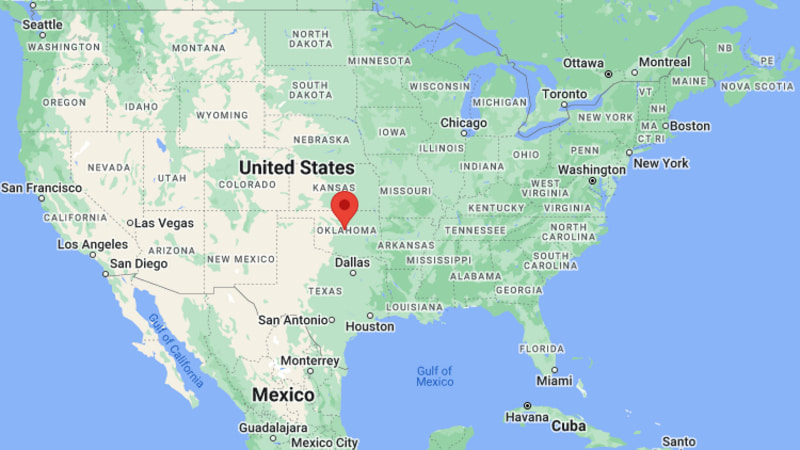
Where is Edmond Located? - Edmond is a city located in the Oklahoma County of Oklahoma, United States. Edmond lies between 35.7079146 Degrees North latitudes and 79.8136446 Degrees West longitudes.
Location Map of Edmond, Oklahoma
Edmond Map, Oklahoma, USA
Where is Edmond?: The Google Map showing the location of Edmond in the U.S. state of Oklahoma.
Where is Edmond Located?
Edmond is a city located in the Oklahoma County of Oklahoma, United States. Edmond lies between 35.7079146 Degrees North latitudes and 79.8136446 Degrees West longitudes. According to 2020 U.S.census, the population of Edmond city is 94428 people and the city has a total area of 84.69 sq mi. The city has numerous parks and recreational facilities.
Transportation and Connectivity in Edmond, Oklahoma
Transportation
Details
Airport Name
Will Rogers World Airport
IATA Code
OKC
Port
None
Major Highways
Interstate 35, U.S. Route 77, State Highway 66, State Highway 74
Train/Amtrak Service
Nearest Amtrak station at Oklahoma City
Local Bus/Transit Service
Citylink Edmond and EMBARK regional transit
Interstate 35 — Major north-south interstate connecting Edmond with Oklahoma City, Wichita, and Dallas.
U.S. Route 77 — Historic highway serving Edmond's downtown and neighboring communities.
State Highway 66 — Follows portions of the historic Route 66 corridor through central Oklahoma.
State Highway 74 — Connects Edmond with northern Oklahoma City suburbs and western Oklahoma County.
Places to Visit in Edmond, Oklahoma
Landmark Name
Type
Arcadia Lake
Recreation Area
Mitch Park
Community Park
Hafer Park
City Park
University of Central Oklahoma
University Campus
Pelican Bay Aquatic Center
Water Park
Edmond Historical Society & Museum
History Museum
Armstrong Auditorium
Performing Arts Venue
E.C. Hafer Park
Nature Park
Arcadia Round Barn
Historic Site
Route 66 Interpretive Attractions
Historic Attraction
Colleges and Universities in Edmond, Oklahoma
Institution Name
Type
Level
Notable For
University of Central Oklahoma
Public
University
Liberal arts and business
Oklahoma Christian University
Private
University
Christian higher education
Oklahoma State University–Oklahoma City
Public
Community College
Career and technical education
Rose State College
Public
Community College
Transfer and workforce programs
Oklahoma City Community College
Public
Community College
Associate degree programs
Southern Nazarene University
Private
University
Liberal arts education
Oklahoma City University
Private
University
Law and performing arts
Edmond Public Schools
Public
K–12 District
Public education
Waterbodies in Edmond, Oklahoma
Arcadia Lake, Deep Fork River, Spring Creek, Coffee Creek, Bluff Creek, Deer Creek, North Canadian River, Lake Hefner
Golf Courses in Edmond, Oklahoma
KickingBird Golf Club, Oak Tree National, Oak Tree Country Club, Coffee Creek Golf Club, River Oaks Golf Club, The Golf Club of Edmond, Quail Creek Golf & Country Club, Lincoln Park Golf Course
Edmond, Oklahoma — Key Historical Facts
Edmond was established during the Land Run of 1889 and quickly became one of the earliest communities founded in Oklahoma Territory.
The city's early growth centered on agriculture, the Santa Fe Railway, and its strategic location north of present-day Oklahoma City.
The University of Central Oklahoma, originally founded in 1890 as a teachers' college, helped shape Edmond into a leading educational community.
Historic U.S. Route 66 passed through the area, bringing commerce and travelers to local businesses during the early and mid-20th century.
Rapid suburban development after World War II transformed Edmond into one of the fastest-growing cities in the Oklahoma City metropolitan area.
Today, Edmond is recognized for its highly rated schools, parks, cultural attractions, thriving business community, and family-friendly neighborhoods.