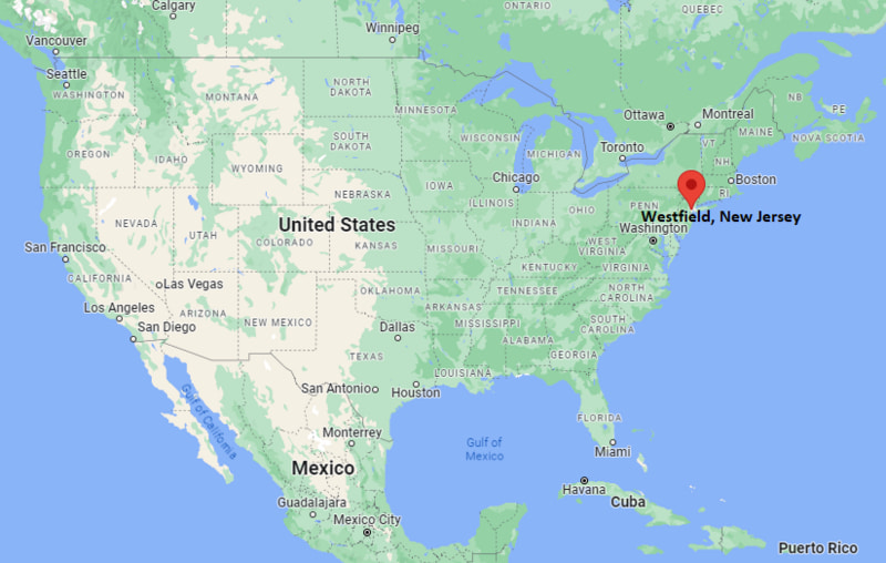
Where is Westfield Located? - Westfield is a city located in the Union County of New Jersey, United States. Westfield lies between 37.7030646 Degrees North latitudes and 85.8649408 Degrees West longitudes.
Location Map of Westfield, New Jersey

Westfield Map, New Jersey, USA
Where is Westfield?: The Google Map showing the location of Westfield in the U.S. state of New Jersey.
Where is Westfield Located?
Westfield is a city located in the Union County of New Jersey, United States. Westfield lies between 37.7030646 Degrees North latitudes and 85.8649408 Degrees West longitudes. According to 2020 U.S.census, the population of Westfield city is 31032 people and the city has a total area of 6.72 sq mi. The city has numerous parks and recreational facilities.
Most Viewed US Maps
Westfield City Facts, New Jersey
| City Name | Westfield |
| County | Union County |
| State | New Jersey |
| Country | United States |
| U.S. Region | Middle Atlantic |
| Coordinates | 40.6589912° N, 74.3473717° W |
| Latitude | 42.1250929 |
| Longitude | -72.749538 |
| Population (2020 Census) | 31032 |
| Population Density (Sq mi) | 4647 |
| Area (Sq mi) | 6.72 |
| Currency | US Dollar, $ (USD) |
| Time Zone | Eastern Time - UTC?05:00 (Standard), UTC?04:00 (DST) |
Other New Jersey Maps & Info
- Where is Atlantic City
- Where is Avenel
- Where is Bayonne
- Where is Bergenfield
- Where is Bridgeton
- Where is Camden
- Where is Carteret
- Where is Cliffside Park
- Where is Clifton
- Where is Colonia
- Where is Dover
- Where is Dumont
- Where is East Orange
- Where is Edgewater
- Where is Elizabeth
- Where is Elmwood Park
- Where is Englewood
- Where is Fair Lawn
- Where is Fairview
- Where is Fort Lee
- Where is Garfield
- Where is Glassboro
- Where is Hackensack
- Where is Harrison
- Where is Hawthorne
- Where is Highland Park
- Where is Hoboken
- Where is Iselin
- Where is Kearny
- Where is Lakewood
- Where is Linden
- Where is Lindenwold
- Where is Lodi
- Where is Long Branch
- Where is Metuchen
- Where is Millville
- Where is Morristown
- Where is New Brunswick
- Where is New Milford
- Where is North Arlington
- Where is North Plainfield
- Where is Ocean Acres
- Where is Old Bridge
- Where is Palisades Park
- Where is Paramus
- Where is Passaic
- Where is Paterson
- Where is Perth Amboy
- Where is Phillipsburg
- Where is Plainfield
- Where is Pleasantville
- Where is Point Pleasant
- Where is Princeton Meadows
- Where is Rahway
- Where is Ridgewood
- Where is Roselle
- Where is Rutherford
- Where is Sayreville
- Where is Secaucus
- Where is Somerset
- Where is South Plainfield
- Where is South River
- Where is Summit
- Where is Tenafly
- Where is Tinton Falls
- Where is Toms River
- Where is Trenton
- Where is Union City
- Where is Vineland
- Where is West New York
- Where is Westfield
- Where is Woodbridge
