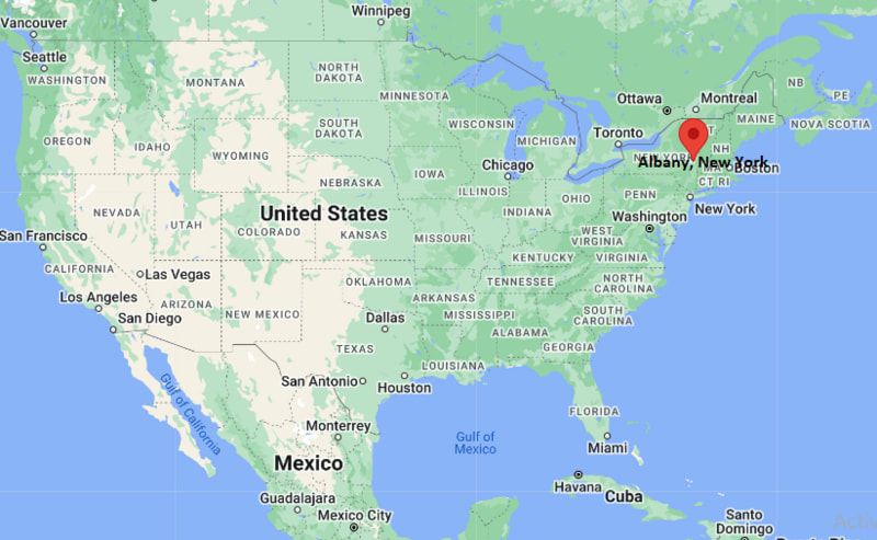
Where is Albany Located? - Albany is a city located in the Albany County of New York, United States. Albany lies between 40.5292099 Degrees North latitudes and 74.6400432 Degrees West longitudes.
Location Map of Albany, New York

Albany Map, New York, USA
Where is Albany?: The Google Map showing the location of Albany in the U.S. state of New York.
Where is Albany Located?
Albany is a city located in the Albany County of New York, United States. Albany lies between 40.5292099 Degrees North latitudes and 74.6400432 Degrees West longitudes. According to 2020 U.S.census, the population of Albany city is 99224 people and the city has a total area of 21.4 sq mi. The city has numerous parks and recreational facilities.
Most Viewed US Maps
Albany City Facts, New York
| City Name | Albany |
| County | Albany County |
| State | New York |
| Country | United States |
| U.S. Region | Middle Atlantic |
| Coordinates | 42.6525793° N, 73.7562317° W |
| Latitude | 42.6525793 |
| Longitude | -73.7562317 |
| Population (2020 Census) | 99224 |
| Population Density (Sq mi) | 4655 |
| Area (Sq mi) | 21.4 |
| Currency | US Dollar, $ (USD) |
| Time Zone | Eastern Time - UTC?05:00 (Standard), UTC?04:00 (DST) | Places to Visit in Albany | Brig Amity,Albany Heritage Park,Middleton Beach,Albany's Historic Whaling Station,Torndirrup National Park | Nearest Airport | Albany International Airport (ALB / KALB) |
New York Maps and Info
| New York Map | Counties in New York | Cities in New York |
| New York Zipcodes | Airports in New York | US Zip code Map |
| New York Area Codes | New York River Map | - |
Location Map of New York Cities
- Where is Albany
- Where is Auburn
- Where is Baldwin
- Where is Bay Shore
- Where is Binghamton
- Where is Brentwood
- Where is Brighton
- Where is Centereach
- Where is Central Islip
- Where is Cheektowaga
- Where is Commack
- Where is Copiague
- Where is Coram
- Where is Deer Park
- Where is Dix Hills
- Where is East Massapequa
- Where is East Meadow
- Where is East Patchogue
- Where is Eastchester
- Where is Elmira
- Where is Elmont
- Where is Franklin Square
- Where is Freeport
- Where is Garden City
- Where is Glen Cove
- Where is Harrison
- Where is Hempstead
- Where is Hicksville
- Where is Holbrook
- Where is Huntington
- Where is Huntington Station
- Where is Irondequoit
- Where is Ithaca
- Where is Jamestown
- Where is Kingston
- Where is Kiryas Joel
- Where is Lackawanna
- Where is Levittown
- Where is Lindenhurst
- Where is Lockport
- Where is Lynbrook
- Where is Mamaroneck
- Where is Massapequa
- Where is Medford
- Where is Merrick
- Where is Middletown
- Where is Mineola
- Where is Monsey
- Where is Mount Vernon
- Where is New City
- Where is New Rochelle
- Where is Newburgh
- Where is Niagara Falls
- Where is North Bellmore
- Where is North Tonawanda
- Where is Oceanside
- Where is Ossining
- Where is Peekskill
- Where is Plainview
- Where is Port Chester
- Where is Poughkeepsie
- Where is Rockville Centre
- Where is Rome
- Where is Rotterdam
- Where is Saratoga Springs
- Where is Schenectady
- Where is Selden
- Where is Shirley
- Where is Smithtown
- Where is Spring Valley
- Where is Syracuse
- Where is Troy
- Where is Uniondale
- Where is Utica
- Where is Valley Stream
- Where is Watertown
- Where is West Babylon
- Where is West Hempstead
- Where is West Islip
- Where is West Seneca
- Where is White Plains
- Where is Yonkers
