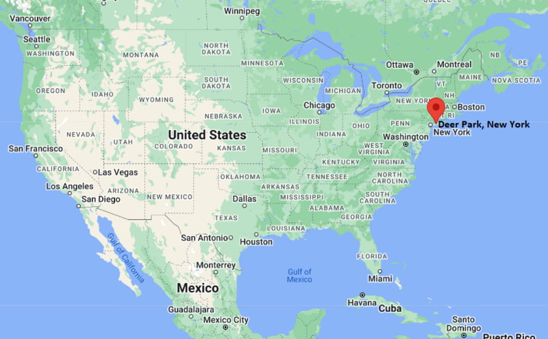
Where is Deer Park Located? - Deer Park is a city located in the Garrett County of New York, United States. Deer Park lies between 40.75908 Degrees North latitudes and -73.3257 Degrees West longitudes.
Location Map of Deer Park, New York
Deer Park Map, New York, USA
Where is Deer Park?: The Google Map showing the location of Deer Park in the U.S. state of New York.
Where is Deer Park Located?
Deer Park is a city located in the Garrett County of New York, United States. Deer Park lies between 40.75908 Degrees North latitudes and -73.3257 Degrees West longitudes. According to 2020 U.S.census, the population of Deer Park city is 28837 people and the city has a total area of 6.171 sq mi. The city has numerous parks and recreational facilities.
Transportation and Connectivity in Deer Park, New York
Transportation
Details
Airport Name
Long Island MacArthur Airport
IATA Code
ISP
Port
No commercial port; nearby Great South Bay marinas
Major Highways
Interstate 495 (Long Island Expressway), Northern State Parkway, Southern State Parkway, Deer Park Avenue (NY 231)
Train/Amtrak Service
Long Island Rail Road (Deer Park Station); no Amtrak service
Local Bus/Transit Service
Suffolk County Transit and Long Island Rail Road
Interstate 495 (Long Island Expressway) - Main east-west highway connecting Deer Park with New York City and eastern Long Island.
Northern State Parkway - Provides access to Nassau County and western Suffolk County.
Southern State Parkway - Major commuter route serving Long Island's southern communities.
Deer Park Avenue (NY 231) - Principal north-south road linking Deer Park with Babylon and Dix Hills.
Key Landmarks and Places to Visit in Deer Park, New York
Landmark Name
Type
Tanger Outlets Deer Park
Shopping Center
Edgewood Oak Brush Plains Preserve
Nature Preserve
Geiger Memorial Park
Community Park
Pine Acres Park
Neighborhood Park
Belmont Lake State Park
State Park
Argyle Park
Park
Sagtikos Manor
Historic Site
Bayard Cutting Arboretum State Park
Arboretum
Fire Island National Seashore
National Seashore
Adventureland
Amusement Park
Colleges and Universities in Deer Park, New York
Institution Name
Type
Level
Notable For
Suffolk County Community College - Brentwood Campus
Public
Community College
Career and transfer programs
Farmingdale State College
Public
University
Applied sciences and technology
Five Towns College
Private
College
Music and media arts
Dowling College Educational Center (former campus)
Private
Higher Education Center
Former higher education site
Deer Park Union Free School District
Public
K-12 District
Public education system
Waterbodies in Deer Park, New York
Carlls River, Sampawams Creek, Great South Bay, Belmont Lake, Argyle Lake, Penataquit Creek, Connetquot River, West Brook
Golf Courses in Deer Park, New York
Bergen Point Golf Course, Heartland Golf Park, Colonial Springs Golf Club, Brentwood Country Club, West Sayville Golf Course, Timber Point Golf Course
Deer Park, New York - Key Historical Facts
Deer Park was established during the 19th century as a rural farming community within the Town of Babylon.
The arrival of the Long Island Rail Road encouraged residential growth and improved transportation to New York City.
The hamlet experienced rapid suburban development after World War II as Long Island's population expanded.
Retail and commercial activity increased significantly with the opening of Tanger Outlets Deer Park, one of Long Island's largest outlet shopping destinations.
Nearby parks and protected pine barrens have helped preserve important natural habitats alongside residential neighborhoods.
Today, Deer Park is known for its convenient commuter access, shopping, family-friendly neighborhoods, and proximity to Long Island's beaches and parks.