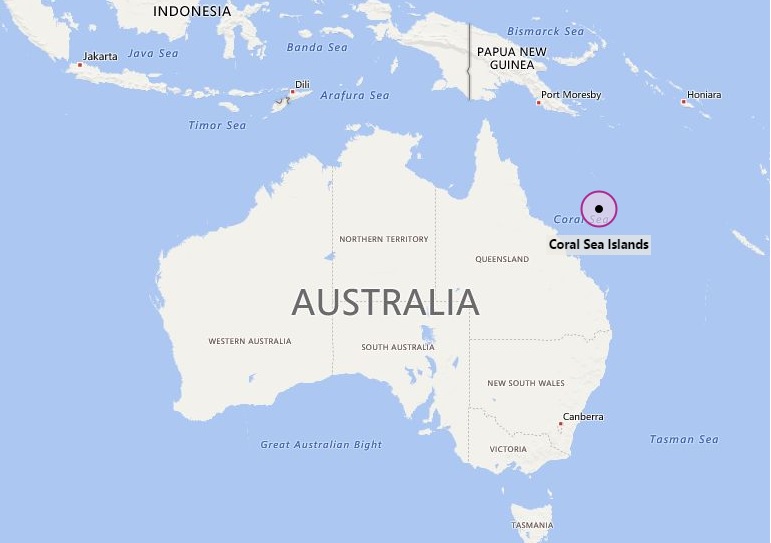
The Coral Sea Islands Territory is an external territory of Australia, located east of Queensland, Australia in the Southern Pacific Ocean.
Location Map of Coral Sea Islands
 About Map: Map showing location of Coral Sea Islands in the Oceania.
Where is Coral Sea Islands Located?
The given Coral Sea Islands Territory location map shows that Coral Sea Islands are located east of Australia in the Southern Pacific Ocean. More precisely, the Coral Sea Islands map also shows that these group of mostly uninhabited islands are located north-east of Queensland, Australia in the Coral Sea. Among the group of islands, Willis is the only inhabited island. Interestingly, the Coral Sea islands lies in the region of Great Barrier Reef.
Facts about Coral Sea Islands
| Official Name | Coral Sea Islands |
| Coordinates | 18°S 158°E / 18°S 158°E |
| Government | Territory of Australia |
| Area of Coral Sea Islands | The territory covers 780,000 km2 (301,160 sq mi) |
| Population of Coral Sea Islands | 4 (most of the islands are uninhabited) |
| Currency | AUD |
| Time Zone | UTC+10:00 |
| Calling Code | 61 |
- Where is American Samoa
- Where is Ashmore and Cartier Islands
- Where is Australia
- Where is Cook Islands
- Where is Coral Sea Islands
- Where is Micronesia
- Where is Fiji
- Where is French Polynesia
- Where is Guam
- Where is Kiribati
- Where is Marshall Islands
- Where is Nauru
- Where is New Caledonia
- Where is New Zealand
- Where is Niue
- Where is Norfolk Island
- Where is Northern Mariana Islands
- Where is Palau
- Where is Palmyra Atoll
- Where is Papua New Guinea
- Where is Paracel Islands
- Where is Pitcairn Islands
- Where is Samoa
- Where is Solomon Islands
- Where is Tokelau
- Where is Tonga
- Where is Tuvalu
- Where is Vanuatu
- Where is Wake Island
- Where is Wallis and Futuna
