Map of Otero County - Otero County is a county located in the U.S. state of New Mexico. Otero County Map showing cities, highways, important places and water bodies. Get Where is Otero County located in the map, major cities in Otero county, population, areas, and places of interest.
Map of Otero County, New Mexico
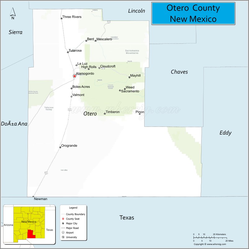
About Otero County Map, New Mexico: The map showing the county boundary, county seat, major cities, highways, water bodies and neighbouring counties.
Other New Mexico Maps & Info
About Otero County, New Mexico
Otero County is a county located in the U.S. state of New Mexico. It's county seat is Alamogordo. As per 2020 census, the population of Otero County is 68537 people and population density is square miles. According to the United States Census Bureau, the county has a total area of 6,627 sq mi (17,164 km2). Otero County was established on 1899.
Otero County Facts
| County Info | Facts |
|---|---|
| County | Otero County |
| County Seat | Alamogordo |
| State | New Mexico |
| Country | United States |
| FIPS code | 35 |
| Established | 1899 |
| Area | 6,627 sq mi (17,164 km2) |
| Population | 68537 |
| Density | |
| Formed / Origin | Parts of Do?a Ana County and Lincoln County. |
- Bernalillo County Map
- Catron County Map
- Chaves County Map
- Cibola County Map
- Colfax County Map
- Curry County Map
- De Baca County Map
- Doña Ana County Map
- Eddy County Map
- Grant County Map
- Guadalupe County Map
- Harding County Map
- Hidalgo County Map
- Lea County Map
- Lincoln County Map
- Los Alamos County Map
- Luna County Map
- McKinley County Map
- Mora County Map
- Otero County Map
- Quay County Map
- Rio Arriba County Map
- Roosevelt County Map
- Sandoval County Map
- San Juan County Map
- San Miguel County Map
- Santa Fe County Map
- Sierra County Map
- Socorro County Map
- Taos County Map
- Torrance County Map
- Union County Map
- Valencia County Map
- Alabama Counties
- Alaska boroughs
- Arizona Counties
- Arkansas Counties
- California County Map
- Colorado Counties
- Connecticut Counties
- Delaware Counties
- Florida County Map
- Georgia County Map
- Hawaii Counties
- Idaho Counties
- Illinois Counties
- Indiana Counties
- Iowa Counties
- Kansas Counties
- Kentucky Counties
- Louisiana Counties
- Maine Counties
- Maryland Counties
- Massachusetts Counties
- Michigan County Map
- Minnesota Counties
- Mississippi Counties
- Missouri Counties
- Montana Counties
- Nebraska Counties
- New Hampshire Counties
- New Jersey Counties
- New Mexico Counties
- North Carolina Counties
- North Dakota Counties
- Oklahoma Counties
- Oregon Counties
- Pennsylvania Counties
- Rhode Island Counties
- South Carolina Counties
- South Dakota Counties
- Map of Tennessee
- Texas County Map
- Utah Counties
- Vermont Counties
- Virginia Counties
- Washington Counties
- West Virginia Counties
- Wisconsin Counties
- Wyoming Counties
- Nevada Counties
- New York Counties
- Ohio County Map