Written and Fact-checked by Whereig Editors, Reviewed by Mukesh Kumar| Last Updated On: May 10, 2026
Map of White County - White County is a county located in the U.S. state of Arkansas. White County Map showing cities, highways, important places and water bodies. Get Where is White County located in the map, major cities in White county, population, areas, and places of interest.
White County Map, Arkansas
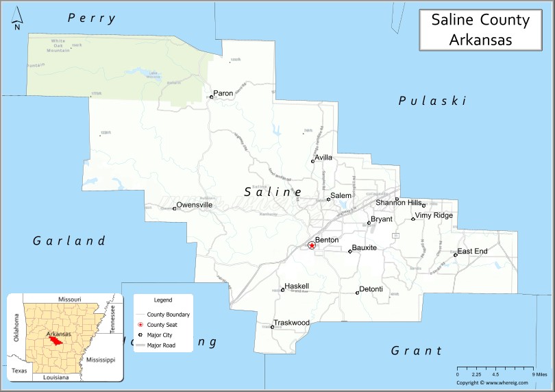
About White County Map, Arkansas: The map showing the county boundary, county seat, major cities, highways, water bodies and neighbouring counties.
Related Arkansas & US Links
Map of White County, Arkansas
White County is a county located in the U.S. state of Arkansas. It's county seat is Searcy. As per 2020 census, the population of White County is 77207 people and population density is square miles. According to the United States Census Bureau, the county has a total area of 1,042.36 sq mi (2,700 km2). White County was established on -23444.
White County Facts
| Continent | North America |
| Country | United States |
| State | Arkansas |
| County Seat | Searcy |
| Largest City/Town | Searcy |
| Established | October 23, 1835 |
| Total Area | 1,042 sq mi (2,699 sq km) |
| Land Area | 1,035 sq mi (2,681 sq km) |
| Water Area | 7 sq mi (18 sq km) |
| Population | 77,076 (Census 2020) |
| Population Density | 74.5 people per sq mi |
| Time Zone | Central Time Zone (CT) |
| Major Highways | Interstate 57, US 64, US 67, US 167, AR 36 |
| Major Rivers | Little Red River, White River |
| Neighboring Counties | Jackson County, Independence County, Cleburne County, Faulkner County, Prairie County, Woodruff County |
| Famous For | Harding University, Searcy, agriculture, Little Red River trout fishing |
| Top Attractions | Harding University, Little Red River, Berryhill Park, White County Pioneer Village |
| Official Website | Official Website |
About White County, Arkansas
White County is located in central Arkansas in the United States and was established in 1835. The county seat is Searcy, which is also the largest city in the county. The county is known for higher education, agriculture, outdoor recreation, and its location along major transportation corridors in central Arkansas.
Cities and Towns in White County, Arkansas
| City/Town | Population (Census 2020) | Latitude & Longitude |
|---|---|---|
| Searcy (county seat) | 23,768 | 35.2506°N, 91.7363°W |
| Bald Knob | 2,621 | 35.3095°N, 91.5671°W |
| Beebe | 8,437 | 35.0706°N, 91.8796°W |
| Bradford | 678 | 35.4259°N, 91.4554°W |
| Garner | 284 | 35.1431°N, 91.7452°W |
| Georgetown | 86 | 35.1295°N, 91.4095°W |
| Griffithville | 225 | 35.1162°N, 91.6204°W |
| Higginson | 657 | 35.1951°N, 91.7115°W |
| Judsonia | 1,982 | 35.2698°N, 91.6396°W |
| Kensett | 1,389 | 35.2309°N, 91.6682°W |
| McRae | 682 | 35.1134°N, 91.8215°W |
| Pangburn | 523 | 35.4265°N, 91.8381°W |
| Rose Bud | 483 | 35.3020°N, 92.0215°W |
| Russell | 216 | 35.2731°N, 91.5065°W |
Golf Courses in White County, Arkansas
| Golf Course | Location | Latitude & Longitude |
|---|---|---|
| Searcy Country Club | Searcy | 35.2619°N, 91.7478°W |
| River Oaks Golf Club | Searcy | 35.2455°N, 91.7559°W |
| Course at Cadron Valley nearby | Beebe | 35.0734°N, 91.8917°W |
Roads and Highways in White County, Arkansas
Major highways connect the county to Little Rock, northeast Arkansas, and surrounding regions.
- Interstate 57 - major interstate corridor connecting northeast Arkansas and Missouri
- US Highway 64 - important east-west route through central Arkansas
- US Highway 67 - major transportation corridor connecting Little Rock with northeast Arkansas
- US Highway 167 - north-south route linking Searcy with other Arkansas communities
- Arkansas Highway 36 - regional roadway serving rural communities and agricultural areas
What Are the Neighboring Counties of White County
- Jackson County (northeast)
- Independence County (north)
- Cleburne County (west)
- Faulkner County (southwest)
- Prairie County (south)
- Woodruff County (east)
Whar Are the Top Attractions in White County, Arkansas
The county offers a mix of natural and cultural attractions.
- Harding University - private Christian university known for academics and cultural events
- Little Red River - nationally recognized trout fishing and recreation destination
- Berryhill Park - large community park with walking trails, sports fields, and playgrounds
- White County Pioneer Village - historic site preserving pioneer-era structures and heritage
- Rialto Theater in Searcy - restored historic theater hosting performances and events
- White River recreation areas - boating, fishing, and wildlife viewing destinations
- Searcy Art Gallery - local cultural attraction featuring regional artists and exhibits
- Spring Park in Searcy - public recreation area with picnic and family facilities
- Bald Knob National Wildlife Refuge nearby - wildlife habitat and birdwatching area
- Downtown Searcy Historic District - shopping and dining district with historic architecture
- Pangburn Bridge and scenic countryside - rural landscapes and scenic driving routes
- Harding University Benson Auditorium - venue for concerts, lectures, and university events
- White County Fairgrounds - location for fairs, festivals, and agricultural events
What is the Distance from White County to Nearby Cities
The following distances are measured by road (driving).
- Searcy to Little Rock (Pulaski County), Arkansas - 51 mi (82 km)
- Searcy to Conway (Faulkner County), Arkansas - 48 mi (77 km)
- Searcy to Batesville (Independence County), Arkansas - 48 mi (77 km)
- Searcy to Jonesboro (Craighead County), Arkansas - 85 mi (137 km)
- Searcy to Heber Springs (Cleburne County), Arkansas - 37 mi (60 km)
- Searcy to Memphis (Shelby County), Tennessee - 109 mi (175 km)
- Searcy to Russellville (Pope County), Arkansas - 104 mi (167 km)
- Searcy to Newport (Jackson County), Arkansas - 36 mi (58 km)
- Searcy to Pine Bluff (Jefferson County), Arkansas - 72 mi (116 km)
- Searcy to Fayetteville (Washington County), Arkansas - 157 mi (253 km)
- Searcy to Mountain View (Stone County), Arkansas - 73 mi (117 km)
- Searcy to Fort Smith (Sebastian County), Arkansas - 144 mi (232 km)
FAQs about White County
White County is located in central Arkansas in the United States.
White County had a population of 77,076 according to the 2020 United States Census.
White County is known for Harding University, agriculture, Searcy, and trout fishing on the Little Red River.
The major highways include Interstate 57, US Highway 64, US Highway 67, US Highway 167, and Arkansas Highway 36.
Yes, White County has several golf facilities including Searcy Country Club and River Oaks Golf Club.
References
- QuickFacts - U.S. Census Bureau
- United States Census Bureau
- United States Geological Survey (USGS)
- National Geodetic Survey
- Official Website
- Arkansas County Map
- Ashley County Map
- Baxter County Map
- Benton County Map
- Boone County Map
- Bradley County Map
- Calhoun County Map
- Carroll County Map
- Chicot County Map
- Clark County Map
- Clay County Map
- Cleburne County Map
- Cleveland County Map
- Columbia County Map
- Conway County Map
- Craighead County Map
- Crawford County Map
- Crittenden County Map
- Cross County Map
- Dallas County Map
- Desha County Map
- Drew County Map
- Faulkner County Map
- Franklin County Map
- Fulton County Map
- Garland County Map
- Grant County Map
- Greene County Map
- Hempstead County Map
- Hot Spring County Map
- Howard County Map
- Independence County Map
- Izard County Map
- Jackson County Map
- Jefferson County Map
- Johnson County Map
- Lafayette County Map
- Lawrence County Map
- Lee County Map
- Lincoln County Map
- Little River County Map
- Logan County Map
- Lonoke County Map
- Madison County Map
- Marion County Map
- Miller County Map
- Mississippi County Map
- Monroe County Map
- Montgomery County Map
- Nevada County Map
- Newton County Map
- Ouachita County Map
- Perry County Map
- Phillips County Map
- Pike County Map
- Poinsett County Map
- Polk County Map
- Pope County Map
- Prairie County Map
- Pulaski County Map
- Randolph County Map
- St Francis County Map
- Saline County Map
- Scott County Map
- Searcy County Map
- Sebastian County Map
- Sevier County Map
- Sharp County Map
- Stone County Map
- Union County Map
- Van Buren County Map
- Washington County Map
- White County Map
- Woodruff County Map
- Yell County Map
- Alabama Counties
- Alaska boroughs
- Arizona Counties
- Arkansas Counties
- California County Map
- Colorado Counties
- Connecticut Counties
- Delaware Counties
- Florida County Map
- Georgia County Map
- Hawaii Counties
- Idaho Counties
- Illinois Counties
- Indiana Counties
- Iowa Counties
- Kansas Counties
- Kentucky Counties
- Louisiana Counties
- Maine Counties
- Maryland Counties
- Massachusetts Counties
- Michigan County Map
- Minnesota Counties
- Mississippi Counties
- Missouri Counties
- Montana Counties
- Nebraska Counties
- Nevada Counties
- New York Counties
- New Hampshire Counties
- New Jersey Counties
- New Mexico Counties
- North Carolina Counties
- North Dakota Counties
- Ohio County Map
- Oklahoma Counties
- Oregon Counties
- Pennsylvania Counties
- Rhode Island Counties
- South Carolina Counties
- South Dakota Counties
- Map of Tennessee
- Texas County Map
- Utah Counties
- Vermont Counties
- Virginia Counties
- Washington Counties
- West Virginia Counties
- Wisconsin Counties
- Wyoming Counties