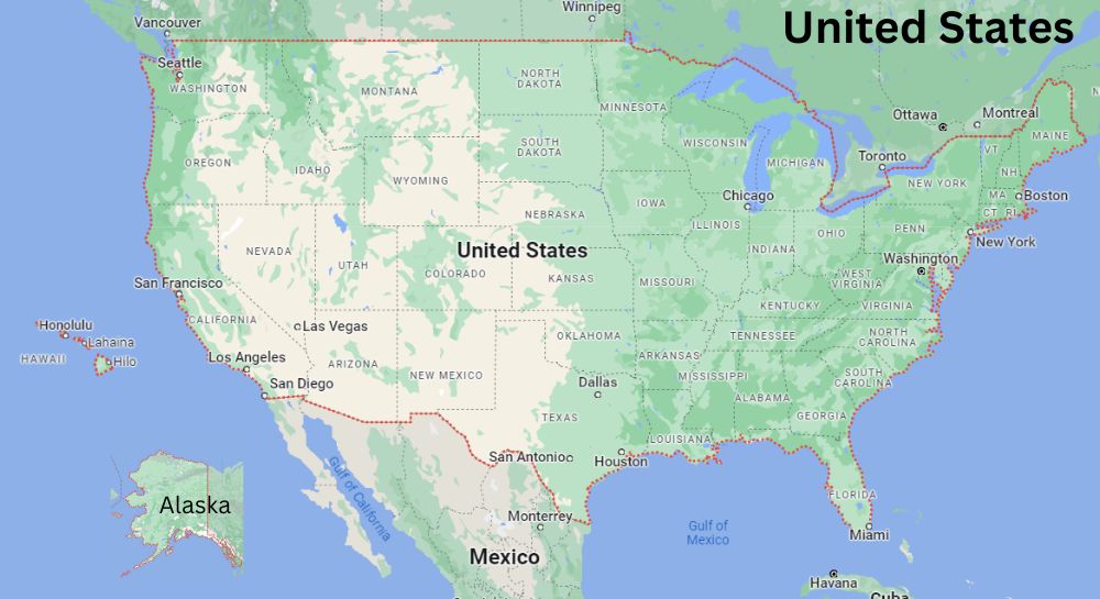
The United States of America is located on the North American Continent. The United States is bordered by the Canada to the north, Mexico to the south, Pacific Ocean on its west coast, the Atlantic Ocean on its east coast.

About Map: United States of America Map and Satellite Image showing 50 States and International boundaries.
The United States is a federal republic, consisting of 50 states, a federal district, five major unincorporated territories, and nine minor outlying islands. United States is the third-largest country in the world by land area, and the fourth-largest by total area. In 2020, the U.S. Census Bureau the population of over 331.4 million people living in the United States. California is the most populous state in 2020 (39.5 million), followed by Texas (29.1 million), Florida (21.5 million), New York (20.2 million) and Pennsylvania (13.0 million).
The capital of the United States is Washington, D.C., which is located in the District of Columbia. The most populous city in the United States is New York City, which is located in the state of New York. Other major cities in the United States include Los Angeles, Chicago, Houston, Philadelphia, and San Antonio.
The country is home to people from all over the world, and English is the most common language spoken. The United States is also a melting pot of cultures, with a wide variety of foods, music, and art.
 About Map: United States of America Map and Satellite Image showing 50 States and International boundaries.
