Written and fact-checked by Whereig.com Web Team | Last Updated: December 16, 2025, 14:30 ET
Map of Alpine County - Alpine County is a county located in the U.S. state of California. Alpine County Map showing cities, highways, important places and water bodies.
Alpine County Map, California
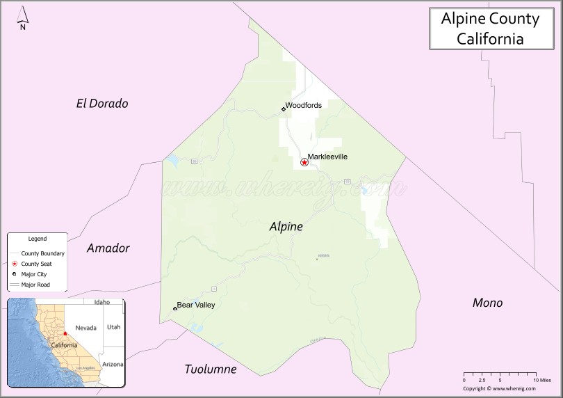
About Alpine County Map, California: The map showing the county boundary, county seat, major cities, highways, water bodies and neighbouring counties.
Most Viewed Links
About Alpine County, California
Alpine County is a county in the eastern part of the U.S. state of California, located in the Sierra Nevada mountain range. The county was created in 1864 and its population was estimated to be 1,138 as of 2021, making it one of the least populous counties in California. The county seat is Markleeville, and other communities within the county include Woodfords, Kirkwood, and Bear Valley. The county is home to a number of outdoor recreational activities, including skiing, snowboarding, hiking, fishing, and camping. Alpine County is also home to several notable natural landmarks, including the Carson River, the Mokelumne Wilderness, and the Stanislaus National Forest. The county is bordered by El Dorado County to the west, Amador County to the north, Mono County to the east, and Douglas County, Nevada to the south. Alpine County is a county located in the U.S. state of California. It's county seat is Markleeville. As per 2020 census, the population of Alpine County is 1235 people and population density is square miles. According to the United States Census Bureau, the county has a total area of 739 sq mi (1,914 km2). Alpine County was established on 1864.
Facts about Alpine County, California
| Country | United States |
| State | California |
| Region | Sierra Nevada |
| County Seat | Markleeville |
| Named After | The alpine terrain resembling the European Alps |
| Established | 1864 |
| Organized | 1864 |
| Coordinates | 38.5976° N, 119.8227° W |
| Total Area | 743 sq mi |
| Land Area | 738 sq mi |
| Water Area | 5 sq mi |
| Population (2020) | 1,204 |
| Population Rank | Least populous county in California |
| Major Community | Markleeville |
| Main Industries | Tourism, Outdoor Recreation, Government Services |
| Major Airport | None (nearest commercial airports outside the county) |
| Time Zone | Pacific Time (UTC−08:00) |
| Known For | Alpine scenery, Carson Pass, Hot springs, Hiking and skiing |
| Website | https://www.alpinecountyca.gov |