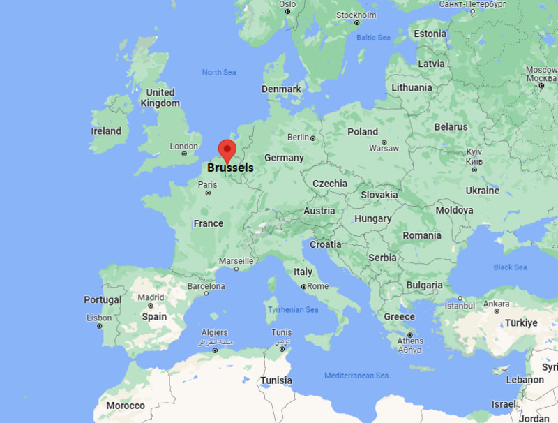
Brussels, is a city and capital of Belgium. It is located in the valley of the Senne River. Brussels lies in the north-central part of Belgium, about 68 mi (110 kilometres) from the Belgian coast and 110 mi (180 km) from Belgium's southern tip.
Location Map of Brussels, Belgium

Where is Brussels Located?
Brussels lies in the north-central part of Belgium. Brussels is the capital city of Belgium, officially the Brussels-Capital Region is a region of Belgium comprising 19 municipalities, including the City of Brussels. Brussels lies between latitudes 50.8465975 and longitudes 4.3527746. It covers an area of 63 sq mi (162 km2), with population of over 1.2 million. The Brussels-Capital Region was formed on 18 June 1989.
Distance from Brussels to other Cities
Organisations headquartered in Brussels
Organisations with an office in Brussels
Brussels City Facts
| Continent | Europe |
| Country | Belgium |
| Coordinates: | 50°51′N 4°21′E |
| Community | French Community, Flemish Community |
| Settled | c. 580 |
| Founded | 979 |
| Region | 18 June 1989 |
| Area (Region/City) | 162.4 km2 (62.7 sq mi) |
| Elevation | 13 m (43 ft) |
| Population (2020) | 1,212,352 |
| Density | 7,400/km2 (19,000/sq mi) |
| Languages | French, Dutch |
| Time zone | UTC+1 (CET), In summer UTC+2 (CEST) |
| ISO 3166 | BE-BRU |
| Postal code(s) | 1000 |
| Dialing Code | +32 |
| Area code(s) | 2 |
| Airport | Brussels-National Airport, Brussels South Charleroi Airport |
| Metro | Brussels metro |
| Road | N1 , N2, N3, N4, N5, N6, N7, N8, N9 |
| Railway Stations (3) | Brussels-South, Brussels-Central and Brussels-North |
| Port | Port of Brussels |
| Website | be.brussels |
Parks in Brussels
Brussels' Park, Mont des Arts / Kunstberg, Parc du Cinquantenaire / Jubelpark, Bois de la Cambre / Ter Kamerenbos, The Botanical Garden of Brussels, Forest Park, The Royal Greenhouses of Laeken and Sonian Forest.
Places to Visit in Brussels
Top Tourist Attractions in Brussels are
| Grand Place | St Michael and St Gudula Cathedral | Musée Magritte Museum | National Basilica of the Sacred Heart in Koekelberg |
| Atomium | Royal Gallery of Saint Hubert | Brussels Park | Parlamentarium |
| Manneken Pis | Mini-Europe | Parc du Cinquantenaire / Jubelpark | Jeanneke-Pis |
| Royal Museums of Fine Arts of Belgium | Mont des Arts | Bois de la Cambre / Ter Kamerenbos | Leopold Park |
| Royal Palace of Brussels | Musical Instruments Museum | Ixelles Ponds | The Royal Greenhouses of Laeken |
| Parc du Cinquantenaire | Museum of Natural Sciences | Forest Park | Le Botanique |
