Where is Bald Head Island, North Carolina - Location Map, Travel Info, Facts, Places to visit, Travel Info

Bald Head Island is located at the confluence of the Cape Fear River and Atlantic Ocean. It situated in the east side of the Cape Fear River in Brunswick County, North Carolina.

Bald Head Island Location Map, North Carolina
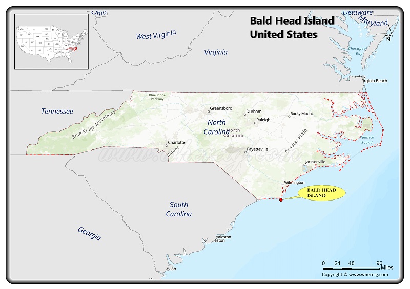
Where is Bald Head Island Located?

Bald Head Island, located in the east side of the Cape Fear River in Brunswick County, North Carolina, United States, Its roughly 5 square mile southern North Carolina barrier island that extends into the Atlantic Ocean.

Bald Head Island Facts & Information:

 
CountryUnited States
StateNorth Carolina
CountyBrunswick
TownshipSmithville Township
Founded1817
LocationLocation within the state of North Carolina
Coordinates: 33°52′2″N 78°0′24″W
Area[ Total5.86 sq mi (15.18 km2)
Land Area3.91 sq mi (10.14 km2)
Water Area1.95 sq mi (5.04 km2)
Elevation5 ft (2 m)
Population 2020182
• Density46.50/sq mi (17.95/km2)
Time zoneUTC-5 (EST)
• Summer (DST)UTC-4 (EDT)
ZIP code28461
Area code(s)910
Websitewww.villagebhi.org

Thing to Do in Bald Head Island

Old Baldy Lighthouse and Smith Island Museum, Bald Head Island Conservancy, Oak Island Lighthouse, Cape Fear, Bald Head Woods Maritime Forest, The Common at Cape Fear Station, Zeke's Island Reserve, Smithville Township District Park, Middle Island, Ibis Lake Sanctuary and Battery Island.